The left side captures the dramatic Atlantic coastline and Grand Strand on departure, which is the most visually distinctive feature of this route. The right side has a slight edge on landing for the Charlotte skyline, but the coastal scenery at takeoff is more memorable and unique to this specific route. The inland Piedmont terrain during cruise is relatively flat and featureless on both sides.
Flight Path
The flight crosses the South Carolina Piedmont, passing over the Pee Dee River basin and the rolling terrain around Lancaster and Rock Hill, South Carolina. The landscape transitions from coastal plain pine forests to Piedmont red clay farmland and suburban sprawl. No significant mountain ranges are visible — the Blue Ridge is well to the northwest and not on this flight path.
Great circle distance and headings ›Phase by phase
Takeoff from MYR
LEFTMyrtle Beach runways typically depart heading northwest or northeast. On a westbound departure toward Charlotte, the left side gives you the Atlantic Ocean and the Grand Strand coastline stretching north toward North Myrtle Beach before the aircraft turns inland. The beach and barrier island geography is clearly visible as you climb out.
Landing at CLT
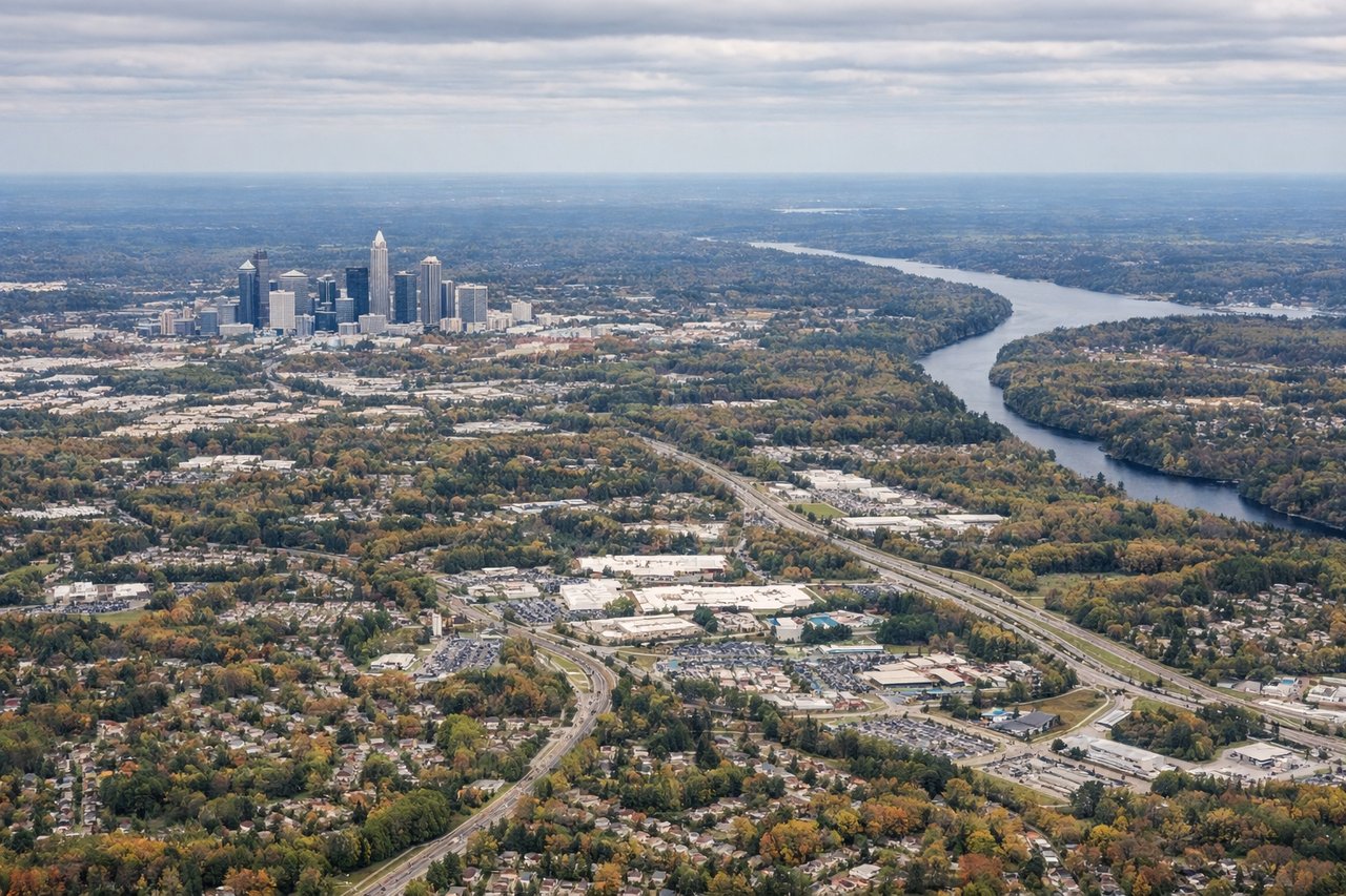
RIGHTCharlotte Douglas typically receives aircraft from the east on approaches to runways 18C/18L/18R or from the southeast on runway 23. Coming from Myrtle Beach to the east-southeast, the right side gives you the Charlotte skyline and the broader Piedmont urban sprawl as you descend. The left side faces away from the city center on most approach headings.
Will your flight be in sunlight?
See exactly which side of the plane gets sun and shade at your departure time.
About This Route
Which side of the plane should I sit on flying from Myrtle Beach International (MYR) to Charlotte Douglas International (CLT)?
Sit on the Left side of the plane for the best views on flights from Myrtle Beach to Charlotte. The left side captures the dramatic Atlantic coastline and Grand Strand on departure, which is the most visually distinctive feature of this route. The right side has a slight edge on landing for the Charlotte skyline, but the coastal scenery at takeoff is more memorable and unique to this specific route. The inland Piedmont terrain during cruise is relatively flat and featureless on both sides.
What can I see during takeoff from Myrtle Beach International in Myrtle Beach?
During takeoff from Myrtle Beach International (MYR), sit on the Left side for the best views. Myrtle Beach runways typically depart heading northwest or northeast. On a westbound departure toward Charlotte, the left side gives you the Atlantic Ocean and the Grand Strand coastline stretching north toward North Myrtle Beach before the aircraft turns inland. The beach and barrier island geography is clearly visible as you climb out. Notable sights include: Atlantic Ocean and Grand Strand beach, Myrtle Beach waterfront and hotel row, Intracoastal Waterway running parallel to the coast, Waccamaw River lowlands to the northwest.
What can I see when landing at Charlotte Douglas International in Charlotte?
When landing at Charlotte Douglas International (CLT), sit on the Right side for the best views. Charlotte Douglas typically receives aircraft from the east on approaches to runways 18C/18L/18R or from the southeast on runway 23. Coming from Myrtle Beach to the east-southeast, the right side gives you the Charlotte skyline and the broader Piedmont urban sprawl as you descend. The left side faces away from the city center on most approach headings. Notable sights include: Charlotte uptown skyline, Lake Norman to the north visible in the distance, Catawba River corridor to the southwest, Charlotte Douglas airport and its distinctive parallel runway layout.
How long is the flight from Myrtle Beach to Charlotte?
The flight from Myrtle Beach International (MYR) to Charlotte Douglas International (CLT) takes Approximately 55 to 70 minutes.
What does the Myrtle Beach to Charlotte flight path pass over?
The flight crosses the South Carolina Piedmont, passing over the Pee Dee River basin and the rolling terrain around Lancaster and Rock Hill, South Carolina. The landscape transitions from coastal plain pine forests to Piedmont red clay farmland and suburban sprawl. No significant mountain ranges are visible — the Blue Ridge is well to the northwest and not on this flight path.