The right side offers more consistent visual interest across the flight — mountainous terrain near Nagoya at departure and an urban, coastal view of Singapore at landing — while the left side is dominated by open ocean for most of the journey.
Flown NGO to XSP? Did we get it right?
Flight Path
Nagoya to Singapore is 3,134 miles (5,044 km), a flight of about 5 hours 55 minutes.
Route crosses the East China Sea near Taiwan's western coast, then continues over the South China Sea past the Philippines' western islands before approaching the Malay Peninsula and Borneo's northern coastline near Singapore.
Great circle distance and headings ›Phase by phase
Takeoff from NGO
RIGHTDeparting Centrair on runway 18, the climb-out curves southwest, putting the Kii Peninsula's forested mountains and the Suzuka range on the right, while the left only shows the flat, hazy expanse of Ise Bay merging into the Pacific.
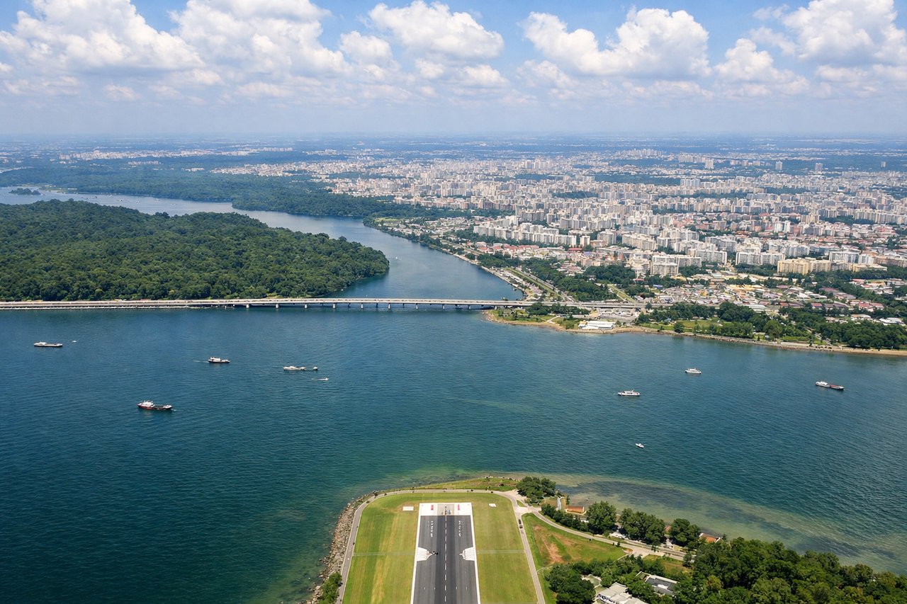
Landing at XSP
RIGHTOn approach into Seletar the aircraft typically banks over the Johor Strait before lining up, giving right-side passengers a clear view of Singapore's northern skyline and the causeway, while the left side mostly faces open water and Malaysian mangrove flats.
Will your flight be in sunlight?
Pick a date and time in the Sun Map to watch the sun move across your whole flight.
About This Route
Which side of the plane should I sit on flying from Chubu Centrair International Airport (NGO) to Seletar (XSP)?
Sit on the Right side of the plane for the best views on flights from Nagoya to Singapore. The right side offers more consistent visual interest across the flight — mountainous terrain near Nagoya at departure and an urban, coastal view of Singapore at landing — while the left side is dominated by open ocean for most of the journey.
What can I see during takeoff from Chubu Centrair International Airport in Nagoya?
During takeoff from Chubu Centrair International Airport (NGO), sit on the Right side for the best views. Departing Centrair on runway 18, the climb-out curves southwest, putting the Kii Peninsula's forested mountains and the Suzuka range on the right, while the left only shows the flat, hazy expanse of Ise Bay merging into the Pacific. Notable sights include: Kii Peninsula ridgelines, Suzuka Mountains, Chita Peninsula coastline, Ise Bay shoreline.
What can I see when landing at Seletar in Singapore?
When landing at Seletar (XSP), sit on the Right side for the best views. On approach into Seletar the aircraft typically banks over the Johor Strait before lining up, giving right-side passengers a clear view of Singapore's northern skyline and the causeway, while the left side mostly faces open water and Malaysian mangrove flats. Notable sights include: Johor-Singapore Causeway, Sembawang shipyards, Central Business District skyline in the distance, Straits of Johor.
How long is the flight from Nagoya to Singapore?
The flight from Chubu Centrair International Airport (NGO) to Seletar (XSP) takes about 5 hours 55 minutes. The shortest flight path between them is 3,134 miles (5,044 km); winds and air traffic control usually add a few percent.
What does the Nagoya to Singapore flight path pass over?
Route crosses the East China Sea near Taiwan's western coast, then continues over the South China Sea past the Philippines' western islands before approaching the Malay Peninsula and Borneo's northern coastline near Singapore.