Chicago to Columbus is 295 miles (475 km), a flight of about 1 hour 25 minutes.
Neither side offers dramatic terrain since this route crosses flat Midwest farmland the entire way, but the left side's brief view of Chicago and Lake Michigan during takeoff gives it a slight edge over the smaller, less distinct Columbus skyline glimpse on arrival.
Flight Path
Flat agricultural plains of northern Indiana and western Ohio, with scattered small towns and grid-pattern farmland visible from cruise altitude; no major rivers or mountains along this direct route.
Great circle distance and headings ›Phase by phase
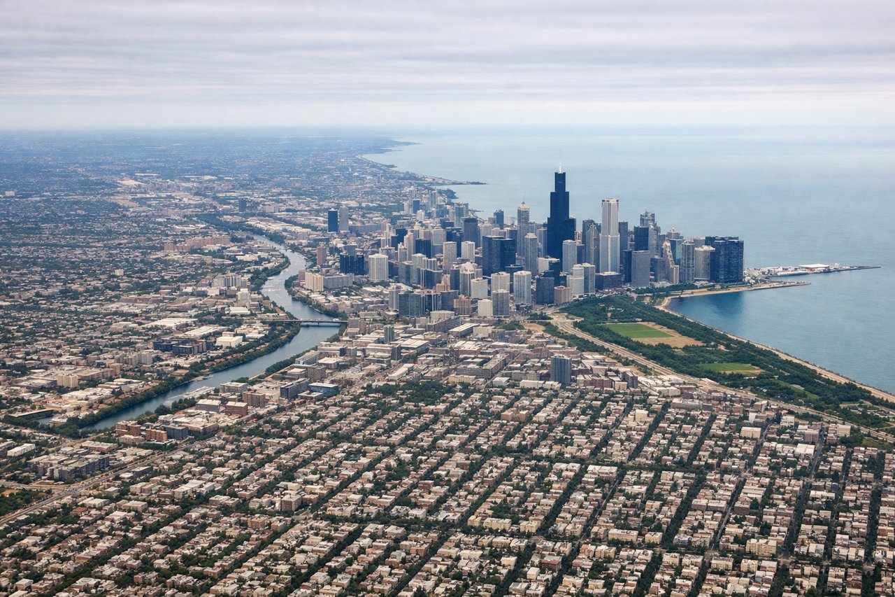
Takeoff from ORD
LEFTDeparting ORD eastbound, the initial climb and turn southeast offers a brief glimpse of Lake Michigan's shoreline and the Chicago skyline off to the north on the left side. This is the most visually distinct moment of the entire flight given the otherwise flat terrain.
Landing at CMH
RIGHTOn approach into CMH from the northwest, the final turn typically swings the aircraft south of downtown Columbus before lining up on the runway, putting the compact Columbus skyline and the Scioto River briefly visible on the right side.
Landmarks on this routeAll landmarks →
Will your flight be in sunlight?
Pick a date and time in the Sun Map to watch the sun move across your whole flight.
About This Route
Which side of the plane should I sit on flying from Chicago Ohare International (ORD) to Port Columbus International (CMH)?
Sit on the Left side of the plane for the best views on flights from Chicago to Columbus. Neither side offers dramatic terrain since this route crosses flat Midwest farmland the entire way, but the left side's brief view of Chicago and Lake Michigan during takeoff gives it a slight edge over the smaller, less distinct Columbus skyline glimpse on arrival.
What can I see during takeoff from Chicago Ohare International in Chicago?
During takeoff from Chicago Ohare International (ORD), sit on the Left side for the best views. Departing ORD eastbound, the initial climb and turn southeast offers a brief glimpse of Lake Michigan's shoreline and the Chicago skyline off to the north on the left side. This is the most visually distinct moment of the entire flight given the otherwise flat terrain. Notable sights include: Lake Michigan shoreline, Chicago downtown skyline, O'Hare's runway grid below.
What can I see when landing at Port Columbus International in Columbus?
When landing at Port Columbus International (CMH), sit on the Right side for the best views. On approach into CMH from the northwest, the final turn typically swings the aircraft south of downtown Columbus before lining up on the runway, putting the compact Columbus skyline and the Scioto River briefly visible on the right side. Notable sights include: Columbus downtown skyline, Scioto River, Ohio State University campus area.
How long is the flight from Chicago to Columbus?
The flight from Chicago Ohare International (ORD) to Port Columbus International (CMH) takes about 1 hour 25 minutes. The shortest flight path between them is 295 miles (475 km); winds and air traffic control usually add a few percent.
What does the Chicago to Columbus flight path pass over?
Flat agricultural plains of northern Indiana and western Ohio, with scattered small towns and grid-pattern farmland visible from cruise altitude; no major rivers or mountains along this direct route.