Port Moresby to Manila is 2,442 miles (3,929 km), a flight of about 4 hours 45 minutes.
The right side captures the most dramatic scenery at both ends of the flight. On departure it holds the Port Moresby harbor and Coral Sea coastline, and during the cruise it faces west over the Bismarck Sea and the Philippine Sea approaches. The left side at landing over Manila Bay is compelling, but the right side's overall consistency across departure and the long overwater crossing gives it the edge.
Flight Path
The flight tracks north-northwest over the Bismarck Sea, passing west of the Admiralty Islands and Manus Island. It then crosses the Philippine Sea, passing east of Mindanao and the Visayas island chain of the Philippines. The Sulu Sea may be visible to the left in the latter portion of the flight. The route is predominantly overwater with scattered tropical cloud systems and occasional island groups visible below.
Great circle distance and headings ›Phase by phase
Takeoff from POM
RIGHTJacksons International typically departs on runway 14L/32R. A northbound departure on runway 14 means a right-hand turn toward the northeast, putting the right side over Port Moresby harbor and the Coral Sea coastline. The left side faces inland scrubland with little of interest.
Landing at MNL
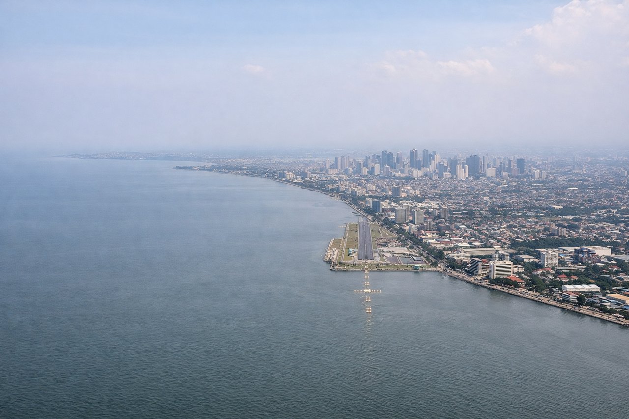
LEFTFlights from Port Moresby approach Manila from the south-southeast, typically landing on runway 24 or 06 at NAIA. On a southeasterly approach heading, the left side faces north toward Manila Bay and the city skyline of Metro Manila, while the right side looks toward Laguna de Bay and the Sierra Madre mountains.
Will your flight be in sunlight?
Pick a date and time in the Sun Map to watch the sun move across your whole flight.
About This Route
Which side of the plane should I sit on flying from Port Moresby Jacksons International (POM) to Ninoy Aquino International (MNL)?
Sit on the Right side of the plane for the best views on flights from Port Moresby to Manila. The right side captures the most dramatic scenery at both ends of the flight. On departure it holds the Port Moresby harbor and Coral Sea coastline, and during the cruise it faces west over the Bismarck Sea and the Philippine Sea approaches. The left side at landing over Manila Bay is compelling, but the right side's overall consistency across departure and the long overwater crossing gives it the edge.
What can I see during takeoff from Port Moresby Jacksons International in Port Moresby?
During takeoff from Port Moresby Jacksons International (POM), sit on the Right side for the best views. Jacksons International typically departs on runway 14L/32R. A northbound departure on runway 14 means a right-hand turn toward the northeast, putting the right side over Port Moresby harbor and the Coral Sea coastline. The left side faces inland scrubland with little of interest. Notable sights include: Port Moresby harbor and Fairfax Harbor, the Coral Sea coastline east of the city, the Owen Stanley Range foothills to the northeast, Bootless Bay.
What can I see when landing at Ninoy Aquino International in Manila?
When landing at Ninoy Aquino International (MNL), sit on the Left side for the best views. Flights from Port Moresby approach Manila from the south-southeast, typically landing on runway 24 or 06 at NAIA. On a southeasterly approach heading, the left side faces north toward Manila Bay and the city skyline of Metro Manila, while the right side looks toward Laguna de Bay and the Sierra Madre mountains. Notable sights include: Manila Bay and its broad expanse to the west, the Metro Manila skyline including Makati and BGC towers, Laguna de Bay visible to the southeast, Corregidor Island in Manila Bay.
How long is the flight from Port Moresby to Manila?
The flight from Port Moresby Jacksons International (POM) to Ninoy Aquino International (MNL) takes about 4 hours 45 minutes. The shortest flight path between them is 2,442 miles (3,929 km); winds and air traffic control usually add a few percent.
What does the Port Moresby to Manila flight path pass over?
The flight tracks north-northwest over the Bismarck Sea, passing west of the Admiralty Islands and Manus Island. It then crosses the Philippine Sea, passing east of Mindanao and the Visayas island chain of the Philippines. The Sulu Sea may be visible to the left in the latter portion of the flight. The route is predominantly overwater with scattered tropical cloud systems and occasional island groups visible below.