Paya Lebar to Osaka is 3,049 miles (4,907 km), a flight of about 6 hours 20 minutes.
While takeoff favors the right, the landing view from the left is more dramatic and distinctive—the artificial island, bay, and urban Kobe skyline are more visually rewarding than the generic forested terrain on the right during approach.
Flight Path
The flight path crosses the East China Sea northwestbound. Notable features include the Oki Islands (small, rocky outcrops visible around 1.5 hours into flight if conditions permit), the Seto Inland Sea's western approaches as you near Honshu, and the transition from open water to the mountainous Chugoku region's coastal ridges. The Hyogo Prefecture coastline becomes visible 30-40 minutes before landing.
Great circle distance and headings ›Phase by phase
Takeoff from QPG
RIGHTPaya Lebar typically departs eastbound (Runway 03). Right-side seats face north across the Strait of Johor toward Peninsular Malaysia, offering views of the Johor Bahru urban area and the strait itself. Left seats look south over developed Singapore and the South China Sea.
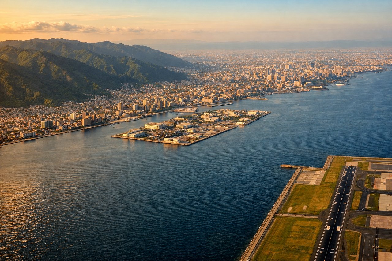
Landing at KIX
LEFTKansai International typically lands westbound (Runway 06L/06R). Left-side seats descending toward Osaka Bay offer views of the bay itself, the artificial island runway complex, and the Kobe-Osaka urban corridor. Right seats face inland toward the Kii Peninsula and forested terrain.
Landmarks on this routeAll landmarks →
Will your flight be in sunlight?
Pick a date and time in the Sun Map to watch the sun move across your whole flight.
About This Route
Which side of the plane should I sit on flying from Paya Lebar (QPG) to Kansai International (KIX)?
Sit on the Left side of the plane for the best views on flights from Paya Lebar to Osaka. While takeoff favors the right, the landing view from the left is more dramatic and distinctive—the artificial island, bay, and urban Kobe skyline are more visually rewarding than the generic forested terrain on the right during approach.
What can I see during takeoff from Paya Lebar in Paya Lebar?
During takeoff from Paya Lebar (QPG), sit on the Right side for the best views. Paya Lebar typically departs eastbound (Runway 03). Right-side seats face north across the Strait of Johor toward Peninsular Malaysia, offering views of the Johor Bahru urban area and the strait itself. Left seats look south over developed Singapore and the South China Sea. Notable sights include: Strait of Johor, Johor Bahru city, Bukit Timah area (Singapore's central ridge), causeway connecting Singapore to Malaysia.
What can I see when landing at Kansai International in Osaka?
When landing at Kansai International (KIX), sit on the Left side for the best views. Kansai International typically lands westbound (Runway 06L/06R). Left-side seats descending toward Osaka Bay offer views of the bay itself, the artificial island runway complex, and the Kobe-Osaka urban corridor. Right seats face inland toward the Kii Peninsula and forested terrain. Notable sights include: Osaka Bay, Kansai International Airport's artificial island, Kobe city skyline, Kii Peninsula mountains.
How long is the flight from Paya Lebar to Osaka?
The flight from Paya Lebar (QPG) to Kansai International (KIX) takes about 6 hours 20 minutes. The shortest flight path between them is 3,049 miles (4,907 km); winds and air traffic control usually add a few percent.
What does the Paya Lebar to Osaka flight path pass over?
The flight path crosses the East China Sea northwestbound. Notable features include the Oki Islands (small, rocky outcrops visible around 1.5 hours into flight if conditions permit), the Seto Inland Sea's western approaches as you near Honshu, and the transition from open water to the mountainous Chugoku region's coastal ridges. The Hyogo Prefecture coastline becomes visible 30-40 minutes before landing.