Richmond to Atlanta is 480 miles (773 km), a flight of about 1 hour 20 minutes.
The left side misses the best of the Richmond departure but wins decisively on the Atlanta arrival with sustained views of the city skyline and Stone Mountain during descent. The flight tracks southwest over central Virginia and northern Georgia, and the left side also picks up better views of the Appalachian foothills and the Blue Ridge ridgelines in the distance during cruise.
Flight Path
The route crosses central Virginia's piedmont, then the North Carolina border region near Greensboro, passing over the Piedmont Triad. The southern Appalachian foothills become visible as low rolling ridges in the distance. Northern Georgia's forested terrain and the Chattahoochee National Forest appear before the Atlanta metro sprawl opens up on descent.
Great circle distance and headings ›Phase by phase
Takeoff from RIC
RIGHTRIC typically departs on Runway 16 heading southeast, then turns southwest toward Atlanta. The right side gives you a clear look back at downtown Richmond and the James River as you climb out. You'll also catch the broad curve of the James River winding through the city.
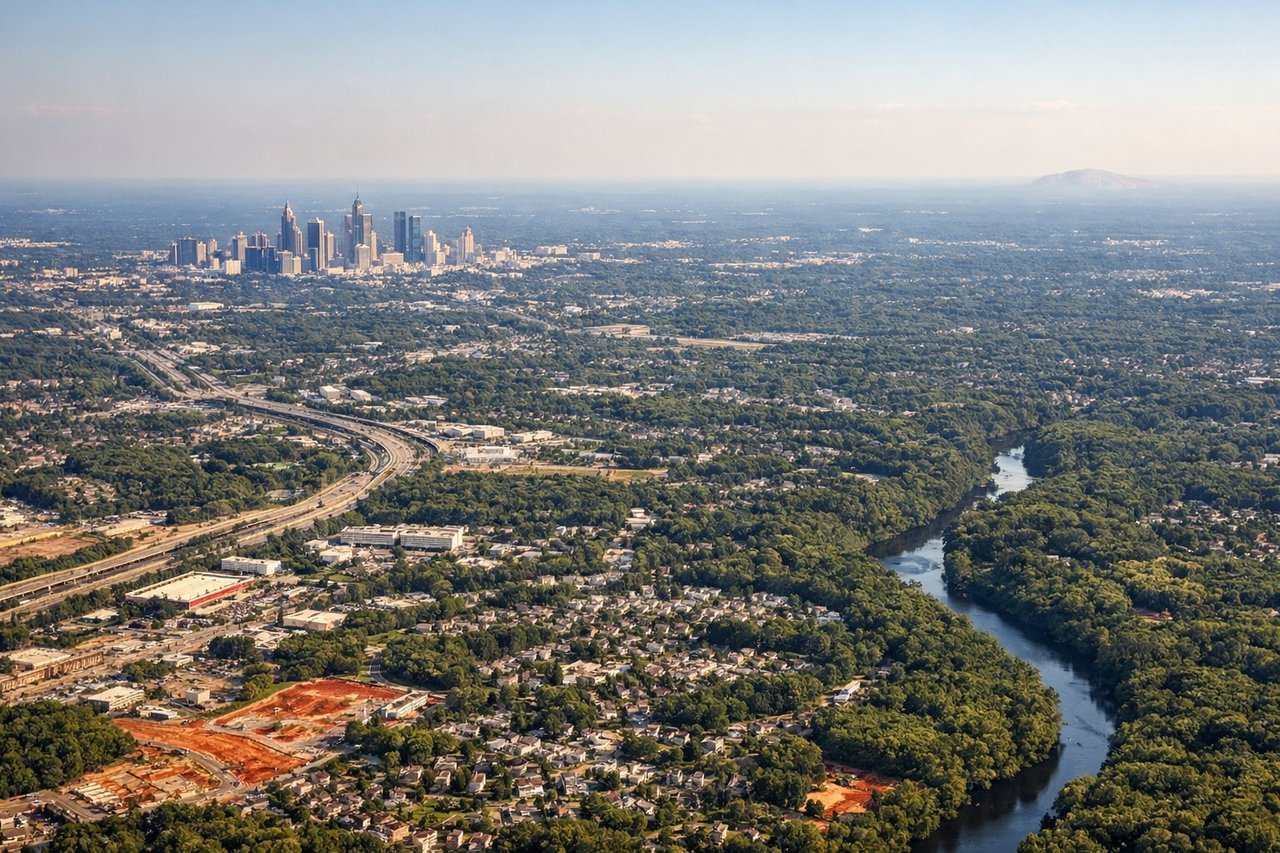
Landing at ATL
LEFTAtlanta typically uses south-flow arrivals on runways 26L/26R or 27L/27R, with approaches from the northeast. The left side gives you a prolonged view of downtown Atlanta's skyline, Midtown, and the distinctive spaghetti junction of I-285 and I-85 as you descend. You'll also see Stone Mountain clearly to the east of the city.
Landmarks on this routeAll landmarks →
Will your flight be in sunlight?
Pick a date and time in the Sun Map to watch the sun move across your whole flight.
About This Route
Which side of the plane should I sit on flying from Richmond International (RIC) to The William B Hartsfield Atlanta International (ATL)?
Sit on the Left side of the plane for the best views on flights from Richmond to Atlanta. The left side misses the best of the Richmond departure but wins decisively on the Atlanta arrival with sustained views of the city skyline and Stone Mountain during descent. The flight tracks southwest over central Virginia and northern Georgia, and the left side also picks up better views of the Appalachian foothills and the Blue Ridge ridgelines in the distance during cruise.
What can I see during takeoff from Richmond International in Richmond?
During takeoff from Richmond International (RIC), sit on the Right side for the best views. RIC typically departs on Runway 16 heading southeast, then turns southwest toward Atlanta. The right side gives you a clear look back at downtown Richmond and the James River as you climb out. You'll also catch the broad curve of the James River winding through the city. Notable sights include: Downtown Richmond skyline, James River and its falls, Richmond's Fan District grid, Henrico County suburban sprawl to the west.
What can I see when landing at The William B Hartsfield Atlanta International in Atlanta?
When landing at The William B Hartsfield Atlanta International (ATL), sit on the Left side for the best views. Atlanta typically uses south-flow arrivals on runways 26L/26R or 27L/27R, with approaches from the northeast. The left side gives you a prolonged view of downtown Atlanta's skyline, Midtown, and the distinctive spaghetti junction of I-285 and I-85 as you descend. You'll also see Stone Mountain clearly to the east of the city. Notable sights include: Downtown Atlanta skyline and Midtown towers, Stone Mountain granite dome to the east, I-285 perimeter highway loop, Hartsfield-Jackson's parallel runway complex.
How long is the flight from Richmond to Atlanta?
The flight from Richmond International (RIC) to The William B Hartsfield Atlanta International (ATL) takes about 1 hour 20 minutes. The shortest flight path between them is 480 miles (773 km); winds and air traffic control usually add a few percent.
What does the Richmond to Atlanta flight path pass over?
The route crosses central Virginia's piedmont, then the North Carolina border region near Greensboro, passing over the Piedmont Triad. The southern Appalachian foothills become visible as low rolling ridges in the distance. Northern Georgia's forested terrain and the Chattahoochee National Forest appear before the Atlanta metro sprawl opens up on descent.