Right side captures the most dramatic scenery: the Arctic-boreal transition and Scandinavian wilderness on departure, plus views of Scandinavia and northern Europe during the cruise phase. Left side offers urban scenery only on approach to London.
Flown RVN to LHR? Did we get it right?
Flight Path
Rovaniemi to London is 1,380 miles (2,220 km), a flight of about 3 hours 20 minutes.
The flight path crosses the North Sea and passes over or near: the Norwegian coast (including fjords and mountains if routed via Norway), the North Sea itself (open water with occasional shipping visible), and the east coast of England (Norfolk and Suffolk coastlines with distinctive estuaries and flat terrain). During cruise at altitude, you may see the Scandinavian Peninsula's forested terrain, the North Sea as a vast expanse, and the transition to the flatter, more densely populated landscape of southern England and the Midlands.
Great circle distance and headings ›

Phase by phase
Takeoff from RVN
RIGHTRight side offers views of the Scandinavian landscape immediately north and east of Rovaniemi. You'll see the boreal forest, lakes, and the transition toward the Arctic terrain that defines Finnish Lapland.
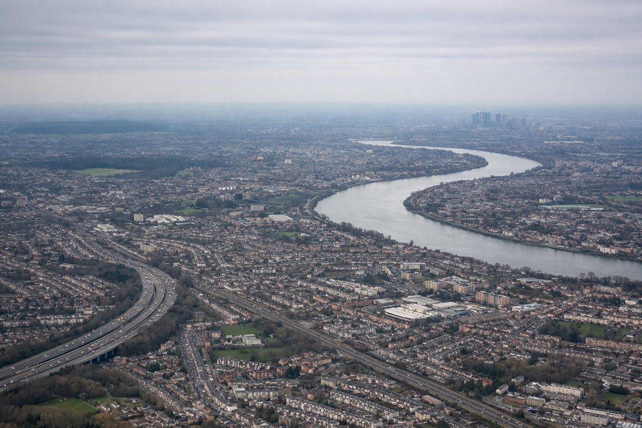
Landing at LHR
LEFTLeft side provides excellent views during descent into London. You'll see the Thames estuary, Greater London's urban sprawl, and the distinctive geography of southeast England as you approach Heathrow from the west.
Will your flight be in sunlight?
Pick a date and time in the Sun Map to watch the sun move across your whole flight.
About This Route
Which side of the plane should I sit on flying from Rovaniemi (RVN) to Heathrow (LHR)?
Sit on the Right side of the plane for the best views on flights from Rovaniemi to London. Right side captures the most dramatic scenery: the Arctic-boreal transition and Scandinavian wilderness on departure, plus views of Scandinavia and northern Europe during the cruise phase. Left side offers urban scenery only on approach to London.
What can I see during takeoff from Rovaniemi in Rovaniemi?
During takeoff from Rovaniemi (RVN), sit on the Right side for the best views. Right side offers views of the Scandinavian landscape immediately north and east of Rovaniemi. You'll see the boreal forest, lakes, and the transition toward the Arctic terrain that defines Finnish Lapland. Notable sights include: Ounasjoki River valley, Lake Inarijärvi (distant, to the northeast), boreal forest canopy, Rovaniemi city grid below.
What can I see when landing at Heathrow in London?
When landing at Heathrow (LHR), sit on the Left side for the best views. Left side provides excellent views during descent into London. You'll see the Thames estuary, Greater London's urban sprawl, and the distinctive geography of southeast England as you approach Heathrow from the west. Notable sights include: Thames estuary and meanders, Greater London urban area, Chiltern Hills (distant, to the northwest), Windsor and surrounding Thames valley towns.
How long is the flight from Rovaniemi to London?
The flight from Rovaniemi (RVN) to Heathrow (LHR) takes about 3 hours 20 minutes. The shortest flight path between them is 1,380 miles (2,220 km); winds and air traffic control usually add a few percent.
What does the Rovaniemi to London flight path pass over?
The flight path crosses the North Sea and passes over or near: the Norwegian coast (including fjords and mountains if routed via Norway), the North Sea itself (open water with occasional shipping visible), and the east coast of England (Norfolk and Suffolk coastlines with distinctive estuaries and flat terrain). During cruise at altitude, you may see the Scandinavian Peninsula's forested terrain, the North Sea as a vast expanse, and the transition to the flatter, more densely populated landscape of southern England and the Midlands.