Santa Ana to San Jose is 342 miles (550 km), a flight of about 1 hour 15 minutes.
The direct routing between SNA and SJC follows the classic Central Coast corridor, keeping the Pacific coastline, Point Conception, and the Big Sur cliffs on the left side for most of the cruise, with the Santa Cruz Mountains and South Bay closing out the view on approach — far more dramatic than the inland ranges and valley farmland visible from the right.
Flight Path
Point Conception, the Santa Barbara Channel and Channel Islands, the Santa Ynez Mountains, the Big Sur coastline, and Monterey Bay
Great circle distance and headings ›.jpg?width=600)

Phase by phase
Takeoff from SNA
RIGHTAfter the steep noise-abatement climb out of SNA toward Newport Beach, the aircraft banks right to turn onto its northbound course, putting Newport Harbor, the Balboa Peninsula, and the open Pacific directly below the right side wing. Passengers get a brief but clear view of the harbor's boat channels and the coastline curving away to the south.
Landing at SJC
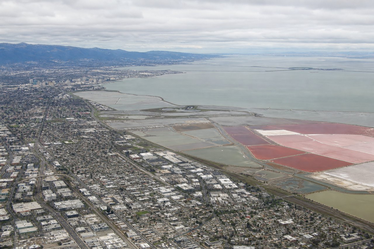
LEFTOn the final approach into SJC from the south, landing to the northwest on runway 30, the left side faces the Santa Cruz Mountains running along the western edge of the Santa Clara Valley, with glimpses of the South Bay's salt ponds and the edge of San Francisco Bay appearing ahead as the plane descends over San Jose.
Landmarks on this routeAll landmarks →
Will your flight be in sunlight?
Pick a date and time in the Sun Map to watch the sun move across your whole flight.
About This Route
Which side of the plane should I sit on flying from John Wayne Arpt Orange Co (SNA) to Norman Y Mineta San Jose International (SJC)?
Sit on the Left side of the plane for the best views on flights from Santa Ana to San Jose. The direct routing between SNA and SJC follows the classic Central Coast corridor, keeping the Pacific coastline, Point Conception, and the Big Sur cliffs on the left side for most of the cruise, with the Santa Cruz Mountains and South Bay closing out the view on approach — far more dramatic than the inland ranges and valley farmland visible from the right.
What can I see during takeoff from John Wayne Arpt Orange Co in Santa Ana?
During takeoff from John Wayne Arpt Orange Co (SNA), sit on the Right side for the best views. After the steep noise-abatement climb out of SNA toward Newport Beach, the aircraft banks right to turn onto its northbound course, putting Newport Harbor, the Balboa Peninsula, and the open Pacific directly below the right side wing. Passengers get a brief but clear view of the harbor's boat channels and the coastline curving away to the south. Notable sights include: Newport Harbor, Balboa Peninsula, Upper Newport Bay wetlands, Catalina Island silhouette offshore.
What can I see when landing at Norman Y Mineta San Jose International in San Jose?
When landing at Norman Y Mineta San Jose International (SJC), sit on the Left side for the best views. On the final approach into SJC from the south, landing to the northwest on runway 30, the left side faces the Santa Cruz Mountains running along the western edge of the Santa Clara Valley, with glimpses of the South Bay's salt ponds and the edge of San Francisco Bay appearing ahead as the plane descends over San Jose. Notable sights include: Santa Cruz Mountains ridgeline, Santa Clara Valley/Silicon Valley sprawl, South Bay salt ponds, southern San Francisco Bay.
How long is the flight from Santa Ana to San Jose?
The flight from John Wayne Arpt Orange Co (SNA) to Norman Y Mineta San Jose International (SJC) takes about 1 hour 15 minutes. The shortest flight path between them is 342 miles (550 km); winds and air traffic control usually add a few percent.
What does the Santa Ana to San Jose flight path pass over?
Point Conception, the Santa Barbara Channel and Channel Islands, the Santa Ynez Mountains, the Big Sur coastline, and Monterey Bay