Tumbes to Lima is 626 miles (1,008 km), a flight of about 2 hours.
While takeoff favors the right for delta and coastal views, the landing approach on the left provides more dramatic and sustained geography—the Andes foothills and Rímac gorge are visually distinctive. The left side also captures Lima's urban approach, which is geographically significant for the destination.
Flight Path
The flight path follows the Peruvian coast southward at roughly 10,000-15,000 feet. Notable features include the coastal plain with scattered settlements, the Pan-American Highway visible as a thin line paralleling the coast, and the Western Cordillera foothills rising gradually to the east. Around the midpoint near Casma or Chimbote (roughly 8°S), the Andes become more prominent and closer to the coast. The landscape transitions from mangrove wetlands in the north to increasingly arid desert. No major rivers are dramatically visible except the Rímac approaching Lima. The Pacific remains visible on the right throughout, with occasional fishing vessels or oil platforms visible near the coast.
Great circle distance and headings ›Phase by phase
Takeoff from TBP
RIGHTTBP typically departs to the south or southeast. Right-side seats capture the Tumbes River delta and mangrove wetlands immediately below, plus the Pacific coastline stretching south toward Paracas. The Western Cordillera foothills rise inland to the left but are less dramatic at this latitude.
Landing at LIM
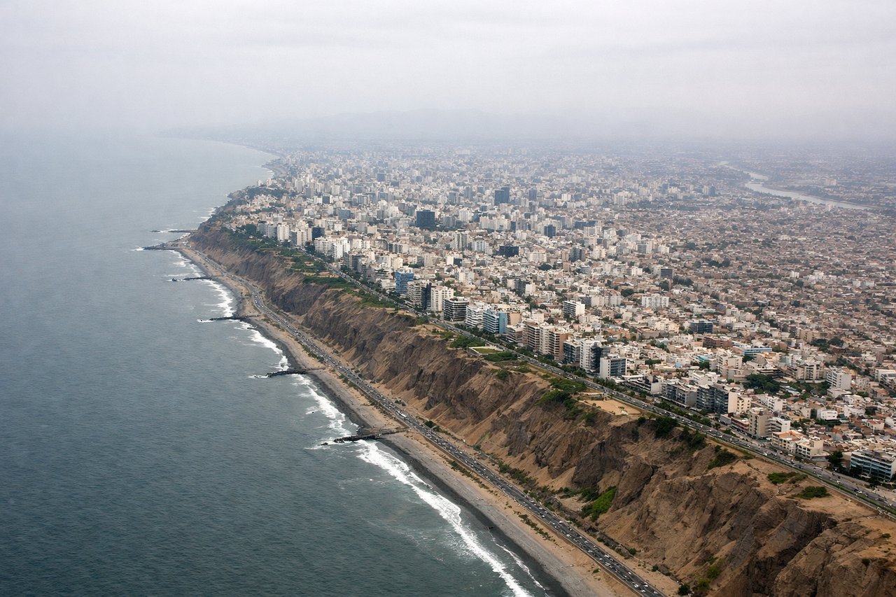
LEFTLIM uses runways 01L/19R and 03R/21L; approach typically comes from the south or southeast. Left-side seats on descent offer views of the Andes foothills and the Rímac River valley leading into Lima's urban sprawl. The right side shows open Pacific, which is less distinctive.
Will your flight be in sunlight?
Pick a date and time in the Sun Map to watch the sun move across your whole flight.
About This Route
Which side of the plane should I sit on flying from Pedro Canga (TBP) to Jorge Chávez International Airport (LIM)?
Sit on the Left side of the plane for the best views on flights from Tumbes to Lima. While takeoff favors the right for delta and coastal views, the landing approach on the left provides more dramatic and sustained geography—the Andes foothills and Rímac gorge are visually distinctive. The left side also captures Lima's urban approach, which is geographically significant for the destination.
What can I see during takeoff from Pedro Canga in Tumbes?
During takeoff from Pedro Canga (TBP), sit on the Right side for the best views. TBP typically departs to the south or southeast. Right-side seats capture the Tumbes River delta and mangrove wetlands immediately below, plus the Pacific coastline stretching south toward Paracas. The Western Cordillera foothills rise inland to the left but are less dramatic at this latitude. Notable sights include: Tumbes River estuary and mangrove system, Pacific Ocean coastline, northern Peru coastal plain, distant Andes foothills.
What can I see when landing at Jorge Chávez International Airport in Lima?
When landing at Jorge Chávez International Airport (LIM), sit on the Left side for the best views. LIM uses runways 01L/19R and 03R/21L; approach typically comes from the south or southeast. Left-side seats on descent offer views of the Andes foothills and the Rímac River valley leading into Lima's urban sprawl. The right side shows open Pacific, which is less distinctive. Notable sights include: Rímac River valley and gorge, Lima metropolitan area and urban districts, Andes Western Cordillera peaks, Pacific coastline south of Lima.
How long is the flight from Tumbes to Lima?
The flight from Pedro Canga (TBP) to Jorge Chávez International Airport (LIM) takes about 2 hours. The shortest flight path between them is 626 miles (1,008 km); winds and air traffic control usually add a few percent.
What does the Tumbes to Lima flight path pass over?
The flight path follows the Peruvian coast southward at roughly 10,000-15,000 feet. Notable features include the coastal plain with scattered settlements, the Pan-American Highway visible as a thin line paralleling the coast, and the Western Cordillera foothills rising gradually to the east. Around the midpoint near Casma or Chimbote (roughly 8°S), the Andes become more prominent and closer to the coast. The landscape transitions from mangrove wetlands in the north to increasingly arid desert. No major rivers are dramatically visible except the Rímac approaching Lima. The Pacific remains visible on the right throughout, with occasional fishing vessels or oil platforms visible near the coast.