While left offers excellent Sahara views at takeoff, right provides superior scenery during the longer descent phase into Kansai, with Osaka Bay, the metropolitan corridor, and Kii Peninsula mountains offering more sustained visual interest over a greater portion of the flight.
Flight Path
The flight path crosses the Mediterranean Sea (southern coast of Greece and Turkey visible), then traverses the Middle East over the Levant region, Iraq, and Iran. The Zagros Mountains form a dramatic spine across western Iran. Further east, the Hindu Kush and Pamir ranges mark the Afghanistan-Tajikistan border region. The flight then crosses the Taklamakan Desert in western China (vast tan expanse with minimal features), transitions over the Tian Shan mountains, and enters central Asia before curving southeast over China toward Japan. The Yangtze River valley and eastern Chinese plains become visible in the final approach phase before reaching the Japanese archipelago.
Great circle distance and headings ›

Phase by phase
Takeoff from TOE
LEFTLeft side offers views of the Sahara Desert stretching southeast from Tozeur, with the distinctive salt flats (chotts) and dune formations visible during the initial climb. Right side faces inland toward less visually distinctive terrain.
Landing at KIX
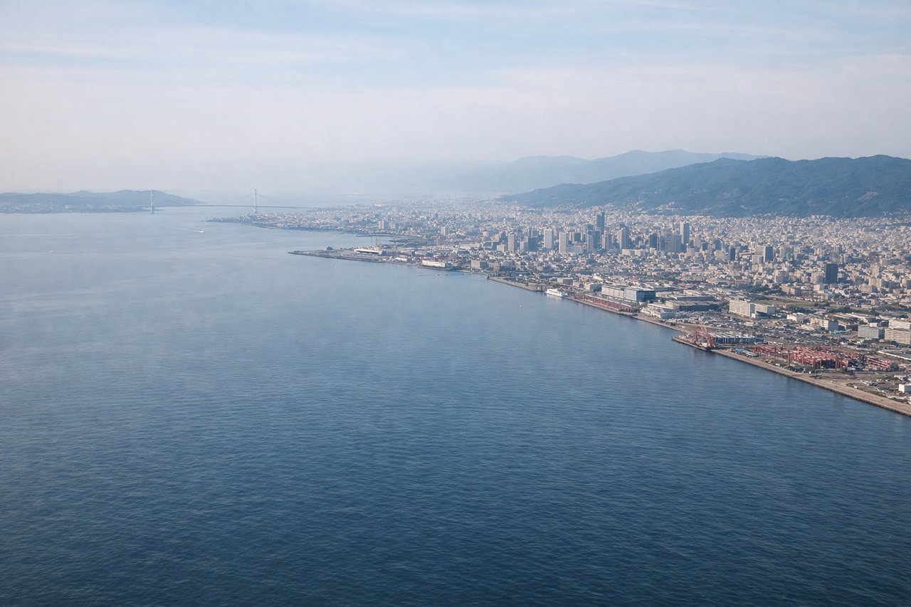
RIGHTRight side provides views of Osaka Bay, the Kobe-Osaka urban corridor, and the Kii Peninsula's mountainous terrain during descent into Kansai. Left side faces the less visually distinctive Iga Highlands inland.
Landmarks on this routeAll landmarks →
Will your flight be in sunlight?
See exactly which side of the plane gets sun and shade at your departure time.
About This Route
Which side of the plane should I sit on flying from Nefta (TOE) to Kansai International (KIX)?
Sit on the Right side of the plane for the best views on flights from Tozeur to Osaka. While left offers excellent Sahara views at takeoff, right provides superior scenery during the longer descent phase into Kansai, with Osaka Bay, the metropolitan corridor, and Kii Peninsula mountains offering more sustained visual interest over a greater portion of the flight.
What can I see during takeoff from Nefta in Tozeur?
During takeoff from Nefta (TOE), sit on the Left side for the best views. Left side offers views of the Sahara Desert stretching southeast from Tozeur, with the distinctive salt flats (chotts) and dune formations visible during the initial climb. Right side faces inland toward less visually distinctive terrain. Notable sights include: Chott el Djerid (salt lake, bright white surface), Sahara Desert dunes, Tozeur oasis settlement, Atlas Mountains foothills to the southwest.
What can I see when landing at Kansai International in Osaka?
When landing at Kansai International (KIX), sit on the Right side for the best views. Right side provides views of Osaka Bay, the Kobe-Osaka urban corridor, and the Kii Peninsula's mountainous terrain during descent into Kansai. Left side faces the less visually distinctive Iga Highlands inland. Notable sights include: Osaka Bay (Osaka-wan), Kobe-Osaka metropolitan sprawl, Kii Peninsula mountains, Akashi Strait.
How long is the flight from Tozeur to Osaka?
The flight from Nefta (TOE) to Kansai International (KIX) takes 10h 25m.
What does the Tozeur to Osaka flight path pass over?
The flight path crosses the Mediterranean Sea (southern coast of Greece and Turkey visible), then traverses the Middle East over the Levant region, Iraq, and Iran. The Zagros Mountains form a dramatic spine across western Iran. Further east, the Hindu Kush and Pamir ranges mark the Afghanistan-Tajikistan border region. The flight then crosses the Taklamakan Desert in western China (vast tan expanse with minimal features), transitions over the Tian Shan mountains, and enters central Asia before curving southeast over China toward Japan. The Yangtze River valley and eastern Chinese plains become visible in the final approach phase before reaching the Japanese archipelago.