Tianjin to Singapore is 2,743 miles (4,414 km), a flight of about 5 hours 45 minutes.
The landing approach on the right side into Changi is the more spectacular and sustained viewing experience — the Johor Strait, causeway, and Singapore skyline are genuinely distinctive. During the flight itself, the right side also tracks closer to the South China Sea coastline over Vietnam and the Malay Peninsula, offering more coastal and island scenery than the left side's inland views.
Flight Path
The route crosses the Yellow Sea briefly, then tracks south over eastern China (Fujian coast visible), crosses the Taiwan Strait region, passes over the South China Sea with the Vietnamese coastline visible to the right, crosses over or near the southern tip of Vietnam around Ho Chi Minh City, then descends over the Gulf of Thailand and South China Sea before approaching Singapore over the Riau Islands of Indonesia
Great circle distance and headings ›


Phase by phase
Takeoff from TSN
LEFTTianjin Binhai airport sits east of the city. Departing typically southward or eastward over the Bohai Bay area, the left (east-facing) side gives views over the Bohai Sea coastline and the massive Tianjin port complex at Tanggu. The right side faces inland toward urban sprawl.
Landing at SIN
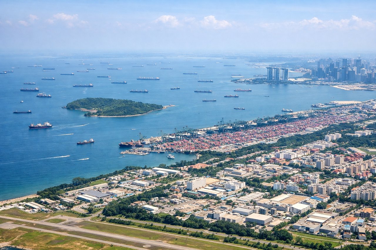
RIGHTChangi Airport's runways run roughly east-west. Aircraft typically approach from the east over the South China Sea and land heading west. The right (north) side gives views over the Johor Strait, the causeway linking Singapore to Malaysia, and the dense urban core of Singapore city. The left side faces south toward open sea and industrial Jurong.
Landmarks on this routeAll landmarks →
Will your flight be in sunlight?
Pick a date and time in the Sun Map to watch the sun move across your whole flight.
About This Route
Which side of the plane should I sit on flying from Binhai (TSN) to Singapore Changi (SIN)?
Sit on the Right side of the plane for the best views on flights from Tianjin to Singapore. The landing approach on the right side into Changi is the more spectacular and sustained viewing experience — the Johor Strait, causeway, and Singapore skyline are genuinely distinctive. During the flight itself, the right side also tracks closer to the South China Sea coastline over Vietnam and the Malay Peninsula, offering more coastal and island scenery than the left side's inland views.
What can I see during takeoff from Binhai in Tianjin?
During takeoff from Binhai (TSN), sit on the Left side for the best views. Tianjin Binhai airport sits east of the city. Departing typically southward or eastward over the Bohai Bay area, the left (east-facing) side gives views over the Bohai Sea coastline and the massive Tianjin port complex at Tanggu. The right side faces inland toward urban sprawl. Notable sights include: Bohai Sea coastline, Tianjin Binhai New Area port infrastructure, Tanggu industrial waterfront, Caofeidian artificial island complex on the distant Bohai coast.
What can I see when landing at Singapore Changi in Singapore?
When landing at Singapore Changi (SIN), sit on the Right side for the best views. Changi Airport's runways run roughly east-west. Aircraft typically approach from the east over the South China Sea and land heading west. The right (north) side gives views over the Johor Strait, the causeway linking Singapore to Malaysia, and the dense urban core of Singapore city. The left side faces south toward open sea and industrial Jurong. Notable sights include: Johor Strait and the Woodlands Causeway, Singapore city skyline including Marina Bay, Pulau Ubin island, Johor Bahru urban area across the strait.
How long is the flight from Tianjin to Singapore?
The flight from Binhai (TSN) to Singapore Changi (SIN) takes about 5 hours 45 minutes. The shortest flight path between them is 2,743 miles (4,414 km); winds and air traffic control usually add a few percent.
What does the Tianjin to Singapore flight path pass over?
The route crosses the Yellow Sea briefly, then tracks south over eastern China (Fujian coast visible), crosses the Taiwan Strait region, passes over the South China Sea with the Vietnamese coastline visible to the right, crosses over or near the southern tip of Vietnam around Ho Chi Minh City, then descends over the Gulf of Thailand and South China Sea before approaching Singapore over the Riau Islands of Indonesia