While the right side wins at takeoff for the Tulsa skyline and Arkansas River, the left side delivers more consistently throughout the flight — particularly over the Ozark highlands of Arkansas, the Tennessee River valley terrain, and the dramatic approach into Charlotte with its skyline view. The left side also catches the western edge of the Appalachian foothills as the flight crosses into the Carolinas.
Flown TUL to CLT? Did we get it right?
Flight Path
Tulsa to Charlotte is 840 miles (1,352 km), a flight of about 2 hours 10 minutes.
The flight crosses the Ozark Plateau of northwest Arkansas with its forested ridgelines and river valleys, then the Tennessee River valley and the Cumberland Plateau in Tennessee. As the route enters the Carolinas, the Blue Ridge escarpment becomes visible — the western front of the Appalachians — before the terrain drops back into the rolling Piedmont approaching Charlotte.
Great circle distance and headings ›

Phase by phase
Takeoff from TUL
RIGHTDeparting Tulsa typically on Runway 18R heading south or Runway 8 heading east, a right-side seat gives you views over downtown Tulsa and the Arkansas River as the aircraft climbs and turns eastward toward Charlotte. The distinctive BOK Center arena and the Art Deco skyline cluster are clearly visible from the right side during the initial climb and turn.
Landing at CLT
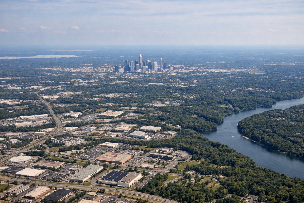
LEFTCharlotte Douglas typically receives arrivals from the west on Runway 18C/18L heading south, or from the southwest. A left-side seat on approach gives you a clear view of uptown Charlotte's skyline as you descend, with the city sitting to the east of the airport. The dense cluster of bank towers — Bank of America Corporate Center, Duke Energy Center — are unmistakable on final approach.
Will your flight be in sunlight?
Pick a date and time in the Sun Map to watch the sun move across your whole flight.
About This Route
Which side of the plane should I sit on flying from Tulsa International (TUL) to Charlotte Douglas International (CLT)?
Sit on the Left side of the plane for the best views on flights from Tulsa to Charlotte. While the right side wins at takeoff for the Tulsa skyline and Arkansas River, the left side delivers more consistently throughout the flight — particularly over the Ozark highlands of Arkansas, the Tennessee River valley terrain, and the dramatic approach into Charlotte with its skyline view. The left side also catches the western edge of the Appalachian foothills as the flight crosses into the Carolinas.
What can I see during takeoff from Tulsa International in Tulsa?
During takeoff from Tulsa International (TUL), sit on the Right side for the best views. Departing Tulsa typically on Runway 18R heading south or Runway 8 heading east, a right-side seat gives you views over downtown Tulsa and the Arkansas River as the aircraft climbs and turns eastward toward Charlotte. The distinctive BOK Center arena and the Art Deco skyline cluster are clearly visible from the right side during the initial climb and turn. Notable sights include: Downtown Tulsa skyline and BOK Center, Arkansas River and its riverside parks, Tulsa Hills to the southwest, Lake Keystone reservoir to the west-northwest.
What can I see when landing at Charlotte Douglas International in Charlotte?
When landing at Charlotte Douglas International (CLT), sit on the Left side for the best views. Charlotte Douglas typically receives arrivals from the west on Runway 18C/18L heading south, or from the southwest. A left-side seat on approach gives you a clear view of uptown Charlotte's skyline as you descend, with the city sitting to the east of the airport. The dense cluster of bank towers — Bank of America Corporate Center, Duke Energy Center — are unmistakable on final approach. Notable sights include: Uptown Charlotte skyline including Bank of America Corporate Center, Lake Norman to the north, Catawba River corridor, Charlotte Motor Speedway visible to the northeast.
How long is the flight from Tulsa to Charlotte?
The flight from Tulsa International (TUL) to Charlotte Douglas International (CLT) takes about 2 hours 10 minutes. The shortest flight path between them is 840 miles (1,352 km); winds and air traffic control usually add a few percent.
What does the Tulsa to Charlotte flight path pass over?
The flight crosses the Ozark Plateau of northwest Arkansas with its forested ridgelines and river valleys, then the Tennessee River valley and the Cumberland Plateau in Tennessee. As the route enters the Carolinas, the Blue Ridge escarpment becomes visible — the western front of the Appalachians — before the terrain drops back into the rolling Piedmont approaching Charlotte.