Comox to Calgary is 488 miles (786 km), a flight of about 1 hour 45 minutes.
While takeoff offers coastal scenery, the landing approach into Calgary provides the most dramatic and sustained visual experience—the Rockies at altitude are genuinely spectacular and visible for the final 30+ minutes of descent. Right seats capture this mountain profile head-on.
Flight Path
The flight path crosses the interior of British Columbia and Alberta. Notable features include the North Thompson River valley (visible around 45 minutes out), the transition from coastal mountains to interior plateau, the Rocky Mountain foothills becoming visible around 90 minutes into flight, and the prairie beginning to dominate the landscape as you approach Calgary. The Bow River valley becomes increasingly prominent in the final approach phase.
Great circle distance and headings ›
.jpg?width=600)

Phase by phase
Takeoff from YQQ
LEFTComox typically departs runway 09/27 depending on wind. Left seats (south-facing on westbound departure) capture the Strait of Georgia and Vancouver Island's dramatic coastline immediately after liftoff, with the Beaufort Range visible across the water.
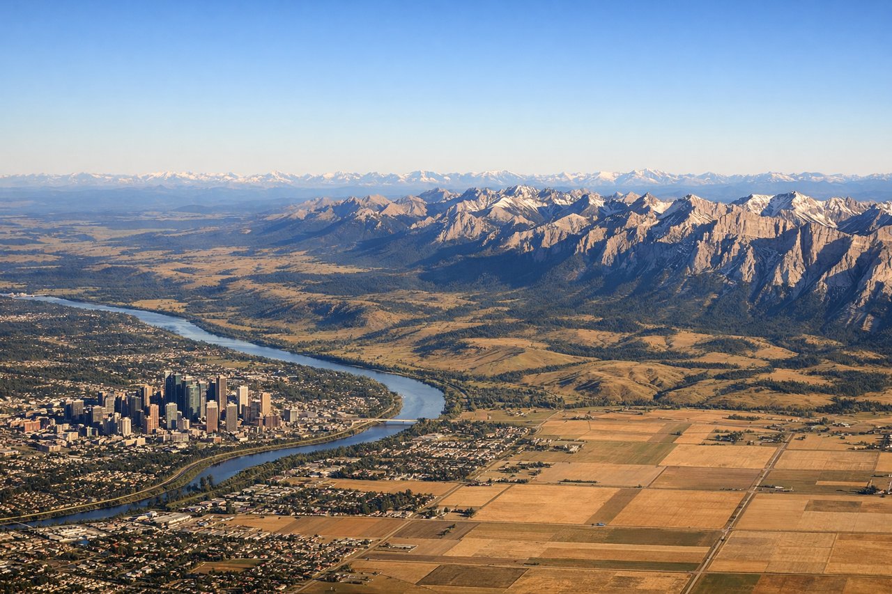
Landing at YYC
RIGHTCalgary approaches from the east on runways 16L/16R or 34L/34R depending on wind. Right seats on eastbound final approach capture the Canadian Rockies in their full dramatic profile—the Front Ranges rise sharply from the prairie with Cascade Mountain and the Bow River valley clearly visible during descent.
Landmarks on this routeAll landmarks →
Will your flight be in sunlight?
Pick a date and time in the Sun Map to watch the sun move across your whole flight.
About This Route
Which side of the plane should I sit on flying from Comox (YQQ) to Calgary International (YYC)?
Sit on the Right side of the plane for the best views on flights from Comox to Calgary. While takeoff offers coastal scenery, the landing approach into Calgary provides the most dramatic and sustained visual experience—the Rockies at altitude are genuinely spectacular and visible for the final 30+ minutes of descent. Right seats capture this mountain profile head-on.
What can I see during takeoff from Comox in Comox?
During takeoff from Comox (YQQ), sit on the Left side for the best views. Comox typically departs runway 09/27 depending on wind. Left seats (south-facing on westbound departure) capture the Strait of Georgia and Vancouver Island's dramatic coastline immediately after liftoff, with the Beaufort Range visible across the water. Notable sights include: Strait of Georgia, Beaufort Range (across water to west), Denman Island, Powell River area to the north.
What can I see when landing at Calgary International in Calgary?
When landing at Calgary International (YYC), sit on the Right side for the best views. Calgary approaches from the east on runways 16L/16R or 34L/34R depending on wind. Right seats on eastbound final approach capture the Canadian Rockies in their full dramatic profile—the Front Ranges rise sharply from the prairie with Cascade Mountain and the Bow River valley clearly visible during descent. Notable sights include: Canadian Rockies Front Range, Cascade Mountain, Bow River valley, Calgary city grid and downtown core.
How long is the flight from Comox to Calgary?
The flight from Comox (YQQ) to Calgary International (YYC) takes about 1 hour 45 minutes. The shortest flight path between them is 488 miles (786 km); winds and air traffic control usually add a few percent.
What does the Comox to Calgary flight path pass over?
The flight path crosses the interior of British Columbia and Alberta. Notable features include the North Thompson River valley (visible around 45 minutes out), the transition from coastal mountains to interior plateau, the Rocky Mountain foothills becoming visible around 90 minutes into flight, and the prairie beginning to dominate the landscape as you approach Calgary. The Bow River valley becomes increasingly prominent in the final approach phase.