Albuquerque to Denver is 350 miles (562 km), a flight of about 1 hour 15 minutes.
While takeoff offers the Sandia Mountains on the right, the landing approach into Denver provides more sustained and dramatic mountain scenery. The Front Range views on descent are more visually impressive and longer-lasting than the brief Sandia views during climb-out.
Flight Path
The flight path northbound from ABQ crosses the Albuquerque Basin, then enters the Sangre de Cristo Mountains foothills around Springer, New Mexico. The Canadian River valley and Raton Pass area (elevation 7,834 feet) mark the Colorado border. From there, the route continues north across the Purgatoire River valley and approaches the Front Range from the south, with views of the Palmer Divide and Pikes Peak region before turning northeast toward Denver.
Great circle distance and headings ›.jpg?width=600)
.jpg?width=600)
Phase by phase
Takeoff from ABQ
RIGHTRight-side seats offer views of the Sandia Mountains immediately east of Albuquerque during climb-out. The aircraft departs northbound, so the Sandias will be on your right wing as you gain altitude over the city.
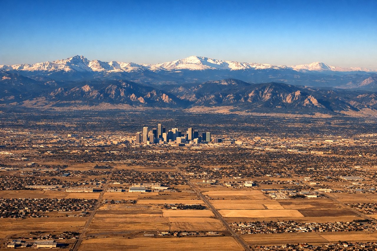
Landing at DEN
LEFTLeft-side seats provide excellent views of the Front Range as you descend into Denver from the south. The Rocky Mountains' eastern slope dominates the approach, with Pike's Peak visible on clear days further south.
Landmarks on this routeAll landmarks →
Will your flight be in sunlight?
Pick a date and time in the Sun Map to watch the sun move across your whole flight.
About This Route
Which side of the plane should I sit on flying from Albuquerque International Sunport (ABQ) to Denver International (DEN)?
Sit on the Left side of the plane for the best views on flights from Albuquerque to Denver. While takeoff offers the Sandia Mountains on the right, the landing approach into Denver provides more sustained and dramatic mountain scenery. The Front Range views on descent are more visually impressive and longer-lasting than the brief Sandia views during climb-out.
What can I see during takeoff from Albuquerque International Sunport in Albuquerque?
During takeoff from Albuquerque International Sunport (ABQ), sit on the Right side for the best views. Right-side seats offer views of the Sandia Mountains immediately east of Albuquerque during climb-out. The aircraft departs northbound, so the Sandias will be on your right wing as you gain altitude over the city. Notable sights include: Sandia Mountains (eastern escarpment), Albuquerque urban sprawl (Rio Grande valley floor), West Mesa volcanic plateau (western horizon).
What can I see when landing at Denver International in Denver?
When landing at Denver International (DEN), sit on the Left side for the best views. Left-side seats provide excellent views of the Front Range as you descend into Denver from the south. The Rocky Mountains' eastern slope dominates the approach, with Pike's Peak visible on clear days further south. Notable sights include: Front Range (Rocky Mountains), Denver metropolitan area (urban grid on plains), South Platte River valley (linear green corridor), Pike's Peak (southern horizon on clear days).
How long is the flight from Albuquerque to Denver?
The flight from Albuquerque International Sunport (ABQ) to Denver International (DEN) takes about 1 hour 15 minutes. The shortest flight path between them is 350 miles (562 km); winds and air traffic control usually add a few percent.
What does the Albuquerque to Denver flight path pass over?
The flight path northbound from ABQ crosses the Albuquerque Basin, then enters the Sangre de Cristo Mountains foothills around Springer, New Mexico. The Canadian River valley and Raton Pass area (elevation 7,834 feet) mark the Colorado border. From there, the route continues north across the Purgatoire River valley and approaches the Front Range from the south, with views of the Palmer Divide and Pikes Peak region before turning northeast toward Denver.