Left side wins at both ends of the flight. During the cruise at 35,000 ft on this northeast routing, the left side also tracks closer to the southern Rockies, the Colorado Plateau edge, and eventually the Appalachian ridgelines of Virginia and West Virginia as you descend — consistently more interesting terrain than the right side's open plains and suburban sprawl.
Flown ABQ to IAD? Did we get it right?
Flight Path
Albuquerque to Washington is 1,624 miles (2,614 km), a flight of about 3 hours 30 minutes.
The flight tracks northeast across the Texas Panhandle and Oklahoma, then over Missouri and southern Illinois before crossing Kentucky and West Virginia into Virginia. Notable features include the Cimarron River breaks in the Oklahoma panhandle, the flat-to-rolling Great Plains transition across Kansas, the Missouri and Ohio River confluence region near Cairo IL visible as broad silver waterways, and the Appalachian Ridge and Valley province of West Virginia — parallel forested ridgelines running northeast-southwest — visible on descent into the DC area.
Great circle distance and headings ›


Phase by phase
Takeoff from ABQ
LEFTABQ typically departs runway 08 (eastbound) or runway 26 (westbound). On the dominant eastbound departure (Rwy 08), a left turn northeastward puts the Sandia Mountains directly on the left side — a dramatic 10,678-ft granite escarpment rising 5,000 ft above the city. On westbound departures (Rwy 26), left side still captures the Rio Grande valley and Sandia crest as you climb out.
Landing at IAD
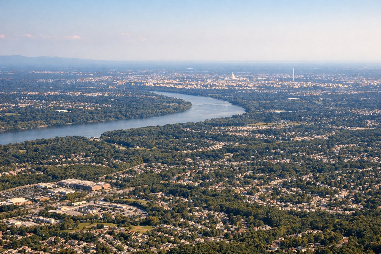
LEFTDulles typically lands on runway 01L/01R (northbound) or runway 19L/19R (southbound). On the common northbound approach (Rwy 01), the left side faces west and northwest, giving views over the Virginia piedmont and the distant Blue Ridge. On southbound approaches, left side captures the Potomac River, Washington DC skyline, and the National Mall corridor as you descend through 5,000-10,000 ft.
Will your flight be in sunlight?
Pick a date and time in the Sun Map to watch the sun move across your whole flight.
About This Route
Which side of the plane should I sit on flying from Albuquerque International Sunport (ABQ) to Washington Dulles International (IAD)?
Sit on the Left side of the plane for the best views on flights from Albuquerque to Washington. Left side wins at both ends of the flight. During the cruise at 35,000 ft on this northeast routing, the left side also tracks closer to the southern Rockies, the Colorado Plateau edge, and eventually the Appalachian ridgelines of Virginia and West Virginia as you descend — consistently more interesting terrain than the right side's open plains and suburban sprawl.
What can I see during takeoff from Albuquerque International Sunport in Albuquerque?
During takeoff from Albuquerque International Sunport (ABQ), sit on the Left side for the best views. ABQ typically departs runway 08 (eastbound) or runway 26 (westbound). On the dominant eastbound departure (Rwy 08), a left turn northeastward puts the Sandia Mountains directly on the left side — a dramatic 10,678-ft granite escarpment rising 5,000 ft above the city. On westbound departures (Rwy 26), left side still captures the Rio Grande valley and Sandia crest as you climb out. Notable sights include: Sandia Mountains (Crest at 10,678 ft), Rio Grande valley and bosque corridor, Albuquerque city grid and Old Town, Jemez Mountains to the northwest.
What can I see when landing at Washington Dulles International in Washington?
When landing at Washington Dulles International (IAD), sit on the Left side for the best views. Dulles typically lands on runway 01L/01R (northbound) or runway 19L/19R (southbound). On the common northbound approach (Rwy 01), the left side faces west and northwest, giving views over the Virginia piedmont and the distant Blue Ridge. On southbound approaches, left side captures the Potomac River, Washington DC skyline, and the National Mall corridor as you descend through 5,000-10,000 ft. Notable sights include: Potomac River and its broad curves, Washington DC skyline and National Mall axis, Blue Ridge Mountains on the western horizon, Dulles Access Road corridor and Tysons Corner cluster.
How long is the flight from Albuquerque to Washington?
The flight from Albuquerque International Sunport (ABQ) to Washington Dulles International (IAD) takes about 3 hours 30 minutes. The shortest flight path between them is 1,624 miles (2,614 km); winds and air traffic control usually add a few percent.
What does the Albuquerque to Washington flight path pass over?
The flight tracks northeast across the Texas Panhandle and Oklahoma, then over Missouri and southern Illinois before crossing Kentucky and West Virginia into Virginia. Notable features include the Cimarron River breaks in the Oklahoma panhandle, the flat-to-rolling Great Plains transition across Kansas, the Missouri and Ohio River confluence region near Cairo IL visible as broad silver waterways, and the Appalachian Ridge and Valley province of West Virginia — parallel forested ridgelines running northeast-southwest — visible on descent into the DC area.