The takeoff scenery from Addis Ababa—the Ethiopian Highlands, Blue Nile gorge, and Simien Mountains—offers more dramatic and distinctive visual features than the landing approach. While Lake Ontario and the Toronto waterfront are pleasant, the Ethiopian terrain is more geographically striking.
Flight Path
The flight path crosses the Sahara Desert (featureless tan terrain for ~4-5 hours), the Atlas Mountains visible near Morocco/Algeria border, the Atlantic Ocean crossing (6-7 hours), and the eastern seaboard of North America including the Appalachian Mountains and Great Lakes region during final descent.
Great circle distance and headings ›

.jpeg?width=600)

Phase by phase
Takeoff from ADD
RIGHTRight-side seats offer views of the Ethiopian Highlands immediately after departure. The aircraft climbs northwestward from Addis Ababa, and right-side windows capture the dramatic escarpment and elevated terrain that defines the region's topography.
Landing at YYZ
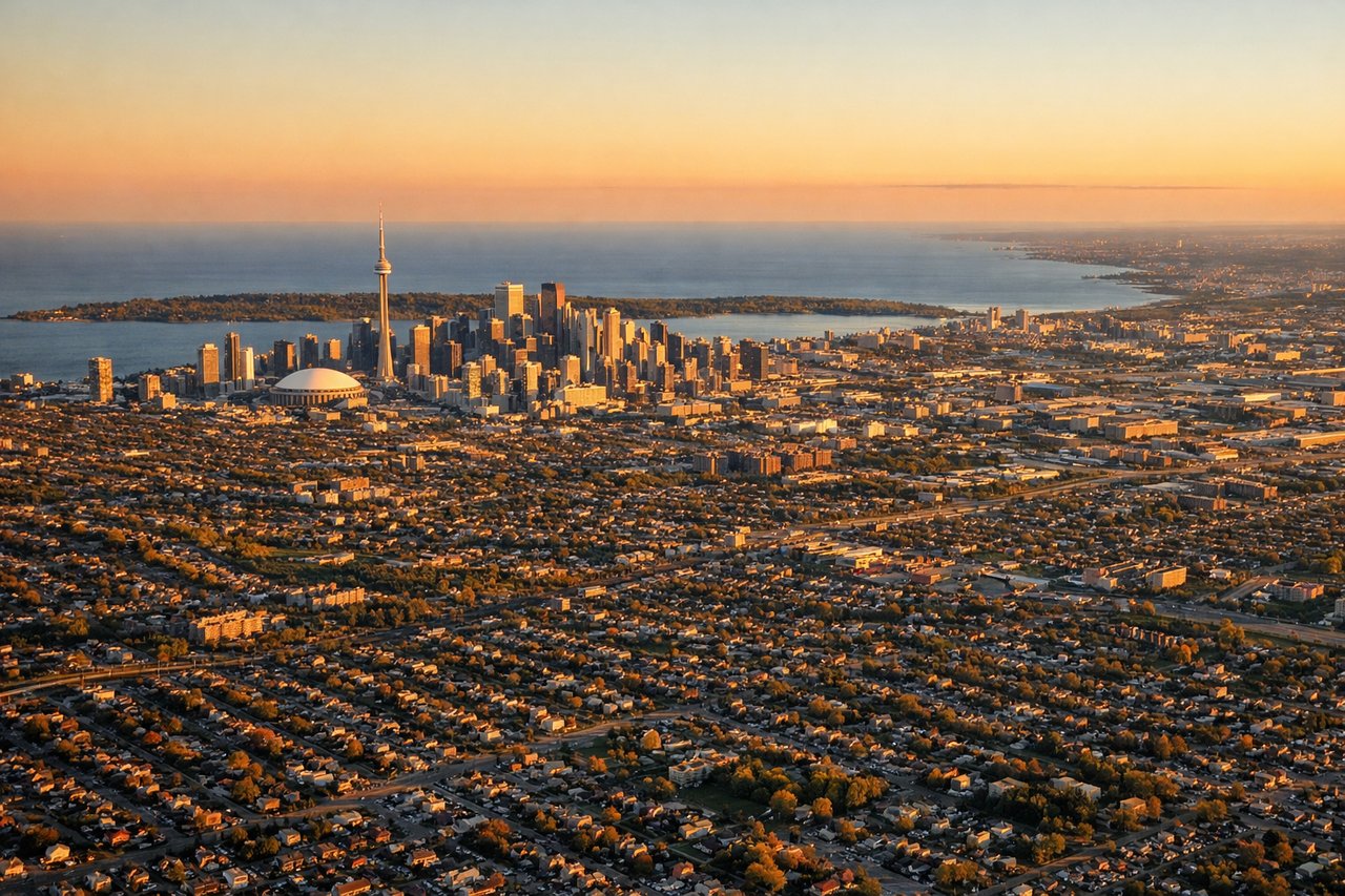
LEFTLeft-side seats provide excellent views during the descent into Toronto. The aircraft approaches from the east over Lake Ontario, and left-side windows capture the Great Lakes shoreline, the Scarborough Bluffs, and the Toronto waterfront as the plane descends toward Lester B. Pearson.
Landmarks on this routeAll landmarks →
Will your flight be in sunlight?
See exactly which side of the plane gets sun and shade at your departure time.
About This Route
Which side of the plane should I sit on flying from Bole International (ADD) to Lester B Pearson International (YYZ)?
Sit on the Right side of the plane for the best views on flights from Addis Ababa to Toronto. The takeoff scenery from Addis Ababa—the Ethiopian Highlands, Blue Nile gorge, and Simien Mountains—offers more dramatic and distinctive visual features than the landing approach. While Lake Ontario and the Toronto waterfront are pleasant, the Ethiopian terrain is more geographically striking.
What can I see during takeoff from Bole International in Addis Ababa?
During takeoff from Bole International (ADD), sit on the Right side for the best views. Right-side seats offer views of the Ethiopian Highlands immediately after departure. The aircraft climbs northwestward from Addis Ababa, and right-side windows capture the dramatic escarpment and elevated terrain that defines the region's topography. Notable sights include: Ethiopian Highlands (Addis Ababa plateau at ~7,700 ft elevation), Blue Nile gorge system to the northwest, Lake Tana (visible at ~15,000 ft altitude during climb), Simien Mountains escarpment.
What can I see when landing at Lester B Pearson International in Toronto?
When landing at Lester B Pearson International (YYZ), sit on the Left side for the best views. Left-side seats provide excellent views during the descent into Toronto. The aircraft approaches from the east over Lake Ontario, and left-side windows capture the Great Lakes shoreline, the Scarborough Bluffs, and the Toronto waterfront as the plane descends toward Lester B. Pearson. Notable sights include: Lake Ontario (dominant water feature), Scarborough Bluffs (distinctive eroded clay cliffs on Toronto's eastern waterfront), Toronto Islands and Toronto Harbor, Niagara Escarpment visible to the west across the lake.
How long is the flight from Addis Ababa to Toronto?
The flight from Bole International (ADD) to Lester B Pearson International (YYZ) takes 15h 20m.
What does the Addis Ababa to Toronto flight path pass over?
The flight path crosses the Sahara Desert (featureless tan terrain for ~4-5 hours), the Atlas Mountains visible near Morocco/Algeria border, the Atlantic Ocean crossing (6-7 hours), and the eastern seaboard of North America including the Appalachian Mountains and Great Lakes region during final descent.