Left side wins both the departure over the Ethiopian Highlands and the arrival into New York Harbor, making it the clear choice for the full journey.
Flown ADD to JFK? Did we get it right?
Flight Path
Addis Ababa to New York is 6,960 miles (11,200 km), a flight of about 13 hours 25 minutes.
The great circle route tracks northwest from Ethiopia over Sudan and the Sahara Desert, then across the Mediterranean near Libya or Tunisia, over the Iberian Peninsula or France, across the North Atlantic, and approaches New York from the northeast over Nova Scotia and New England. Key features include the Nile Valley visible as a green ribbon through the Saharan desert, the Atlas Mountains of Morocco or the Alps depending on exact routing, the vast blue expanse of the North Atlantic, and the Canadian Maritime coastline before descending into the northeastern US.
Great circle distance and headings ›


Phase by phase
Takeoff from ADD
LEFTAddis Ababa's primary departure runway 07R sends aircraft northeast, putting the Ethiopian Highlands and the Entoto Hills directly on the left (north) side. The city itself spreads out to the left with the distinctive plateau terrain visible during climb-out.
Landing at JFK
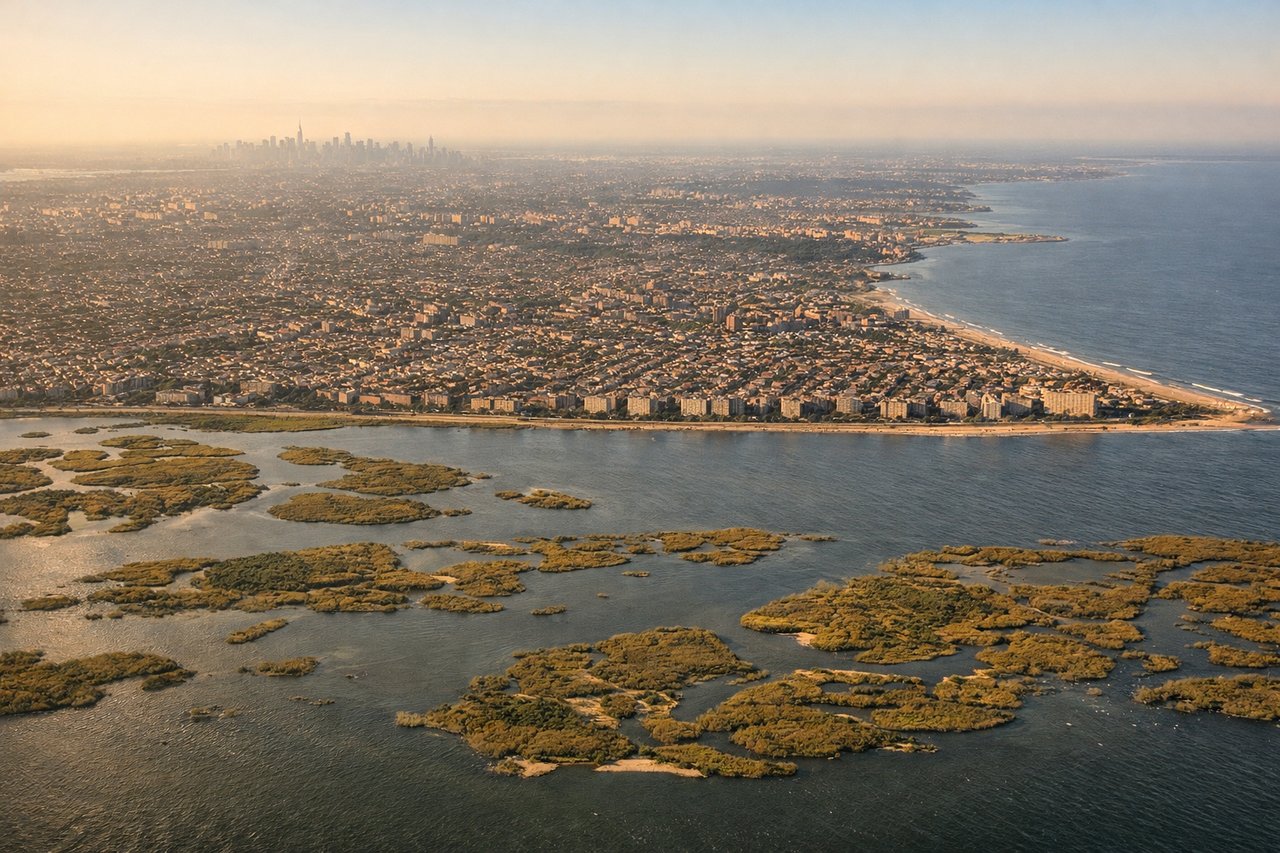
LEFTJFK's most common arrival approach is from the northeast on runway 31L/31R, meaning aircraft track southwest over Long Island before touchdown. The left side gives a clear view of Lower Manhattan's skyline, New York Harbor, and the Verrazano-Narrows Bridge as the aircraft descends over Jamaica Bay.
Will your flight be in sunlight?
Pick a date and time in the Sun Map to watch the sun move across your whole flight.
About This Route
Which side of the plane should I sit on flying from Bole International (ADD) to John F Kennedy International (JFK)?
Sit on the Left side of the plane for the best views on flights from Addis Ababa to New York. Left side wins both the departure over the Ethiopian Highlands and the arrival into New York Harbor, making it the clear choice for the full journey.
What can I see during takeoff from Bole International in Addis Ababa?
During takeoff from Bole International (ADD), sit on the Left side for the best views. Addis Ababa's primary departure runway 07R sends aircraft northeast, putting the Ethiopian Highlands and the Entoto Hills directly on the left (north) side. The city itself spreads out to the left with the distinctive plateau terrain visible during climb-out. Notable sights include: Entoto Hills ridge north of the city, Addis Ababa urban grid below, Ethiopian Highlands plateau escarpment to the northwest, Mount Zuqualla volcanic cone to the south visible briefly on left during turn.
What can I see when landing at John F Kennedy International in New York?
When landing at John F Kennedy International (JFK), sit on the Left side for the best views. JFK's most common arrival approach is from the northeast on runway 31L/31R, meaning aircraft track southwest over Long Island before touchdown. The left side gives a clear view of Lower Manhattan's skyline, New York Harbor, and the Verrazano-Narrows Bridge as the aircraft descends over Jamaica Bay. Notable sights include: Lower Manhattan skyline across Jamaica Bay, Verrazano-Narrows Bridge, Jamaica Bay wetlands directly below, Brooklyn waterfront.
How long is the flight from Addis Ababa to New York?
The flight from Bole International (ADD) to John F Kennedy International (JFK) takes about 13 hours 25 minutes. The shortest flight path between them is 6,960 miles (11,200 km); winds and air traffic control usually add a few percent.
What does the Addis Ababa to New York flight path pass over?
The great circle route tracks northwest from Ethiopia over Sudan and the Sahara Desert, then across the Mediterranean near Libya or Tunisia, over the Iberian Peninsula or France, across the North Atlantic, and approaches New York from the northeast over Nova Scotia and New England. Key features include the Nile Valley visible as a green ribbon through the Saharan desert, the Atlas Mountains of Morocco or the Alps depending on exact routing, the vast blue expanse of the North Atlantic, and the Canadian Maritime coastline before descending into the northeastern US.