Buenos Aires to Mendoza is 608 miles (979 km), a flight of about 2 hours 15 minutes.
Right-side seats dominate both departure and arrival phases. The westbound flight path keeps the Andes on the left (southern) side at altitude, but right seats capture the more dramatic Buenos Aires departure and the river approach on landing.
Flight Path
The flight crosses the flat Pampas terrain with no significant elevation gain until the final 200 km. Around the midpoint (near Bragado/Junín region), the landscape remains uniformly flat with sparse settlements and agricultural fields. The Andes foothills begin appearing on the left (south) side around 100 km west of Mendoza, with the Sierra de Córdoba visible as low ridges on the left around 150 km from destination. The final descent reveals the Andes' eastern face with Aconcagua massif (6,961 m) visible as a distant peak on the left horizon during clear conditions, though often obscured by haze or cloud. El Plumerillo airport sits in the Cuyo region's piedmont, surrounded by irrigated vineyards and the Mendoza River valley.
Great circle distance and headings ›Phase by phase
Takeoff from AEP
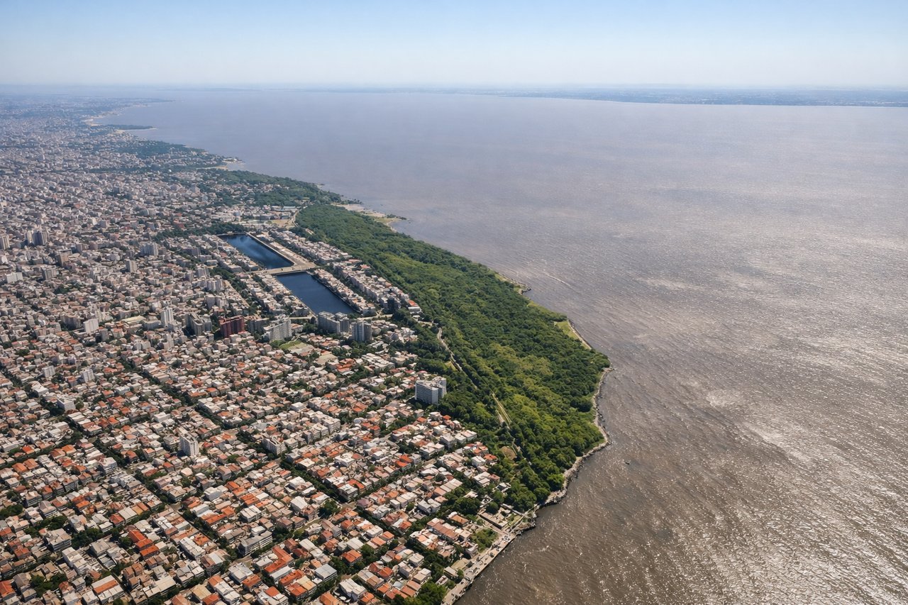
RIGHTAEP typically departs northbound (Runway 09/27 or 13/31), and right-side seats offer immediate views of the Río de la Plata's northern shore and the city grid of Buenos Aires spreading inland. Left seats face the river's southern expanse with fewer distinctive landmarks during initial climb.
Landing at MDZ
RIGHTApproach to AEP typically comes from the west or northwest, and right-side seats provide the best view of the Andes foothills as they recede and the approach to the Río de la Plata. The descent path aligns the right side with the incoming terrain and river approach.
Landmarks on this routeAll landmarks →
Will your flight be in sunlight?
Pick a date and time in the Sun Map to watch the sun move across your whole flight.
About This Route
Which side of the plane should I sit on flying from Aeroparque Jorge Newbery (AEP) to El Plumerillo (MDZ)?
Sit on the Right side of the plane for the best views on flights from Buenos Aires to Mendoza. Right-side seats dominate both departure and arrival phases. The westbound flight path keeps the Andes on the left (southern) side at altitude, but right seats capture the more dramatic Buenos Aires departure and the river approach on landing.
What can I see during takeoff from Aeroparque Jorge Newbery in Buenos Aires?
During takeoff from Aeroparque Jorge Newbery (AEP), sit on the Right side for the best views. AEP typically departs northbound (Runway 09/27 or 13/31), and right-side seats offer immediate views of the Río de la Plata's northern shore and the city grid of Buenos Aires spreading inland. Left seats face the river's southern expanse with fewer distinctive landmarks during initial climb. Notable sights include: Río de la Plata (immediate view), Buenos Aires urban grid (Palermo and Recoleta districts), Tigre Delta waterways to the north, Paraná River confluence.
What can I see when landing at El Plumerillo in Mendoza?
When landing at El Plumerillo (MDZ), sit on the Right side for the best views. Approach to AEP typically comes from the west or northwest, and right-side seats provide the best view of the Andes foothills as they recede and the approach to the Río de la Plata. The descent path aligns the right side with the incoming terrain and river approach. Notable sights include: Río de la Plata (final approach corridor), Paraná River delta system, Buenos Aires sprawl (San Isidro, Vicente López districts), approaching runway alignment over water.
How long is the flight from Buenos Aires to Mendoza?
The flight from Aeroparque Jorge Newbery (AEP) to El Plumerillo (MDZ) takes about 2 hours 15 minutes. The shortest flight path between them is 608 miles (979 km); winds and air traffic control usually add a few percent.
What does the Buenos Aires to Mendoza flight path pass over?
The flight crosses the flat Pampas terrain with no significant elevation gain until the final 200 km. Around the midpoint (near Bragado/Junín region), the landscape remains uniformly flat with sparse settlements and agricultural fields. The Andes foothills begin appearing on the left (south) side around 100 km west of Mendoza, with the Sierra de Córdoba visible as low ridges on the left around 150 km from destination. The final descent reveals the Andes' eastern face with Aconcagua massif (6,961 m) visible as a distant peak on the left horizon during clear conditions, though often obscured by haze or cloud. El Plumerillo airport sits in the Cuyo region's piedmont, surrounded by irrigated vineyards and the Mendoza River valley.