Buenos Aires to Toronto is 5,568 miles (8,961 km), a flight of about 10 hours 30 minutes.
While the right seat wins at departure for the Rio de la Plata views, the left seat delivers the more dramatic single moment of the flight: the Toronto skyline and Lake Ontario on approach. Over the long 10-hour flight the left side also tracks closer to the Amazon basin and Caribbean coastline during the equatorial crossing, offering more varied terrain interest.
Flight Path
The route tracks northward over Paraguay and western Brazil, crossing the Amazon basin with its vast river network and forest canopy visible on clear days. The flight then crosses Venezuela and the Caribbean Sea, passing near Trinidad and Tobago. After crossing Cuba and the Gulf of Mexico or Florida Straits depending on routing, the aircraft enters the eastern United States before crossing into Ontario. The Appalachian Mountains may be visible as a broad ridgeline system in the eastern US portion of the flight.
Great circle distance and headings ›_(cropped).jpg?width=600)
.jpeg?width=600)

Phase by phase
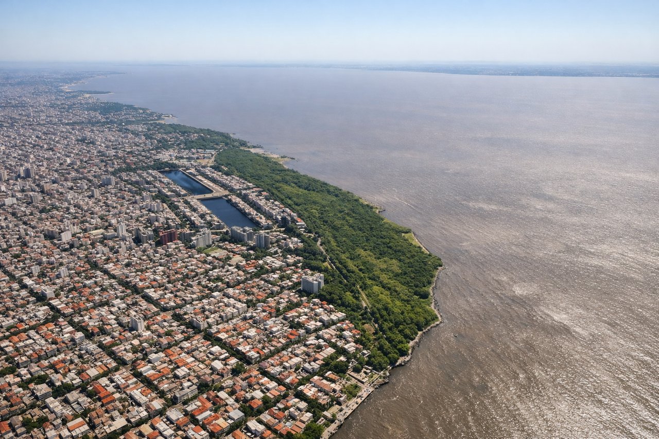
Takeoff from AEP
RIGHTAeroparque sits right on the Rio de la Plata shoreline. Departing north on runway 13/31, a right-side seat gives you the Buenos Aires city grid, the wide brown expanse of the Rio de la Plata, and the dense urban fabric of the northern barrios. Left side faces inland toward the western suburbs with less visual interest.
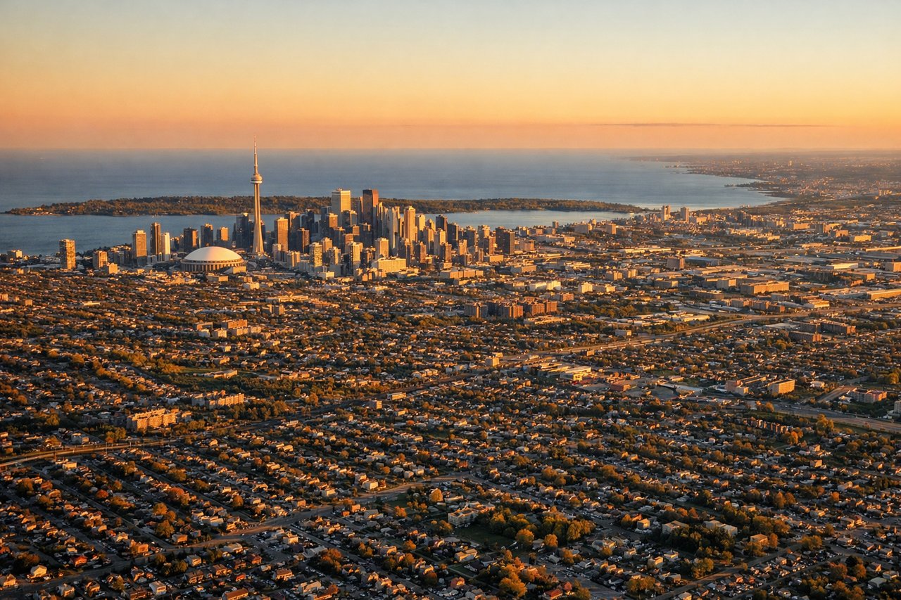
Landing at YYZ
LEFTPearson typically uses runways oriented roughly east-west. On approach from the south, a left-side seat gives views over Lake Ontario, the Toronto skyline including the CN Tower, and the city's lakefront before crossing over Mississauga toward the airport. Right side faces north toward suburban sprawl with less visual payoff.
Landmarks on this routeAll landmarks →
Will your flight be in sunlight?
Pick a date and time in the Sun Map to watch the sun move across your whole flight.
About This Route
Which side of the plane should I sit on flying from Aeroparque Jorge Newbery (AEP) to Lester B Pearson International (YYZ)?
Sit on the Left side of the plane for the best views on flights from Buenos Aires to Toronto. While the right seat wins at departure for the Rio de la Plata views, the left seat delivers the more dramatic single moment of the flight: the Toronto skyline and Lake Ontario on approach. Over the long 10-hour flight the left side also tracks closer to the Amazon basin and Caribbean coastline during the equatorial crossing, offering more varied terrain interest.
What can I see during takeoff from Aeroparque Jorge Newbery in Buenos Aires?
During takeoff from Aeroparque Jorge Newbery (AEP), sit on the Right side for the best views. Aeroparque sits right on the Rio de la Plata shoreline. Departing north on runway 13/31, a right-side seat gives you the Buenos Aires city grid, the wide brown expanse of the Rio de la Plata, and the dense urban fabric of the northern barrios. Left side faces inland toward the western suburbs with less visual interest. Notable sights include: Rio de la Plata estuary, Buenos Aires city grid and Puerto Madero waterfront, Costanera Norte recreational strip, Tigre Delta channels visible to the north.
What can I see when landing at Lester B Pearson International in Toronto?
When landing at Lester B Pearson International (YYZ), sit on the Left side for the best views. Pearson typically uses runways oriented roughly east-west. On approach from the south, a left-side seat gives views over Lake Ontario, the Toronto skyline including the CN Tower, and the city's lakefront before crossing over Mississauga toward the airport. Right side faces north toward suburban sprawl with less visual payoff. Notable sights include: Lake Ontario, Toronto downtown skyline and CN Tower, Toronto Islands, Mississauga urban grid.
How long is the flight from Buenos Aires to Toronto?
The flight from Aeroparque Jorge Newbery (AEP) to Lester B Pearson International (YYZ) takes about 10 hours 30 minutes. The shortest flight path between them is 5,568 miles (8,961 km); winds and air traffic control usually add a few percent.
What does the Buenos Aires to Toronto flight path pass over?
The route tracks northward over Paraguay and western Brazil, crossing the Amazon basin with its vast river network and forest canopy visible on clear days. The flight then crosses Venezuela and the Caribbean Sea, passing near Trinidad and Tobago. After crossing Cuba and the Gulf of Mexico or Florida Straits depending on routing, the aircraft enters the eastern United States before crossing into Ontario. The Appalachian Mountains may be visible as a broad ridgeline system in the eastern US portion of the flight.