Aracaju to Washington is 4,318 miles (6,949 km), a flight of about 9 hours 15 minutes.
Right-side seats dominate both departure and arrival phases. The takeoff offers coastal and river delta scenery, while the landing provides river, mountain, and metropolitan views. Left-side seats would see inland Sergipe and Virginia farmland—less visually distinctive.
Flight Path
The flight path crosses the Atlantic Ocean for roughly 5,000 miles. Notable features include the Caribbean islands (Barbados, Dominica, or Guadeloupe may be visible depending on exact routing), the Bahamas, and the southeastern United States coastline. The Appalachian Mountains become visible in the final 2 hours of flight as the aircraft descends toward Washington.
Great circle distance and headings ›

.jpeg?width=600)
Phase by phase
Takeoff from AJU
RIGHTRight-side seats offer views of the Sergipe coastline and the Atlantic Ocean immediately after departure. The aircraft climbs northwestward, so right-side passengers see the mouth of the Rio São Francisco and the northeastern Brazilian coast stretching toward Pernambuco.
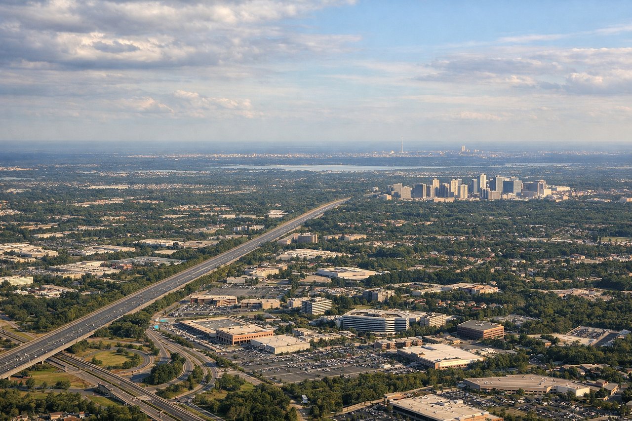
Landing at IAD
RIGHTRight-side seats provide excellent views during the descent into Washington Dulles. The aircraft approaches from the southeast, and right-side passengers see the Potomac River, the Blue Ridge Mountains in the distance, and the Washington metropolitan area's urban sprawl before touchdown.
Landmarks on this routeAll landmarks →
Will your flight be in sunlight?
Pick a date and time in the Sun Map to watch the sun move across your whole flight.
About This Route
Which side of the plane should I sit on flying from Santa Maria (AJU) to Washington Dulles International (IAD)?
Sit on the Right side of the plane for the best views on flights from Aracaju to Washington. Right-side seats dominate both departure and arrival phases. The takeoff offers coastal and river delta scenery, while the landing provides river, mountain, and metropolitan views. Left-side seats would see inland Sergipe and Virginia farmland—less visually distinctive.
What can I see during takeoff from Santa Maria in Aracaju?
During takeoff from Santa Maria (AJU), sit on the Right side for the best views. Right-side seats offer views of the Sergipe coastline and the Atlantic Ocean immediately after departure. The aircraft climbs northwestward, so right-side passengers see the mouth of the Rio São Francisco and the northeastern Brazilian coast stretching toward Pernambuco. Notable sights include: Atlantic Ocean, Rio São Francisco delta, Sergipe coastline, Recife metropolitan area (visible at distance).
What can I see when landing at Washington Dulles International in Washington?
When landing at Washington Dulles International (IAD), sit on the Right side for the best views. Right-side seats provide excellent views during the descent into Washington Dulles. The aircraft approaches from the southeast, and right-side passengers see the Potomac River, the Blue Ridge Mountains in the distance, and the Washington metropolitan area's urban sprawl before touchdown. Notable sights include: Potomac River, Blue Ridge Mountains, Washington DC metropolitan area, Dulles Airport runways.
How long is the flight from Aracaju to Washington?
The flight from Santa Maria (AJU) to Washington Dulles International (IAD) takes about 9 hours 15 minutes. The shortest flight path between them is 4,318 miles (6,949 km); winds and air traffic control usually add a few percent.
What does the Aracaju to Washington flight path pass over?
The flight path crosses the Atlantic Ocean for roughly 5,000 miles. Notable features include the Caribbean islands (Barbados, Dominica, or Guadeloupe may be visible depending on exact routing), the Bahamas, and the southeastern United States coastline. The Appalachian Mountains become visible in the final 2 hours of flight as the aircraft descends toward Washington.