This is a short hop of about 400 km over flat Low Countries and northern French plains, so neither side scores high. The left side wins because of the Paris approach, with the city, Montmartre and La Défense ahead-left on final. It also gets distant views toward Antwerp and Brussels, which lie east of the track. The right side's best moment is the polder and tulip-field departure.
Flown AMS to CDG? Did we get it right?
Flight Path
Amsterdam to Paris is 248 miles (399 km), a flight of about 1 hour 15 minutes.
The track runs south-southwest over the Dutch polders near Rotterdam and passes west of Antwerp and its Scheldt port (left side). Brussels lies farther east, again on the left. It crosses the Belgian-French border near Tournai and Lille, then runs over the flat plains of Picardy toward the Oise valley and the forests around Chantilly just north of Paris.
Great circle distance and headings ›

Phase by phase
Takeoff from AMS
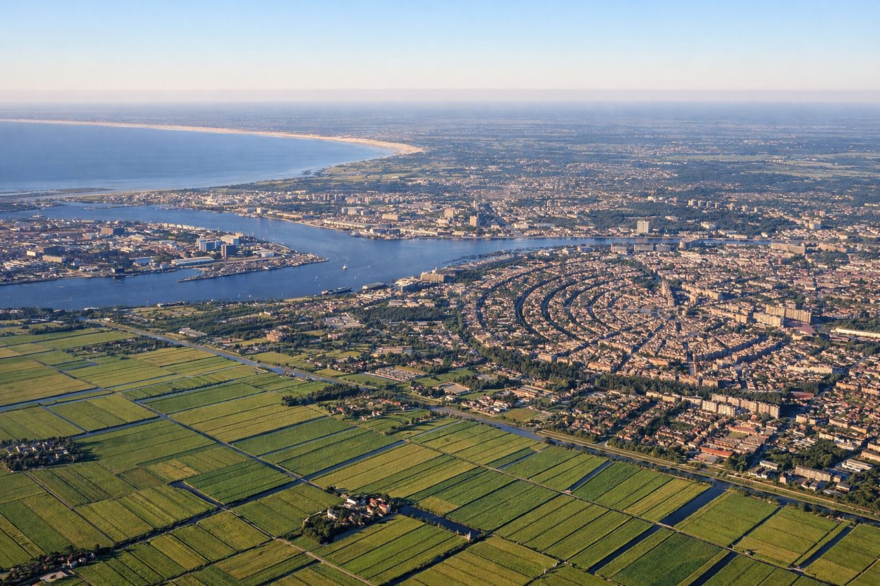
RIGHTAssuming a southbound departure from the 18-side runways (Aalsmeerbaan or Polderbaan) followed by a gentle right turn toward Belgium, the right windows look west over the Haarlemmermeer polder, the Kaag lakes and the bulb fields around Lisse. On a clear day you can also see the North Sea dune coast about 25 km away. The left side gets Schiphol and the edge of Amstelveen, but Amsterdam stays mostly behind the wing.
Landing at CDG
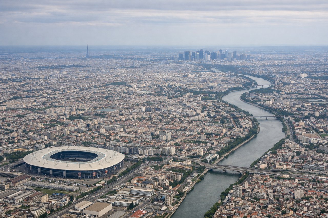
LEFTIn the usual west-flow configuration at CDG, arrivals from the north swing around the northeast side of the airport and line up heading west on the 26/27 runways. Paris then sits ahead and to the left of the aircraft. The left windows get the city sprawl, Montmartre, La Défense and a small Eiffel Tower, while the right side sees mostly farmland and suburbs.
Will your flight be in sunlight?
Pick a date and time in the Sun Map to watch the sun move across your whole flight.
About This Route
Which side of the plane should I sit on flying from Schiphol (AMS) to Charles De Gaulle (CDG)?
Sit on the Left side of the plane for the best views on flights from Amsterdam to Paris. This is a short hop of about 400 km over flat Low Countries and northern French plains, so neither side scores high. The left side wins because of the Paris approach, with the city, Montmartre and La Défense ahead-left on final. It also gets distant views toward Antwerp and Brussels, which lie east of the track. The right side's best moment is the polder and tulip-field departure.
What can I see during takeoff from Schiphol in Amsterdam?
During takeoff from Schiphol (AMS), sit on the Right side for the best views. Assuming a southbound departure from the 18-side runways (Aalsmeerbaan or Polderbaan) followed by a gentle right turn toward Belgium, the right windows look west over the Haarlemmermeer polder, the Kaag lakes and the bulb fields around Lisse. On a clear day you can also see the North Sea dune coast about 25 km away. The left side gets Schiphol and the edge of Amstelveen, but Amsterdam stays mostly behind the wing. Notable sights include: Haarlemmermeer polder grid, Kagerplassen lakes near Kaag, Lisse bulb fields (colourful in spring), North Sea dune coast near Katwijk.
What can I see when landing at Charles De Gaulle in Paris?
When landing at Charles De Gaulle (CDG), sit on the Left side for the best views. In the usual west-flow configuration at CDG, arrivals from the north swing around the northeast side of the airport and line up heading west on the 26/27 runways. Paris then sits ahead and to the left of the aircraft. The left windows get the city sprawl, Montmartre, La Défense and a small Eiffel Tower, while the right side sees mostly farmland and suburbs. Notable sights include: Paris skyline and city sprawl, Sacré-Cœur on Montmartre, La Défense towers, Eiffel Tower in the distance.
How long is the flight from Amsterdam to Paris?
The flight from Schiphol (AMS) to Charles De Gaulle (CDG) takes about 1 hour 15 minutes. The shortest flight path between them is 248 miles (399 km); winds and air traffic control usually add a few percent.
What does the Amsterdam to Paris flight path pass over?
The track runs south-southwest over the Dutch polders near Rotterdam and passes west of Antwerp and its Scheldt port (left side). Brussels lies farther east, again on the left. It crosses the Belgian-French border near Tournai and Lille, then runs over the flat plains of Picardy toward the Oise valley and the forests around Chantilly just north of Paris.