The right side captures Amsterdam's cityscape and coastline on departure and Atlanta's skyline with Stone Mountain on arrival, while the long mid-ocean cruise phase is scenically flat on both sides. The left side lacks any comparable landmark moments at either end of the flight.
Flown AMS to ATL? Did we get it right?
Flight Path
Amsterdam to Atlanta is 4,390 miles (7,066 km), a flight of about 10 hours 15 minutes.
Extended North Atlantic crossing with no land visible for most of the flight; the great-circle track passes near the south coast of Ireland shortly after the UK and later crosses over Newfoundland/Atlantic Canada before continuing down over the Appalachian Mountains toward Georgia.
Great circle distance and headings ›


Phase by phase
Takeoff from AMS
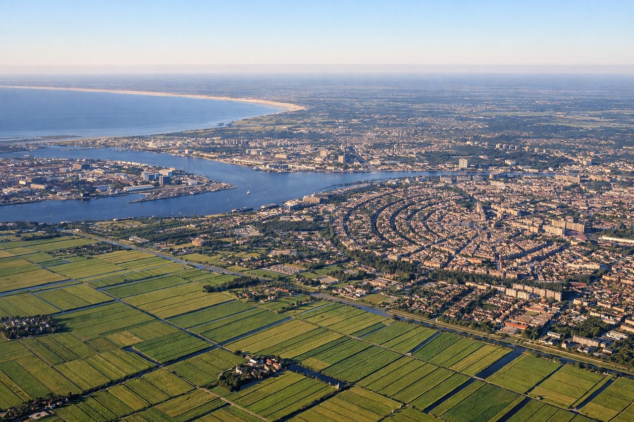
RIGHTDepartures off Schiphol's Polderbaan typically roll south before banking right onto the westbound oceanic track, swinging Amsterdam's city center, canal rings, and the North Sea coast into view on the right side. The left side mostly shows flat, repetitive polder farmland toward Rotterdam and The Hague.

Landing at ATL
RIGHTArriving from the northeast under typical west-flow operations, the aircraft descends past the north side of metro Atlanta before turning onto final, putting downtown Atlanta's skyline and Stone Mountain's granite dome on the right. The left side mostly shows undifferentiated southern suburbs and pine forest.
Will your flight be in sunlight?
Pick a date and time in the Sun Map to watch the sun move across your whole flight.
About This Route
Which side of the plane should I sit on flying from Schiphol (AMS) to The William B Hartsfield Atlanta International (ATL)?
Sit on the Right side of the plane for the best views on flights from Amsterdam to Atlanta. The right side captures Amsterdam's cityscape and coastline on departure and Atlanta's skyline with Stone Mountain on arrival, while the long mid-ocean cruise phase is scenically flat on both sides. The left side lacks any comparable landmark moments at either end of the flight.
What can I see during takeoff from Schiphol in Amsterdam?
During takeoff from Schiphol (AMS), sit on the Right side for the best views. Departures off Schiphol's Polderbaan typically roll south before banking right onto the westbound oceanic track, swinging Amsterdam's city center, canal rings, and the North Sea coast into view on the right side. The left side mostly shows flat, repetitive polder farmland toward Rotterdam and The Hague. Notable sights include: Amsterdam city center and canal ring, Haarlem, North Sea coastline near Zandvoort/IJmuiden, IJsselmeer in the distance.
What can I see when landing at The William B Hartsfield Atlanta International in Atlanta?
When landing at The William B Hartsfield Atlanta International (ATL), sit on the Right side for the best views. Arriving from the northeast under typical west-flow operations, the aircraft descends past the north side of metro Atlanta before turning onto final, putting downtown Atlanta's skyline and Stone Mountain's granite dome on the right. The left side mostly shows undifferentiated southern suburbs and pine forest. Notable sights include: Downtown Atlanta skyline, Stone Mountain, Chattahoochee River, north Georgia foothills on the horizon.
How long is the flight from Amsterdam to Atlanta?
The flight from Schiphol (AMS) to The William B Hartsfield Atlanta International (ATL) takes about 10 hours 15 minutes. The shortest flight path between them is 4,390 miles (7,066 km); winds and air traffic control usually add a few percent.
What does the Amsterdam to Atlanta flight path pass over?
Extended North Atlantic crossing with no land visible for most of the flight; the great-circle track passes near the south coast of Ireland shortly after the UK and later crosses over Newfoundland/Atlantic Canada before continuing down over the Appalachian Mountains toward Georgia.