Amsterdam to Santa Ana is 5,565 miles (8,955 km), a flight of about 11 hours.
While the takeoff offers North Sea views, the landing approach provides more dramatic and visually distinctive scenery with mountains, coastline, and the Pacific Ocean. Right side captures the most memorable portion of this transatlantic route.
Flight Path
The flight path crosses the Atlantic Ocean for roughly 6-7 hours with no visible landmarks. Notable waypoints include the southern tip of Greenland (visible on clear days during the northern route), the Canadian Arctic archipelago, and the Rocky Mountains as the aircraft approaches North America. The descent into Southern California offers views of the Sierra Nevada range and the Mojave Desert before reaching the coastal approach zone.
Great circle distance and headings ›

.jpg?width=600)


.jpg?width=600)
Phase by phase
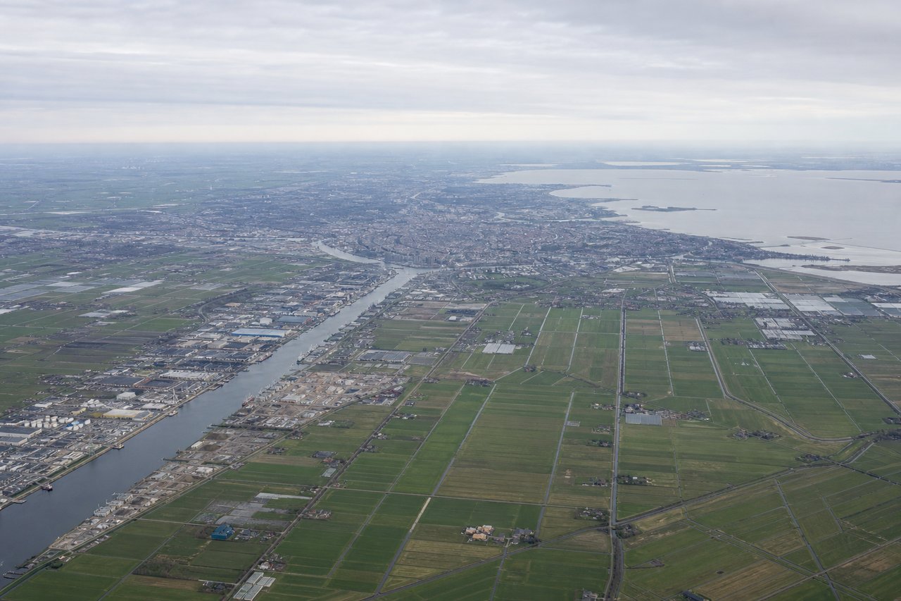
Takeoff from AMS
LEFTLeft side offers views of the North Sea coast and the Dutch coastline as the aircraft climbs northwestward from Schiphol. You'll see the distinctive flat polder landscape and waterways that characterize the Netherlands' western edge.
Landing at SNA
RIGHTRight side provides excellent views during descent into Orange County. You'll see the Santa Ana Mountains, the Los Angeles Basin sprawl, and the Pacific coastline including Newport Beach and the distinctive Balboa Peninsula before final approach into SNA.
Landmarks on this routeAll landmarks →
Will your flight be in sunlight?
Pick a date and time in the Sun Map to watch the sun move across your whole flight.
About This Route
Which side of the plane should I sit on flying from Schiphol (AMS) to John Wayne Arpt Orange Co (SNA)?
Sit on the Right side of the plane for the best views on flights from Amsterdam to Santa Ana. While the takeoff offers North Sea views, the landing approach provides more dramatic and visually distinctive scenery with mountains, coastline, and the Pacific Ocean. Right side captures the most memorable portion of this transatlantic route.
What can I see during takeoff from Schiphol in Amsterdam?
During takeoff from Schiphol (AMS), sit on the Left side for the best views. Left side offers views of the North Sea coast and the Dutch coastline as the aircraft climbs northwestward from Schiphol. You'll see the distinctive flat polder landscape and waterways that characterize the Netherlands' western edge. Notable sights include: North Sea, Dutch coastline near Zandvoort, IJmuiden harbor, flat polder fields with drainage canals.
What can I see when landing at John Wayne Arpt Orange Co in Santa Ana?
When landing at John Wayne Arpt Orange Co (SNA), sit on the Right side for the best views. Right side provides excellent views during descent into Orange County. You'll see the Santa Ana Mountains, the Los Angeles Basin sprawl, and the Pacific coastline including Newport Beach and the distinctive Balboa Peninsula before final approach into SNA. Notable sights include: Santa Ana Mountains, Pacific Ocean and Orange County coastline, Newport Beach and Balboa Peninsula, Los Angeles Basin urban grid.
How long is the flight from Amsterdam to Santa Ana?
The flight from Schiphol (AMS) to John Wayne Arpt Orange Co (SNA) takes about 11 hours. The shortest flight path between them is 5,565 miles (8,955 km); winds and air traffic control usually add a few percent.
What does the Amsterdam to Santa Ana flight path pass over?
The flight path crosses the Atlantic Ocean for roughly 6-7 hours with no visible landmarks. Notable waypoints include the southern tip of Greenland (visible on clear days during the northern route), the Canadian Arctic archipelago, and the Rocky Mountains as the aircraft approaches North America. The descent into Southern California offers views of the Sierra Nevada range and the Mojave Desert before reaching the coastal approach zone.