While the right side wins at takeoff for Atlanta city views, the left side delivers more sustained geographic interest across the full flight — the Blue Ridge Mountains of northern Georgia and western North Carolina, the Appalachian ridges through Virginia, the Delaware Water Gap, the Hudson Highlands, and finally the Hudson River valley on descent into Albany.
Flown ATL to ALB? Did we get it right?
Flight Path
Atlanta to Albany is 853 miles (1,372 km), a flight of about 2 hours 10 minutes.
The flight tracks northeast over the Blue Ridge Mountains of northern Georgia and western North Carolina, then crosses the Virginia Appalachians including the Shenandoah Valley and Blue Ridge Parkway corridor. Over Maryland and Pennsylvania the parallel ridges of the Ridge and Valley Appalachians are clearly visible as long northeast-trending wooded lines. The Delaware Water Gap where the Delaware River cuts through the Kittatinny Ridge is a notable landmark. Over New Jersey and into New York the terrain flattens before the Hudson Highlands and Catskills appear on descent.
Great circle distance and headings ›Phase by phase
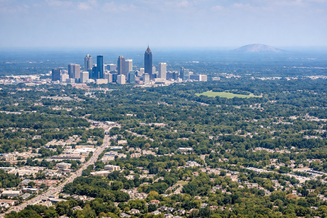
Takeoff from ATL
RIGHTATL's primary departure runways (8L/8R heading east, or 27L/27R heading west) mean the right side gives you a clear view over downtown Atlanta's skyline as you climb out northbound. The city's dense core with Midtown and the CNN Center area is distinctly visible on the right before the aircraft turns northeast.
Landing at ALB
LEFTAlbany typically uses runway 01 for northbound arrivals, meaning the approach comes from the south over the Hudson River valley. The left side gives you a sustained view of the Hudson River itself, the Catskill Mountains to the west, and the Capital District urban area as you descend.
Will your flight be in sunlight?
Pick a date and time in the Sun Map to watch the sun move across your whole flight.
About This Route
Which side of the plane should I sit on flying from The William B Hartsfield Atlanta International (ATL) to Albany International (ALB)?
Sit on the Left side of the plane for the best views on flights from Atlanta to Albany. While the right side wins at takeoff for Atlanta city views, the left side delivers more sustained geographic interest across the full flight — the Blue Ridge Mountains of northern Georgia and western North Carolina, the Appalachian ridges through Virginia, the Delaware Water Gap, the Hudson Highlands, and finally the Hudson River valley on descent into Albany.
What can I see during takeoff from The William B Hartsfield Atlanta International in Atlanta?
During takeoff from The William B Hartsfield Atlanta International (ATL), sit on the Right side for the best views. ATL's primary departure runways (8L/8R heading east, or 27L/27R heading west) mean the right side gives you a clear view over downtown Atlanta's skyline as you climb out northbound. The city's dense core with Midtown and the CNN Center area is distinctly visible on the right before the aircraft turns northeast. Notable sights include: Downtown Atlanta skyline, Stone Mountain (visible to the northeast as a granite dome), Lake Allatoona to the northwest, Chattahoochee River corridor.
What can I see when landing at Albany International in Albany?
When landing at Albany International (ALB), sit on the Left side for the best views. Albany typically uses runway 01 for northbound arrivals, meaning the approach comes from the south over the Hudson River valley. The left side gives you a sustained view of the Hudson River itself, the Catskill Mountains to the west, and the Capital District urban area as you descend. Notable sights include: Hudson River, Catskill Mountains, Adirondack foothills to the north, Albany-Troy urban corridor.
How long is the flight from Atlanta to Albany?
The flight from The William B Hartsfield Atlanta International (ATL) to Albany International (ALB) takes about 2 hours 10 minutes. The shortest flight path between them is 853 miles (1,372 km); winds and air traffic control usually add a few percent.
What does the Atlanta to Albany flight path pass over?
The flight tracks northeast over the Blue Ridge Mountains of northern Georgia and western North Carolina, then crosses the Virginia Appalachians including the Shenandoah Valley and Blue Ridge Parkway corridor. Over Maryland and Pennsylvania the parallel ridges of the Ridge and Valley Appalachians are clearly visible as long northeast-trending wooded lines. The Delaware Water Gap where the Delaware River cuts through the Kittatinny Ridge is a notable landmark. Over New Jersey and into New York the terrain flattens before the Hudson Highlands and Catskills appear on descent.