The left side wins primarily on the strength of the Bogota approach, where the Eastern Andes and the city's mountain backdrop dominate the view, plus a marginally better departure with Atlanta's skyline in frame.
Flown ATL to BOG? Did we get it right?
Flight Path
Atlanta to Bogota is 2,106 miles (3,389 km), a flight of about 4 hours 35 minutes.
Caribbean Sea crossing, Colombian Caribbean coastline near Barranquilla, Sierra Nevada de Santa Marta mountains visible inland before the route turns south toward the Andes
Great circle distance and headings ›


Phase by phase
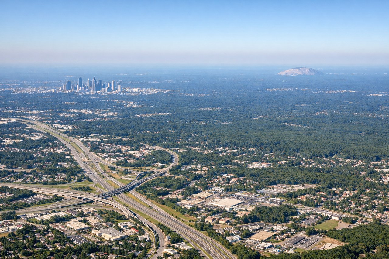
Takeoff from ATL
LEFTDeparting ATL, the southbound routing gives left-side passengers a brief view of downtown Atlanta's skyline and the Chattahoochee River valley before the flight settles over the flat Georgia and Florida panhandle terrain. It's not dramatic, but it's more visually interesting than the featureless farmland typically seen on the right.
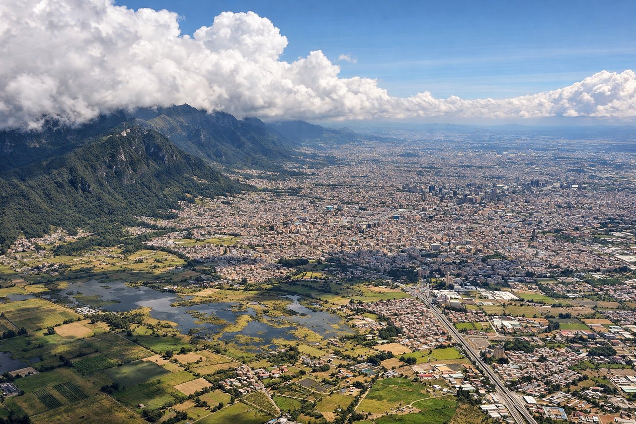
Landing at BOG
LEFTOn approach into El Dorado, the aircraft descends from the north and aligns with the southeast-facing runway, putting the dramatic Eastern Andean ridge—including the peaks above Monserrate and Guadalupe that overlook downtown Bogota—directly on the left side. This is the signature scenic moment of the flight, with the city's high-altitude savanna and green mountain wall filling the window.
Will your flight be in sunlight?
Pick a date and time in the Sun Map to watch the sun move across your whole flight.
About This Route
Which side of the plane should I sit on flying from The William B Hartsfield Atlanta International (ATL) to Eldorado International (BOG)?
Sit on the Left side of the plane for the best views on flights from Atlanta to Bogota. The left side wins primarily on the strength of the Bogota approach, where the Eastern Andes and the city's mountain backdrop dominate the view, plus a marginally better departure with Atlanta's skyline in frame.
What can I see during takeoff from The William B Hartsfield Atlanta International in Atlanta?
During takeoff from The William B Hartsfield Atlanta International (ATL), sit on the Left side for the best views. Departing ATL, the southbound routing gives left-side passengers a brief view of downtown Atlanta's skyline and the Chattahoochee River valley before the flight settles over the flat Georgia and Florida panhandle terrain. It's not dramatic, but it's more visually interesting than the featureless farmland typically seen on the right. Notable sights include: Atlanta downtown skyline, Chattahoochee River, Georgia pine forests, Florida panhandle coastline in the distance.
What can I see when landing at Eldorado International in Bogota?
When landing at Eldorado International (BOG), sit on the Left side for the best views. On approach into El Dorado, the aircraft descends from the north and aligns with the southeast-facing runway, putting the dramatic Eastern Andean ridge—including the peaks above Monserrate and Guadalupe that overlook downtown Bogota—directly on the left side. This is the signature scenic moment of the flight, with the city's high-altitude savanna and green mountain wall filling the window. Notable sights include: Eastern Andes ridge (Cerro de Monserrate and Guadalupe), Bogota savanna plateau, downtown Bogota skyline, Bogota River valley.
How long is the flight from Atlanta to Bogota?
The flight from The William B Hartsfield Atlanta International (ATL) to Eldorado International (BOG) takes about 4 hours 35 minutes. The shortest flight path between them is 2,106 miles (3,389 km); winds and air traffic control usually add a few percent.
What does the Atlanta to Bogota flight path pass over?
Caribbean Sea crossing, Colombian Caribbean coastline near Barranquilla, Sierra Nevada de Santa Marta mountains visible inland before the route turns south toward the Andes