Atlanta to Houston is 688 miles (1,108 km), a flight of about 2 hours 10 minutes.
Neither side offers dramatic terrain since the route crosses flat Southeastern and Gulf coastal plains, but the left side edges ahead due to skyline glimpses on both ends of the flight near Atlanta and Houston.
Flight Path
Flat forested terrain of Alabama and Mississippi, the Mobile-Tensaw River delta near the Gulf coast, and low-lying agricultural land of eastern Louisiana
Great circle distance and headings ›.jpeg?width=600)

Phase by phase

Takeoff from ATL
RIGHTDeparting ATL westbound, the right side offers glimpses of downtown Atlanta's skyline as the aircraft climbs and banks, while the left side shows mostly suburban sprawl and forest.
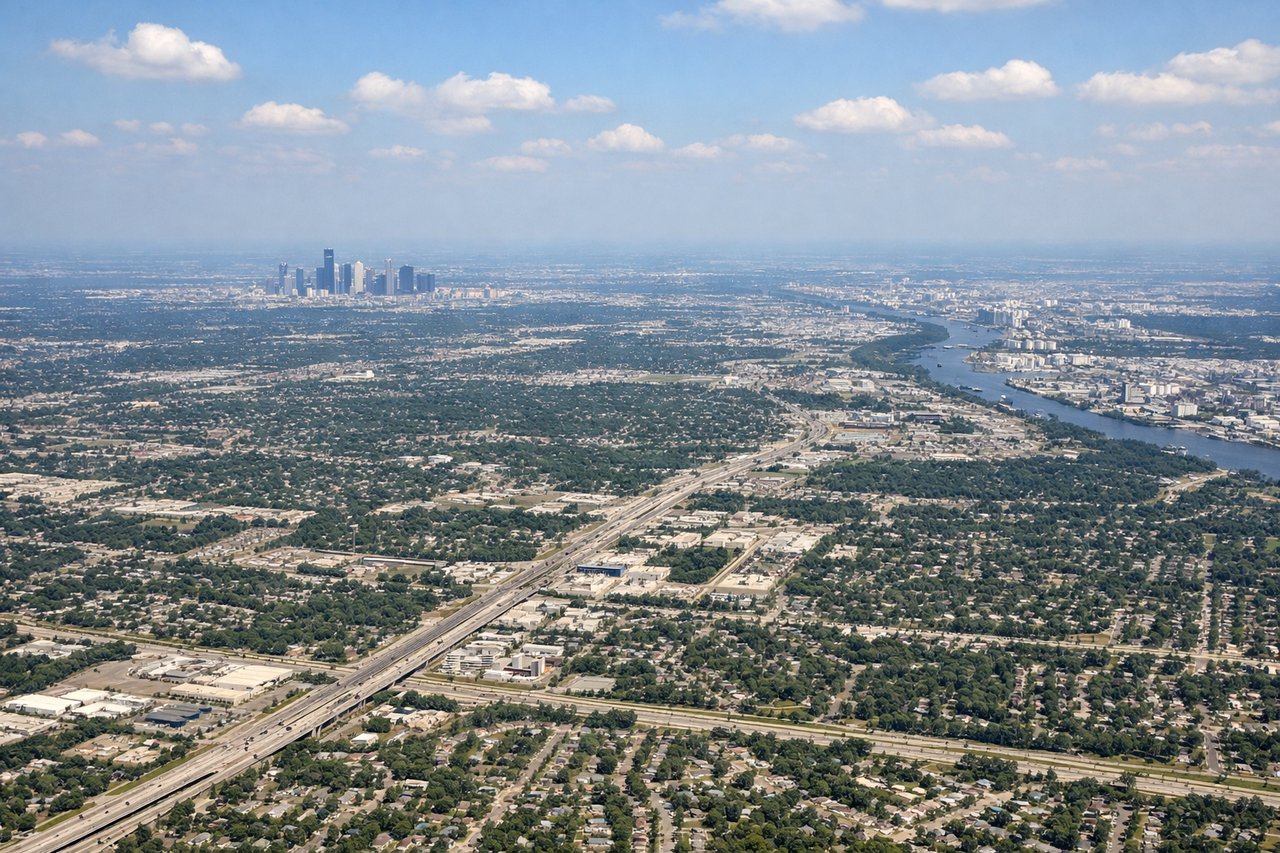
Landing at IAH
LEFTOn approach into IAH from the northeast, the left side gives views over the flat coastal plain and Houston's northern suburbs, including glimpses of the city's skyline in the distance, while the right side faces mostly featureless farmland.
Landmarks on this routeAll landmarks →
Will your flight be in sunlight?
Pick a date and time in the Sun Map to watch the sun move across your whole flight.
About This Route
Which side of the plane should I sit on flying from The William B Hartsfield Atlanta International (ATL) to George Bush Intcntl Houston (IAH)?
Sit on the Left side of the plane for the best views on flights from Atlanta to Houston. Neither side offers dramatic terrain since the route crosses flat Southeastern and Gulf coastal plains, but the left side edges ahead due to skyline glimpses on both ends of the flight near Atlanta and Houston.
What can I see during takeoff from The William B Hartsfield Atlanta International in Atlanta?
During takeoff from The William B Hartsfield Atlanta International (ATL), sit on the Right side for the best views. Departing ATL westbound, the right side offers glimpses of downtown Atlanta's skyline as the aircraft climbs and banks, while the left side shows mostly suburban sprawl and forest. Notable sights include: Downtown Atlanta skyline, Buckhead towers, Chattahoochee River.
What can I see when landing at George Bush Intcntl Houston in Houston?
When landing at George Bush Intcntl Houston (IAH), sit on the Left side for the best views. On approach into IAH from the northeast, the left side gives views over the flat coastal plain and Houston's northern suburbs, including glimpses of the city's skyline in the distance, while the right side faces mostly featureless farmland. Notable sights include: Houston skyline (distant), Lake Houston, flat coastal plain, suburban grid.
How long is the flight from Atlanta to Houston?
The flight from The William B Hartsfield Atlanta International (ATL) to George Bush Intcntl Houston (IAH) takes about 2 hours 10 minutes. The shortest flight path between them is 688 miles (1,108 km); winds and air traffic control usually add a few percent.
What does the Atlanta to Houston flight path pass over?
Flat forested terrain of Alabama and Mississippi, the Mobile-Tensaw River delta near the Gulf coast, and low-lying agricultural land of eastern Louisiana