Atlanta to Jacksonville is 270 miles (435 km), a flight of about 1 hour 5 minutes.
The left side delivers the best views at both ends of this short flight — Atlanta's skyline on departure and the St. Johns River on approach into Jacksonville. The flight path tracks southeast across Georgia, and the left side also keeps you oriented toward the coast as you descend.
Flight Path
The flight crosses the Georgia coastal plain southeast of Atlanta, passing over Waycross-area pine flatwoods and the Okefenokee Swamp region to the southwest. The Altamaha River watershed is visible below as the terrain flattens completely into the coastal plain. No significant terrain changes — this is low, forested, and largely rural Georgia the entire route.
Great circle distance and headings ›Phase by phase
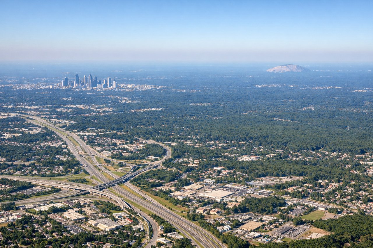
Takeoff from ATL
LEFTATL primarily departs eastward on runways 8L/8R/9L/9R, so the left (north) side gives you a clear view over downtown Atlanta's skyline as you climb out. You can pick out the cluster of skyscrapers around Peachtree Street and the Georgia Dome area before the city falls behind.
Landing at JAX
LEFTJAX typically lands westbound on runway 7/25 or approaches from the south, and the left (south/east) side gives the best view of the St. Johns River as it winds through Jacksonville toward the Atlantic coast. The broad, dark river and its bridges are the defining visual feature of this approach.
Will your flight be in sunlight?
Pick a date and time in the Sun Map to watch the sun move across your whole flight.
About This Route
Which side of the plane should I sit on flying from The William B Hartsfield Atlanta International (ATL) to Jacksonville International (JAX)?
Sit on the Left side of the plane for the best views on flights from Atlanta to Jacksonville. The left side delivers the best views at both ends of this short flight — Atlanta's skyline on departure and the St. Johns River on approach into Jacksonville. The flight path tracks southeast across Georgia, and the left side also keeps you oriented toward the coast as you descend.
What can I see during takeoff from The William B Hartsfield Atlanta International in Atlanta?
During takeoff from The William B Hartsfield Atlanta International (ATL), sit on the Left side for the best views. ATL primarily departs eastward on runways 8L/8R/9L/9R, so the left (north) side gives you a clear view over downtown Atlanta's skyline as you climb out. You can pick out the cluster of skyscrapers around Peachtree Street and the Georgia Dome area before the city falls behind. Notable sights include: Downtown Atlanta skyline, Stone Mountain (visible to the northeast as a distinctive granite dome), Piedmont Park, Lake Allatoona to the northwest.
What can I see when landing at Jacksonville International in Jacksonville?
When landing at Jacksonville International (JAX), sit on the Left side for the best views. JAX typically lands westbound on runway 7/25 or approaches from the south, and the left (south/east) side gives the best view of the St. Johns River as it winds through Jacksonville toward the Atlantic coast. The broad, dark river and its bridges are the defining visual feature of this approach. Notable sights include: St. Johns River and its downtown bridges, Jacksonville downtown skyline, Nassau Sound and barrier islands to the northeast, Amelia Island coastline.
How long is the flight from Atlanta to Jacksonville?
The flight from The William B Hartsfield Atlanta International (ATL) to Jacksonville International (JAX) takes about 1 hour 5 minutes. The shortest flight path between them is 270 miles (435 km); winds and air traffic control usually add a few percent.
What does the Atlanta to Jacksonville flight path pass over?
The flight crosses the Georgia coastal plain southeast of Atlanta, passing over Waycross-area pine flatwoods and the Okefenokee Swamp region to the southwest. The Altamaha River watershed is visible below as the terrain flattens completely into the coastal plain. No significant terrain changes — this is low, forested, and largely rural Georgia the entire route.