Atlanta to New Orleans is 425 miles (684 km), a flight of about 1 hour 25 minutes.
The right side combines a glimpse of Atlanta's skyline on departure with the far more distinctive Lake Pontchartrain and New Orleans approach on arrival, giving it more visual variety and landmark density than the left side's flat farmland and marsh views.
Flight Path
Rolling pine forests of central Alabama, the Tombigbee River valley, and the flat agricultural lowlands of eastern Mississippi before descending into the Louisiana bayou country.
Great circle distance and headings ›.jpeg?width=600)

Phase by phase

Takeoff from ATL
RIGHTDeparting ATL on a westbound runway, the aircraft typically banks south toward the Gulf, putting downtown Atlanta's skyline and the granite dome of Stone Mountain briefly on the right side during initial climb. The left side over this stretch shows only flat suburban sprawl.
Landing at MSY
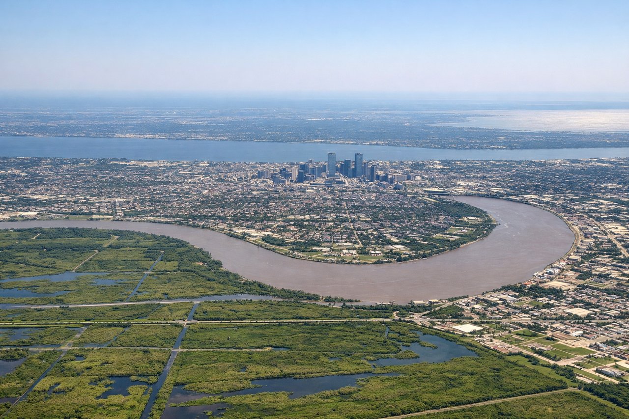
RIGHTOn approach to MSY from the east, the flight path crosses Lake Pontchartrain, giving right-side passengers a sweeping view of the lake's open water, the Causeway bridge, and the New Orleans skyline before landing. The left side mostly shows flat marsh and bayou with less visual contrast.
Landmarks on this routeAll landmarks →
Will your flight be in sunlight?
Pick a date and time in the Sun Map to watch the sun move across your whole flight.
About This Route
Which side of the plane should I sit on flying from The William B Hartsfield Atlanta International (ATL) to Louis Armstrong New Orleans International (MSY)?
Sit on the Right side of the plane for the best views on flights from Atlanta to New Orleans. The right side combines a glimpse of Atlanta's skyline on departure with the far more distinctive Lake Pontchartrain and New Orleans approach on arrival, giving it more visual variety and landmark density than the left side's flat farmland and marsh views.
What can I see during takeoff from The William B Hartsfield Atlanta International in Atlanta?
During takeoff from The William B Hartsfield Atlanta International (ATL), sit on the Right side for the best views. Departing ATL on a westbound runway, the aircraft typically banks south toward the Gulf, putting downtown Atlanta's skyline and the granite dome of Stone Mountain briefly on the right side during initial climb. The left side over this stretch shows only flat suburban sprawl. Notable sights include: Downtown Atlanta skyline, Stone Mountain, Hartsfield-Jackson terminal complex.
What can I see when landing at Louis Armstrong New Orleans International in New Orleans?
When landing at Louis Armstrong New Orleans International (MSY), sit on the Right side for the best views. On approach to MSY from the east, the flight path crosses Lake Pontchartrain, giving right-side passengers a sweeping view of the lake's open water, the Causeway bridge, and the New Orleans skyline before landing. The left side mostly shows flat marsh and bayou with less visual contrast. Notable sights include: Lake Pontchartrain, Lake Pontchartrain Causeway, New Orleans downtown skyline, Mississippi River delta marshland.
How long is the flight from Atlanta to New Orleans?
The flight from The William B Hartsfield Atlanta International (ATL) to Louis Armstrong New Orleans International (MSY) takes about 1 hour 25 minutes. The shortest flight path between them is 425 miles (684 km); winds and air traffic control usually add a few percent.
What does the Atlanta to New Orleans flight path pass over?
Rolling pine forests of central Alabama, the Tombigbee River valley, and the flat agricultural lowlands of eastern Mississippi before descending into the Louisiana bayou country.