The right side offers a more consistent scenic arc — Atlanta's skyline at takeoff, a chance at the Appalachian ridgelines over Tennessee, and the Rocky Mountain high country of Wyoming and Idaho during cruise — while the left side's best moment is concentrated in the final Mount Hood approach.
Flight Path
The great-circle route curves north through the Great Plains and into the Rockies, passing near the Bighorn Mountains and Wind River Range in Wyoming, then over the high plateau country near Yellowstone and the Snake River Plain of Idaho before reaching the Cascades in Oregon.
Great circle distance and headings ›.jpeg?width=600)

.jpg?width=600)

.jpg?width=600)
Phase by phase

Takeoff from ATL
RIGHTDeparting Atlanta on a west-flow runway, the aircraft's turn onto its northwest course puts downtown Atlanta's skyline and the granite dome of Stone Mountain into view on the right side during initial climb. The left side mostly shows Atlanta's southern suburbs and flat Piedmont terrain.
Landing at PDX
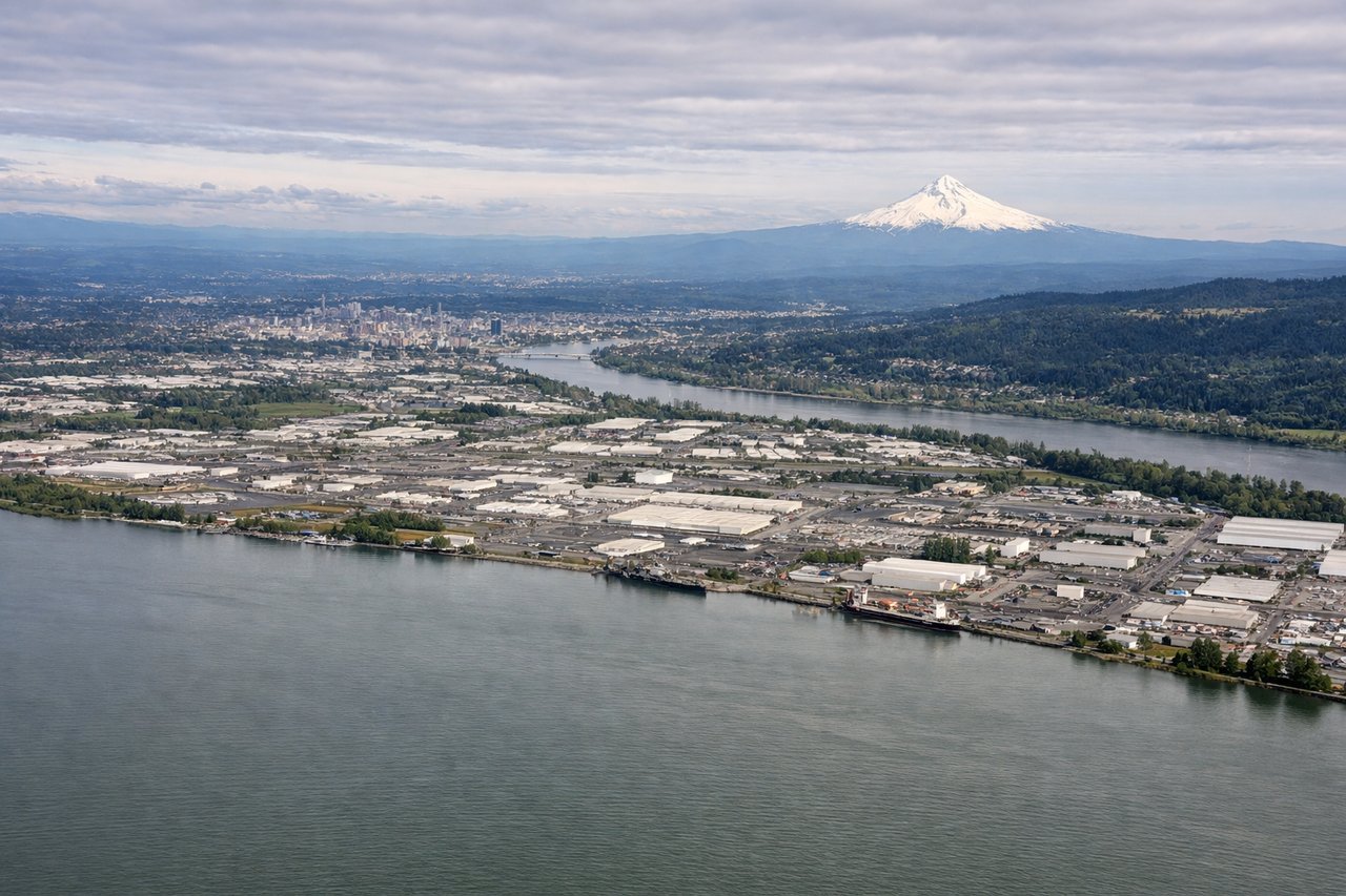
LEFTOn the descent into Portland from the east, the aircraft tracks roughly along the Columbia River corridor before turning for the westward landing runway. Mount Hood's snow-capped cone sits prominently to the south, dominating the left-side view, while the Willamette Valley farmland unfolds below.
Landmarks on this routeAll landmarks →
Will your flight be in sunlight?
See exactly which side of the plane gets sun and shade at your departure time.
About This Route
Which side of the plane should I sit on flying from The William B Hartsfield Atlanta International (ATL) to Portland International (PDX)?
Sit on the Right side of the plane for the best views on flights from Atlanta to Portland. The right side offers a more consistent scenic arc — Atlanta's skyline at takeoff, a chance at the Appalachian ridgelines over Tennessee, and the Rocky Mountain high country of Wyoming and Idaho during cruise — while the left side's best moment is concentrated in the final Mount Hood approach.
What can I see during takeoff from The William B Hartsfield Atlanta International in Atlanta?
During takeoff from The William B Hartsfield Atlanta International (ATL), sit on the Right side for the best views. Departing Atlanta on a west-flow runway, the aircraft's turn onto its northwest course puts downtown Atlanta's skyline and the granite dome of Stone Mountain into view on the right side during initial climb. The left side mostly shows Atlanta's southern suburbs and flat Piedmont terrain. Notable sights include: Downtown Atlanta skyline, Stone Mountain, Chattahoochee River, Piedmont foothills.
What can I see when landing at Portland International in Portland?
When landing at Portland International (PDX), sit on the Left side for the best views. On the descent into Portland from the east, the aircraft tracks roughly along the Columbia River corridor before turning for the westward landing runway. Mount Hood's snow-capped cone sits prominently to the south, dominating the left-side view, while the Willamette Valley farmland unfolds below. Notable sights include: Mount Hood, Columbia River, Willamette Valley, Portland's West Hills.
How long is the flight from Atlanta to Portland?
The flight from The William B Hartsfield Atlanta International (ATL) to Portland International (PDX) takes 4h 55m.
What does the Atlanta to Portland flight path pass over?
The great-circle route curves north through the Great Plains and into the Rockies, passing near the Bighorn Mountains and Wind River Range in Wyoming, then over the high plateau country near Yellowstone and the Snake River Plain of Idaho before reaching the Cascades in Oregon.