Atlanta to San Jose is 2,111 miles (3,398 km), a flight of about 4 hours 35 minutes.
The right side strings together a distant glimpse of the Grand Canyon region near Flagstaff, the snow-streaked peaks of the Sierra Nevada, and a Bay-facing final approach into San Jose, giving it far more variety and drama than the left side's desert basin views.
Flight Path
The route crosses the Ozark foothills of Arkansas, the Texas and Oklahoma panhandles, the high desert plateau near Albuquerque, the Grand Canyon/Flagstaff region of northern Arizona, and the Mojave Desert basin near Las Vegas before climbing over the Sierra Nevada into California's Central Valley.
Great circle distance and headings ›.jpeg?width=600)

.jpg?width=600)

.jpg?width=600)


Phase by phase

Takeoff from ATL
RIGHTDeparting ATL to the west, the right side offers a brief but clear view back toward downtown Atlanta's skyline and Buckhead towers before the plane turns onto its transcontinental heading. The left side only shows flat suburban Georgia sprawl with no distinguishing features.
Landing at SJC
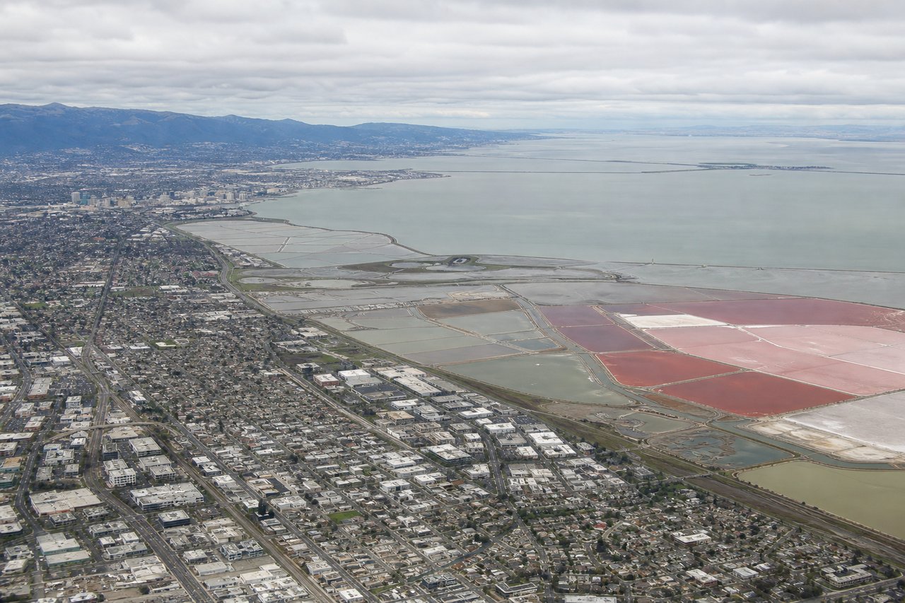
RIGHTOn approach to SJC's runway 30 from the southeast, the right side faces northeast toward the South Bay, giving passengers a view of the Bay's salt ponds, the water itself, and the Diablo Range foothills behind Silicon Valley. The left side mainly shows the Santa Cruz Mountains, which are scenic but farther away and less distinctive at this stage.
Landmarks on this routeAll landmarks →
Will your flight be in sunlight?
Pick a date and time in the Sun Map to watch the sun move across your whole flight.
About This Route
Which side of the plane should I sit on flying from The William B Hartsfield Atlanta International (ATL) to Norman Y Mineta San Jose International (SJC)?
Sit on the Right side of the plane for the best views on flights from Atlanta to San Jose. The right side strings together a distant glimpse of the Grand Canyon region near Flagstaff, the snow-streaked peaks of the Sierra Nevada, and a Bay-facing final approach into San Jose, giving it far more variety and drama than the left side's desert basin views.
What can I see during takeoff from The William B Hartsfield Atlanta International in Atlanta?
During takeoff from The William B Hartsfield Atlanta International (ATL), sit on the Right side for the best views. Departing ATL to the west, the right side offers a brief but clear view back toward downtown Atlanta's skyline and Buckhead towers before the plane turns onto its transcontinental heading. The left side only shows flat suburban Georgia sprawl with no distinguishing features. Notable sights include: Downtown Atlanta skyline, Buckhead high-rises, Hartsfield-Jackson runway complex, Chattahoochee River.
What can I see when landing at Norman Y Mineta San Jose International in San Jose?
When landing at Norman Y Mineta San Jose International (SJC), sit on the Right side for the best views. On approach to SJC's runway 30 from the southeast, the right side faces northeast toward the South Bay, giving passengers a view of the Bay's salt ponds, the water itself, and the Diablo Range foothills behind Silicon Valley. The left side mainly shows the Santa Cruz Mountains, which are scenic but farther away and less distinctive at this stage. Notable sights include: South San Francisco Bay salt ponds, Diablo Range and Mount Hamilton, Silicon Valley tech campuses, San Jose downtown skyline.
How long is the flight from Atlanta to San Jose?
The flight from The William B Hartsfield Atlanta International (ATL) to Norman Y Mineta San Jose International (SJC) takes about 4 hours 35 minutes. The shortest flight path between them is 2,111 miles (3,398 km); winds and air traffic control usually add a few percent.
What does the Atlanta to San Jose flight path pass over?
The route crosses the Ozark foothills of Arkansas, the Texas and Oklahoma panhandles, the high desert plateau near Albuquerque, the Grand Canyon/Flagstaff region of northern Arizona, and the Mojave Desert basin near Las Vegas before climbing over the Sierra Nevada into California's Central Valley.