The right side wins because of the dramatic harbor approach into St. Thomas with its turquoise water and island backdrop, plus partial views of the Bahamas during the Atlantic crossing, outweighing the brief Atlanta skyline glimpse on departure.
Flight Path
Atlantic Ocean east of Florida, scattered Bahamian islands such as Great Abaco and Eleuthera visible below during cruise, open Caribbean waters as the route nears the Virgin Islands
Great circle distance and headings ›Phase by phase
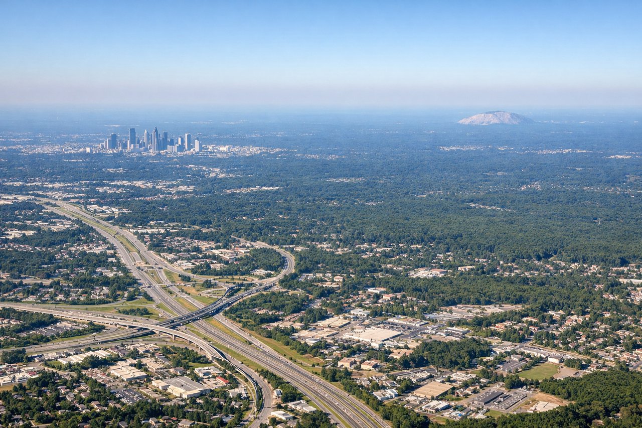
Takeoff from ATL
LEFTDeparting ATL to the south before turning southeast, the northeast-facing side offers a brief glimpse of downtown Atlanta's skyline and the wooded Piedmont terrain, while the opposite side shows only suburban sprawl.
Landing at STT
RIGHTLanding on Runway 10 at STT requires a scenic turn over Charlotte Amalie harbor, and the south-facing side reveals the town, cruise ship docks, and the turquoise water stretching toward St. John and the British Virgin Islands.
Landmarks on this routeAll landmarks →
Will your flight be in sunlight?
See exactly which side of the plane gets sun and shade at your departure time.
About This Route
Which side of the plane should I sit on flying from The William B Hartsfield Atlanta International (ATL) to Cyril E King (STT)?
Sit on the Right side of the plane for the best views on flights from Atlanta to St. Thomas. The right side wins because of the dramatic harbor approach into St. Thomas with its turquoise water and island backdrop, plus partial views of the Bahamas during the Atlantic crossing, outweighing the brief Atlanta skyline glimpse on departure.
What can I see during takeoff from The William B Hartsfield Atlanta International in Atlanta?
During takeoff from The William B Hartsfield Atlanta International (ATL), sit on the Left side for the best views. Departing ATL to the south before turning southeast, the northeast-facing side offers a brief glimpse of downtown Atlanta's skyline and the wooded Piedmont terrain, while the opposite side shows only suburban sprawl. Notable sights include: Atlanta downtown skyline, Hartsfield-Jackson terminal complex, Piedmont forest belt.
What can I see when landing at Cyril E King in St. Thomas?
When landing at Cyril E King (STT), sit on the Right side for the best views. Landing on Runway 10 at STT requires a scenic turn over Charlotte Amalie harbor, and the south-facing side reveals the town, cruise ship docks, and the turquoise water stretching toward St. John and the British Virgin Islands. Notable sights include: Charlotte Amalie harbor, Hassel Island, St. John, British Virgin Islands in the distance.
How long is the flight from Atlanta to St. Thomas?
The flight from The William B Hartsfield Atlanta International (ATL) to Cyril E King (STT) takes 2h 50m.
What does the Atlanta to St. Thomas flight path pass over?
Atlantic Ocean east of Florida, scattered Bahamian islands such as Great Abaco and Eleuthera visible below during cruise, open Caribbean waters as the route nears the Virgin Islands