Brest to Paris is 320 miles (515 km), a flight of about 1 hour 5 minutes.
Left side wins both takeoff and landing. During the cruise over Brittany and the Loire country, the left side also tends to offer slightly better views of the Loire valley towns and river as the route tracks southeast, making it the consistent choice for the full flight.
Flight Path
The flight tracks roughly east-southeast over central Brittany, crossing the Monts d'Arrée (low rounded hills, highest point 385m), then over the Loire-Atlantique bocage farmland, the Loire river valley near Nantes or Angers visible as a broad river corridor, then across the Beauce plateau — flat open wheatfields of the Paris Basin — before descending into Île-de-France
Great circle distance and headings ›

.jpg?width=600)
Phase by phase
Takeoff from BES
LEFTBrest airport's primary departure runway 27R/09L means eastbound departures typically head east then turn southeast toward Paris. A left-side seat gives you views over the Brest harbor, the Penfeld river estuary, and the Rade de Brest — one of the world's largest natural harbors. The naval base and the Pont de l'Iroise bridge are clearly identifiable from low altitude.
Landing at CDG
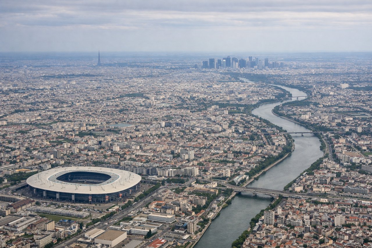
LEFTCDG typically uses runways 27L/27R for westerly arrivals or 09R/09L for easterly arrivals. Approaching from the west, aircraft generally track over northern Île-de-France. A left-side seat on approach gives views toward central Paris — you can see the Seine river bends, and on clear days the Eiffel Tower and La Défense cluster are visible to the south as you descend over the northern suburbs.
Landmarks on this routeAll landmarks →
Will your flight be in sunlight?
Pick a date and time in the Sun Map to watch the sun move across your whole flight.
About This Route
Which side of the plane should I sit on flying from Guipavas (BES) to Charles De Gaulle (CDG)?
Sit on the Left side of the plane for the best views on flights from Brest to Paris. Left side wins both takeoff and landing. During the cruise over Brittany and the Loire country, the left side also tends to offer slightly better views of the Loire valley towns and river as the route tracks southeast, making it the consistent choice for the full flight.
What can I see during takeoff from Guipavas in Brest?
During takeoff from Guipavas (BES), sit on the Left side for the best views. Brest airport's primary departure runway 27R/09L means eastbound departures typically head east then turn southeast toward Paris. A left-side seat gives you views over the Brest harbor, the Penfeld river estuary, and the Rade de Brest — one of the world's largest natural harbors. The naval base and the Pont de l'Iroise bridge are clearly identifiable from low altitude. Notable sights include: Rade de Brest (vast natural harbor), Pont de l'Iroise suspension bridge, Penfeld river and naval dockyards, Presqu'île de Crozon peninsula across the bay.
What can I see when landing at Charles De Gaulle in Paris?
When landing at Charles De Gaulle (CDG), sit on the Left side for the best views. CDG typically uses runways 27L/27R for westerly arrivals or 09R/09L for easterly arrivals. Approaching from the west, aircraft generally track over northern Île-de-France. A left-side seat on approach gives views toward central Paris — you can see the Seine river bends, and on clear days the Eiffel Tower and La Défense cluster are visible to the south as you descend over the northern suburbs. Notable sights include: Seine river meanders through northern Île-de-France, La Défense business district tower cluster, Paris urban grid extending to the south, Forêt de Montmorency north of Paris.
How long is the flight from Brest to Paris?
The flight from Guipavas (BES) to Charles De Gaulle (CDG) takes about 1 hour 5 minutes. The shortest flight path between them is 320 miles (515 km); winds and air traffic control usually add a few percent.
What does the Brest to Paris flight path pass over?
The flight tracks roughly east-southeast over central Brittany, crossing the Monts d'Arrée (low rounded hills, highest point 385m), then over the Loire-Atlantique bocage farmland, the Loire river valley near Nantes or Angers visible as a broad river corridor, then across the Beauce plateau — flat open wheatfields of the Paris Basin — before descending into Île-de-France