The right side offers the more consistent payoff: a glimpse of Nashville at takeoff, a passage near the Rockies' northern reaches and Wyoming basin during cruise, and a dramatic Wasatch Range and Great Salt Lake view on arrival, while the left side mostly overlooks flat plains with only distant, fading views of the southern Colorado Rockies.
Flown BNA to SLC? Did we get it right?
Flight Path
Nashville to Salt Lake City is 1,401 miles (2,255 km), a flight of about 3 hours 25 minutes.
Ozark foothills of Arkansas, Great Plains of Kansas and eastern Colorado, the Front Range of the Rockies near Denver, and the high plains of southern Wyoming before descending into the Wasatch Range near Salt Lake City
Great circle distance and headings ›


Phase by phase
Takeoff from BNA
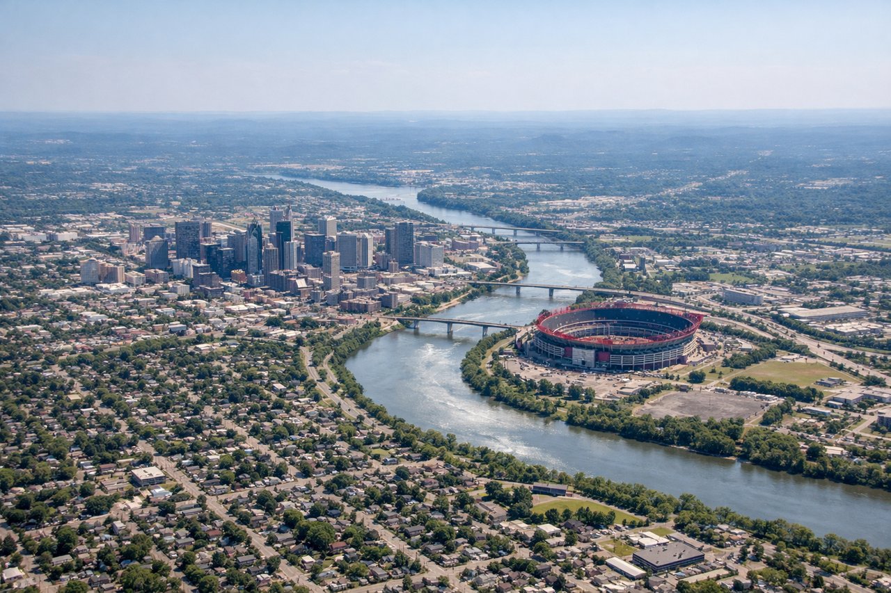
RIGHTDeparting BNA and turning onto a westbound heading, the initial climb typically swings the aircraft so downtown Nashville and the Cumberland River bends fall on the right side of the cabin. It's a brief but recognizable urban view before the route settles into flat farmland over Tennessee and Arkansas.
Landing at SLC
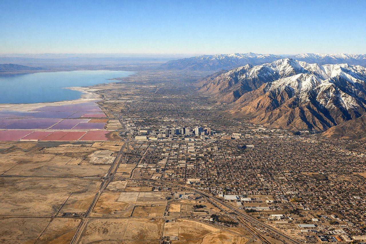
RIGHTOn approach into SLC from the east, the descent brings the Wasatch Range into view on the right side of the aircraft, with sharp peaks rising directly behind the city before the plane turns onto final for the north-south runways. The Great Salt Lake and its salt flats are also visible off to the northwest during the turn.
Will your flight be in sunlight?
Pick a date and time in the Sun Map to watch the sun move across your whole flight.
About This Route
Which side of the plane should I sit on flying from Nashville International (BNA) to Salt Lake City International (SLC)?
Sit on the Right side of the plane for the best views on flights from Nashville to Salt Lake City. The right side offers the more consistent payoff: a glimpse of Nashville at takeoff, a passage near the Rockies' northern reaches and Wyoming basin during cruise, and a dramatic Wasatch Range and Great Salt Lake view on arrival, while the left side mostly overlooks flat plains with only distant, fading views of the southern Colorado Rockies.
What can I see during takeoff from Nashville International in Nashville?
During takeoff from Nashville International (BNA), sit on the Right side for the best views. Departing BNA and turning onto a westbound heading, the initial climb typically swings the aircraft so downtown Nashville and the Cumberland River bends fall on the right side of the cabin. It's a brief but recognizable urban view before the route settles into flat farmland over Tennessee and Arkansas. Notable sights include: Downtown Nashville skyline, Cumberland River, Nissan Stadium area.
What can I see when landing at Salt Lake City International in Salt Lake City?
When landing at Salt Lake City International (SLC), sit on the Right side for the best views. On approach into SLC from the east, the descent brings the Wasatch Range into view on the right side of the aircraft, with sharp peaks rising directly behind the city before the plane turns onto final for the north-south runways. The Great Salt Lake and its salt flats are also visible off to the northwest during the turn. Notable sights include: Wasatch Range, Mount Olympus, Great Salt Lake, Salt Lake Valley grid.
How long is the flight from Nashville to Salt Lake City?
The flight from Nashville International (BNA) to Salt Lake City International (SLC) takes about 3 hours 25 minutes. The shortest flight path between them is 1,401 miles (2,255 km); winds and air traffic control usually add a few percent.
What does the Nashville to Salt Lake City flight path pass over?
Ozark foothills of Arkansas, Great Plains of Kansas and eastern Colorado, the Front Range of the Rockies near Denver, and the high plains of southern Wyoming before descending into the Wasatch Range near Salt Lake City