While the Brisbane departure offers a nice but brief city and bay view on the left, the right side's approach into Christchurch delivers a sustained, dramatic view of the Southern Alps against the Canterbury Plains, which outweighs the mostly symmetrical, ocean-dominated cruise phase over the Tasman Sea.
Flown BNE to CHC? Did we get it right?
Flight Path
Brisbane to Christchurch is 1,552 miles (2,498 km), a flight of about 3 hours 45 minutes.
The majority of the route crosses the open Tasman Sea with no land visible for roughly two to three hours, until the South Island's western foothills and the Southern Alps come into view as the descent into Christchurch begins.
Great circle distance and headings ›Phase by phase
Takeoff from BNE
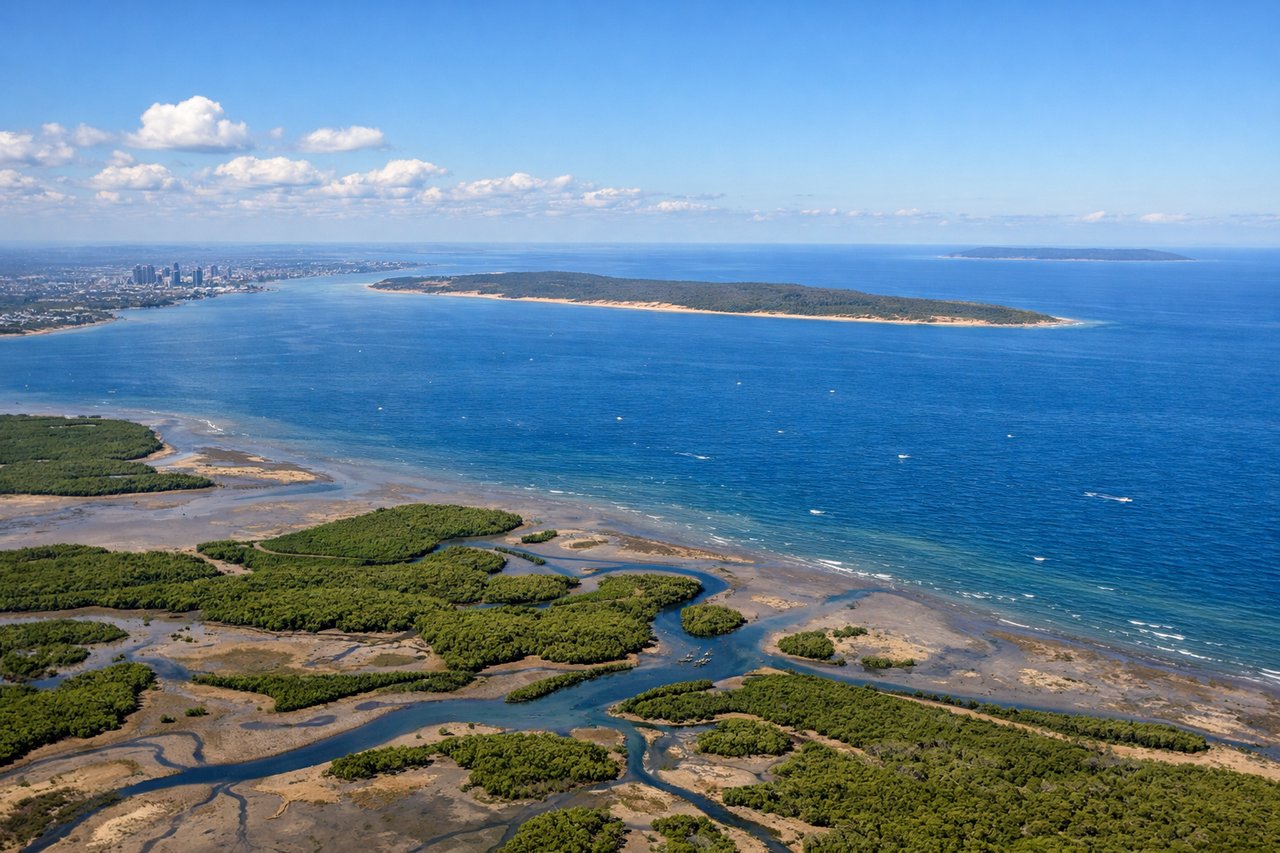
LEFTDeparting Brisbane on runway 19, the aircraft banks left over Moreton Bay, giving a brief but clear view of the Brisbane CBD skyline along the river and the sandy outlines of Moreton and North Stradbroke Islands before the route heads out over open water. The right side mostly sees the flat outer suburbs and quickly loses any landmarks.
Landing at CHC
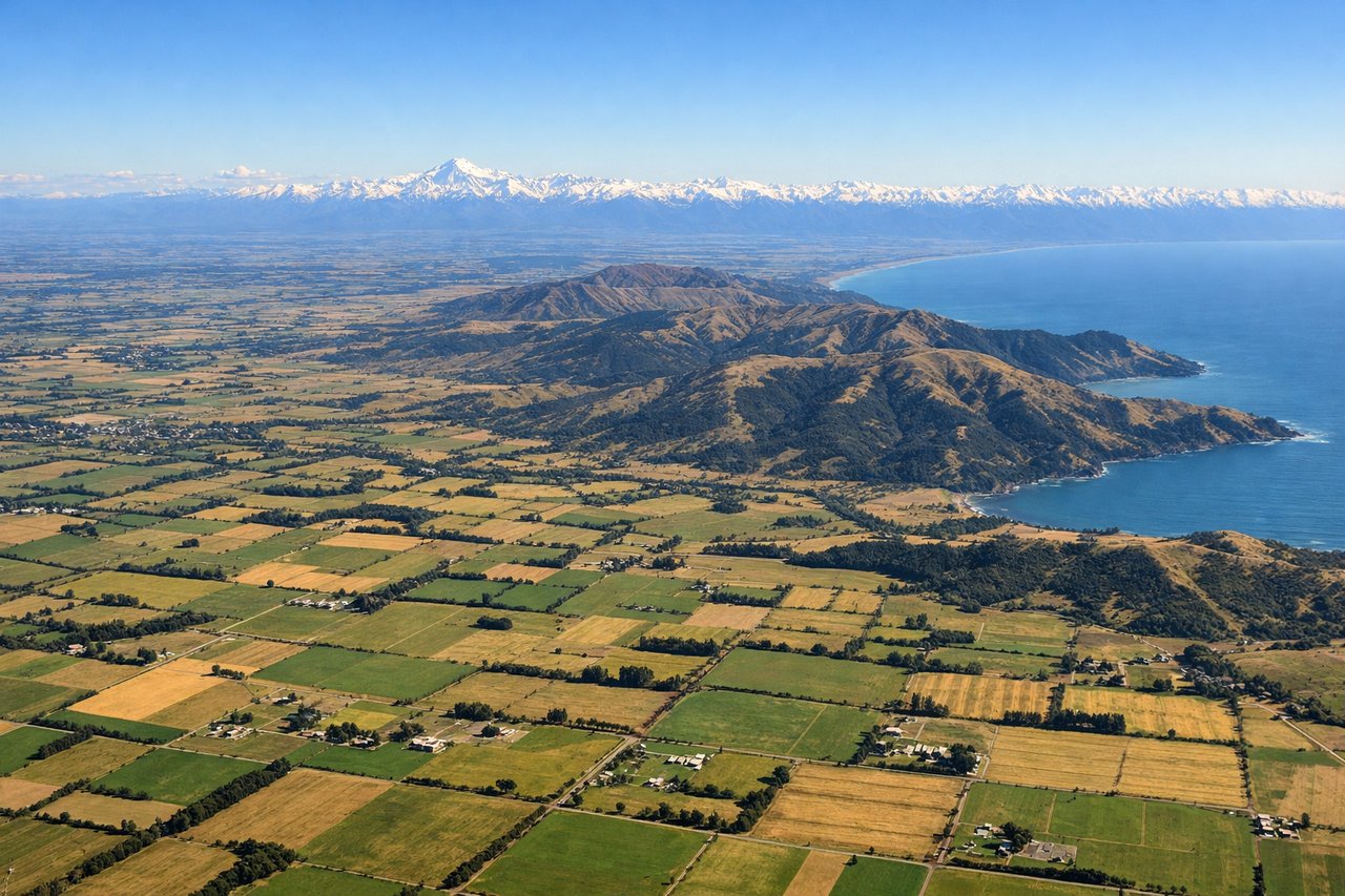
RIGHTOn approach into Christchurch the aircraft descends over the Canterbury Plains with the snow-capped Southern Alps, including peaks near Aoraki/Mount Cook, visible off to the west on the right side. The left side mainly faces the flat Pacific coastline and Banks Peninsula, which is scenic but far less dramatic than the alpine skyline.
Will your flight be in sunlight?
Pick a date and time in the Sun Map to watch the sun move across your whole flight.
About This Route
Which side of the plane should I sit on flying from Brisbane International (BNE) to Christchurch International (CHC)?
Sit on the Right side of the plane for the best views on flights from Brisbane to Christchurch. While the Brisbane departure offers a nice but brief city and bay view on the left, the right side's approach into Christchurch delivers a sustained, dramatic view of the Southern Alps against the Canterbury Plains, which outweighs the mostly symmetrical, ocean-dominated cruise phase over the Tasman Sea.
What can I see during takeoff from Brisbane International in Brisbane?
During takeoff from Brisbane International (BNE), sit on the Left side for the best views. Departing Brisbane on runway 19, the aircraft banks left over Moreton Bay, giving a brief but clear view of the Brisbane CBD skyline along the river and the sandy outlines of Moreton and North Stradbroke Islands before the route heads out over open water. The right side mostly sees the flat outer suburbs and quickly loses any landmarks. Notable sights include: Brisbane CBD and Brisbane River, Moreton Bay, Moreton Island, North Stradbroke Island.
What can I see when landing at Christchurch International in Christchurch?
When landing at Christchurch International (CHC), sit on the Right side for the best views. On approach into Christchurch the aircraft descends over the Canterbury Plains with the snow-capped Southern Alps, including peaks near Aoraki/Mount Cook, visible off to the west on the right side. The left side mainly faces the flat Pacific coastline and Banks Peninsula, which is scenic but far less dramatic than the alpine skyline. Notable sights include: Southern Alps, Aoraki/Mount Cook foothills, Canterbury Plains, Waimakariri River.
How long is the flight from Brisbane to Christchurch?
The flight from Brisbane International (BNE) to Christchurch International (CHC) takes about 3 hours 45 minutes. The shortest flight path between them is 1,552 miles (2,498 km); winds and air traffic control usually add a few percent.
What does the Brisbane to Christchurch flight path pass over?
The majority of the route crosses the open Tasman Sea with no land visible for roughly two to three hours, until the South Island's western foothills and the Southern Alps come into view as the descent into Christchurch begins.