Both sides spend most of the 13-plus-hour flight over open Pacific with nothing to see, capping the ceiling for either side, but the right side gets the more interesting bookends: Brisbane's skyline on departure and the Los Angeles basin with its mountain backdrop on arrival.
Flight Path
The flight path crosses vast, remote open Pacific Ocean, passing well north of New Zealand and generally south of Hawaii, with no islands or coastlines visible for the large majority of the cruise phase.
Great circle distance and headings ›
.jpg?width=600)
Phase by phase
Takeoff from BNE
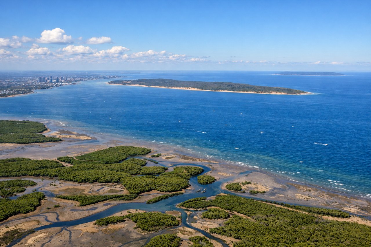
RIGHTDeparting Brisbane, the aircraft turns to head out over the Pacific, and during that turn the right side sweeps past the Brisbane CBD skyline and river before settling on views toward the Scenic Rim hinterland. The left side mostly looks out over Moreton Bay's islands and open water, which is pleasant but less varied.

Landing at LAX
RIGHTArriving from the Pacific, LAX-bound flights typically curve up the coast past Palos Verdes before turning inland to line up for the westward landing. On the right side, that turn reveals the Los Angeles basin, downtown skyline, and the San Gabriel Mountains, while the left side mostly holds views of Santa Monica Bay and open ocean.
Landmarks on this routeAll landmarks →
Will your flight be in sunlight?
See exactly which side of the plane gets sun and shade at your departure time.
About This Route
Which side of the plane should I sit on flying from Brisbane International (BNE) to Los Angeles International (LAX)?
Sit on the Right side of the plane for the best views on flights from Brisbane to Los Angeles. Both sides spend most of the 13-plus-hour flight over open Pacific with nothing to see, capping the ceiling for either side, but the right side gets the more interesting bookends: Brisbane's skyline on departure and the Los Angeles basin with its mountain backdrop on arrival.
What can I see during takeoff from Brisbane International in Brisbane?
During takeoff from Brisbane International (BNE), sit on the Right side for the best views. Departing Brisbane, the aircraft turns to head out over the Pacific, and during that turn the right side sweeps past the Brisbane CBD skyline and river before settling on views toward the Scenic Rim hinterland. The left side mostly looks out over Moreton Bay's islands and open water, which is pleasant but less varied. Notable sights include: Brisbane CBD skyline, Story Bridge and Brisbane River, D'Aguilar Range foothills, distant Scenic Rim/Lamington Plateau.
What can I see when landing at Los Angeles International in Los Angeles?
When landing at Los Angeles International (LAX), sit on the Right side for the best views. Arriving from the Pacific, LAX-bound flights typically curve up the coast past Palos Verdes before turning inland to line up for the westward landing. On the right side, that turn reveals the Los Angeles basin, downtown skyline, and the San Gabriel Mountains, while the left side mostly holds views of Santa Monica Bay and open ocean. Notable sights include: San Gabriel Mountains, downtown Los Angeles skyline, Santa Monica Mountains, South Bay coastline near El Segundo.
How long is the flight from Brisbane to Los Angeles?
The flight from Brisbane International (BNE) to Los Angeles International (LAX) takes 13h 45m.
What does the Brisbane to Los Angeles flight path pass over?
The flight path crosses vast, remote open Pacific Ocean, passing well north of New Zealand and generally south of Hawaii, with no islands or coastlines visible for the large majority of the cruise phase.