While left offers good Brisbane departure views, right provides superior scenery for the majority of the flight and especially on approach into Hanoi, where the Red River delta and agricultural landscape are visually distinctive and geographically significant.
Flown BNE to HAN? Did we get it right?
Flight Path
Brisbane to Hanoi is 4,612 miles (7,422 km), a flight of about 9 hours 10 minutes.
The flight path crosses the Coral Sea, then passes over the northern tip of the Great Barrier Reef system near Cape York Peninsula. Further north, you'll cross the Arafura Sea and approach the Vietnamese coast near the Gulf of Tonkin, with the Red River delta visible well before landing.
Great circle distance and headings ›Phase by phase
Takeoff from BNE
LEFTLeft side captures the Brisbane River estuary and Moreton Bay as the aircraft climbs northwestward. You'll see the river's distinctive meanders through the city and the bay's islands spreading across the horizon.
Landing at HAN
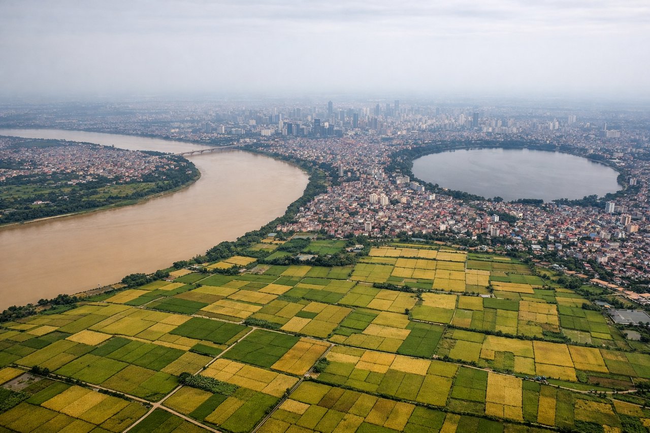
RIGHTRight side provides the best approach views into Hanoi. As the aircraft descends on final approach from the southeast, you'll see the Red River delta's agricultural patchwork and the river itself curving through the city.
Will your flight be in sunlight?
Pick a date and time in the Sun Map to watch the sun move across your whole flight.
About This Route
Which side of the plane should I sit on flying from Brisbane International (BNE) to Noibai International (HAN)?
Sit on the Right side of the plane for the best views on flights from Brisbane to Hanoi. While left offers good Brisbane departure views, right provides superior scenery for the majority of the flight and especially on approach into Hanoi, where the Red River delta and agricultural landscape are visually distinctive and geographically significant.
What can I see during takeoff from Brisbane International in Brisbane?
During takeoff from Brisbane International (BNE), sit on the Left side for the best views. Left side captures the Brisbane River estuary and Moreton Bay as the aircraft climbs northwestward. You'll see the river's distinctive meanders through the city and the bay's islands spreading across the horizon. Notable sights include: Brisbane River estuary, Moreton Bay, North Stradbroke Island, Brisbane CBD.
What can I see when landing at Noibai International in Hanoi?
When landing at Noibai International (HAN), sit on the Right side for the best views. Right side provides the best approach views into Hanoi. As the aircraft descends on final approach from the southeast, you'll see the Red River delta's agricultural patchwork and the river itself curving through the city. Notable sights include: Red River delta, Red River, Hanoi urban area, Thai Nguyen highlands (distant).
How long is the flight from Brisbane to Hanoi?
The flight from Brisbane International (BNE) to Noibai International (HAN) takes about 9 hours 10 minutes. The shortest flight path between them is 4,612 miles (7,422 km); winds and air traffic control usually add a few percent.
What does the Brisbane to Hanoi flight path pass over?
The flight path crosses the Coral Sea, then passes over the northern tip of the Great Barrier Reef system near Cape York Peninsula. Further north, you'll cross the Arafura Sea and approach the Vietnamese coast near the Gulf of Tonkin, with the Red River delta visible well before landing.