Brisbane to Wellington is 1,560 miles (2,511 km), a flight of about 3 hours 40 minutes.
The right side wins both legs — Moreton Bay and the Queensland coastline at departure, then Cook Strait and Wellington Harbour's dramatic hills at arrival. The left side offers mostly flat inland terrain on departure and less distinctive hill country on approach.
Flight Path
The flight crosses the Tasman Sea for several hours with no land visible, passing well south of New Caledonia and north of the Tasman Sea's open water before reaching New Zealand's North Island coastline near the Wairarapa.
Great circle distance and headings ›Phase by phase
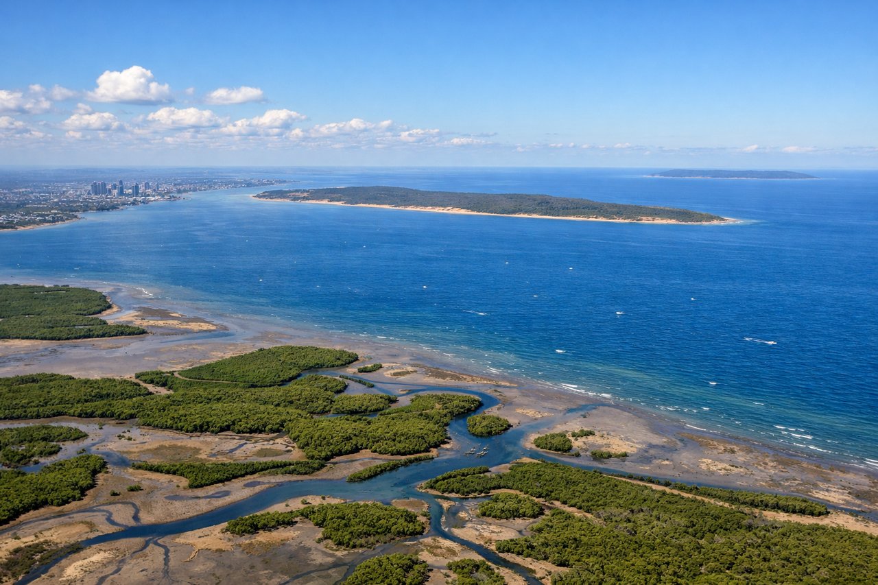
Takeoff from BNE
RIGHTDeparting BNE to the south/southeast, the right side gives a view back over Moreton Bay, the sandy expanse of Moreton Island, and the Brisbane coastline before the aircraft turns out over open water. The left side mostly shows the flat Lockyer Valley and inland farmland receding quickly.
Landing at WLG
RIGHTArriving into Wellington from the north, the approach typically curves over Cook Strait and the South Wairarapa coast before lining up on the runway, giving right-side passengers views of the strait, the rugged Remutaka Range, and Wellington Harbour opening up on final approach. The left side sees more of the inland hill country with less coastal definition.
Will your flight be in sunlight?
Pick a date and time in the Sun Map to watch the sun move across your whole flight.
About This Route
Which side of the plane should I sit on flying from Brisbane International (BNE) to Wellington International (WLG)?
Sit on the Right side of the plane for the best views on flights from Brisbane to Wellington. The right side wins both legs — Moreton Bay and the Queensland coastline at departure, then Cook Strait and Wellington Harbour's dramatic hills at arrival. The left side offers mostly flat inland terrain on departure and less distinctive hill country on approach.
What can I see during takeoff from Brisbane International in Brisbane?
During takeoff from Brisbane International (BNE), sit on the Right side for the best views. Departing BNE to the south/southeast, the right side gives a view back over Moreton Bay, the sandy expanse of Moreton Island, and the Brisbane coastline before the aircraft turns out over open water. The left side mostly shows the flat Lockyer Valley and inland farmland receding quickly. Notable sights include: Moreton Bay, Moreton Island, Brisbane coastline, Gold Coast skyline in the distance.
What can I see when landing at Wellington International in Wellington?
When landing at Wellington International (WLG), sit on the Right side for the best views. Arriving into Wellington from the north, the approach typically curves over Cook Strait and the South Wairarapa coast before lining up on the runway, giving right-side passengers views of the strait, the rugged Remutaka Range, and Wellington Harbour opening up on final approach. The left side sees more of the inland hill country with less coastal definition. Notable sights include: Cook Strait, Remutaka Range, Wellington Harbour, Miramar Peninsula.
How long is the flight from Brisbane to Wellington?
The flight from Brisbane International (BNE) to Wellington International (WLG) takes about 3 hours 40 minutes. The shortest flight path between them is 1,560 miles (2,511 km); winds and air traffic control usually add a few percent.
What does the Brisbane to Wellington flight path pass over?
The flight crosses the Tasman Sea for several hours with no land visible, passing well south of New Caledonia and north of the Tasman Sea's open water before reaching New Zealand's North Island coastline near the Wairarapa.