Bogota to Cuzco is 1,269 miles (2,043 km), a flight of about 2 hours 25 minutes.
The right (west) side dominates the long cruise portion of the flight, offering repeated views of the Andes' volcanic spine - Nevado del Huila in Colombia followed by Cotopaxi, Chimborazo, and Cayambe in Ecuador - snow-capped cones rising above the clouds for well over an hour of flying time, which outweighs the shorter takeoff and landing advantages on the left.
Flight Path
The route tracks south along the eastern edge of the Andes, passing near Colombia's Nevado del Huila, Ecuador's volcanic corridor (Cotopaxi, Chimborazo, Cayambe, Antisana) to the west, with the green expanse of the upper Amazon basin visible to the east before the terrain rises again into the high Andean plateau of southern Peru near Cusco.
Great circle distance and headings ›.jpg?width=600)

.jpg?width=600)

Phase by phase

Takeoff from BOG
LEFTDeparting El Dorado on runway 14, the aircraft banks toward the southeast, putting Bogota's Eastern Hills right in view on the left side. Passengers get a good look at Monserrate and Guadalupe churches perched on the ridgeline above the city before the plane settles onto its southbound track.
Landing at CUZ
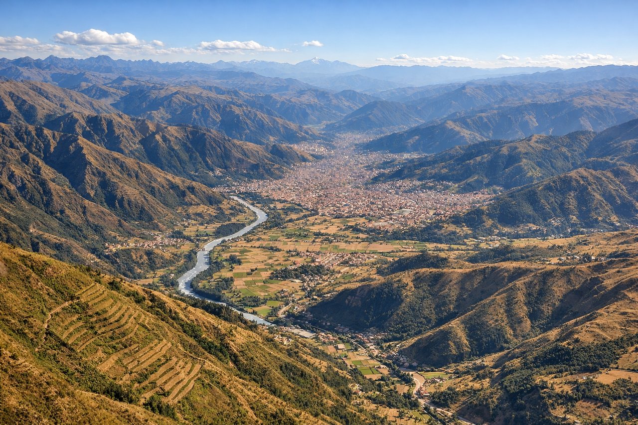
LEFTLanding runway 28 means approaching from the east over the Sacred Valley region, and as the plane banks into Cusco's valley the snow-capped Ausangate massif and the Vilcanota range are visible off the left side to the south. This final descent through terraced Andean farmland is one of the most dramatic valley landings in South America.
Landmarks on this routeAll landmarks →
Will your flight be in sunlight?
Pick a date and time in the Sun Map to watch the sun move across your whole flight.
About This Route
Which side of the plane should I sit on flying from Eldorado International (BOG) to Velazco Astete (CUZ)?
Sit on the Right side of the plane for the best views on flights from Bogota to Cuzco. The right (west) side dominates the long cruise portion of the flight, offering repeated views of the Andes' volcanic spine - Nevado del Huila in Colombia followed by Cotopaxi, Chimborazo, and Cayambe in Ecuador - snow-capped cones rising above the clouds for well over an hour of flying time, which outweighs the shorter takeoff and landing advantages on the left.
What can I see during takeoff from Eldorado International in Bogota?
During takeoff from Eldorado International (BOG), sit on the Left side for the best views. Departing El Dorado on runway 14, the aircraft banks toward the southeast, putting Bogota's Eastern Hills right in view on the left side. Passengers get a good look at Monserrate and Guadalupe churches perched on the ridgeline above the city before the plane settles onto its southbound track. Notable sights include: Cerro de Monserrate, Cerro de Guadalupe, Bogota's dense urban grid, La Calera reservoir foothills.
What can I see when landing at Velazco Astete in Cuzco?
When landing at Velazco Astete (CUZ), sit on the Left side for the best views. Landing runway 28 means approaching from the east over the Sacred Valley region, and as the plane banks into Cusco's valley the snow-capped Ausangate massif and the Vilcanota range are visible off the left side to the south. This final descent through terraced Andean farmland is one of the most dramatic valley landings in South America. Notable sights include: Ausangate peak, Vilcanota mountain range, Urubamba river valley terraces, patchwork Andean farmland near Cusco.
How long is the flight from Bogota to Cuzco?
The flight from Eldorado International (BOG) to Velazco Astete (CUZ) takes about 2 hours 25 minutes. The shortest flight path between them is 1,269 miles (2,043 km); winds and air traffic control usually add a few percent.
What does the Bogota to Cuzco flight path pass over?
The route tracks south along the eastern edge of the Andes, passing near Colombia's Nevado del Huila, Ecuador's volcanic corridor (Cotopaxi, Chimborazo, Cayambe, Antisana) to the west, with the green expanse of the upper Amazon basin visible to the east before the terrain rises again into the high Andean plateau of southern Peru near Cusco.