Cuzco to Bogota is 1,269 miles (2,043 km), a flight of about 2 hours 30 minutes.
Right-side seats capture the most dramatic geography: the Sacred Valley and Andean peaks during departure, then the flight path northwestward provides views of the high Andes chain and major river valleys (Magdalena system) that define Colombia's interior geography.
Flight Path
The flight path crosses the Peruvian-Colombian border in the Amazon basin foothills, then climbs into the Colombian Andes. Notable features include the upper Ucayali River drainage (visible in early cruise), the transition from Amazon lowlands to Andean foothills around the Putumayo region, and the Cordillera Occidental (Western Range) as you approach Bogota's airspace. The Magdalena River valley becomes visible in the final approach phase, running north-south through Colombia's interior.
Great circle distance and headings ›.jpg?width=600)

.jpg?width=600)

Phase by phase
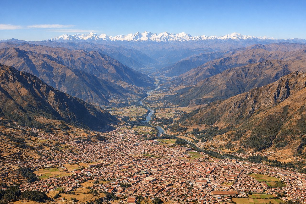
Takeoff from CUZ
RIGHTCusco typically departs runway 27 (westbound). Right-side seats face north during climb-out, offering direct views of the Sacred Valley and the high Andean peaks that dominate the immediate terrain around Cusco.
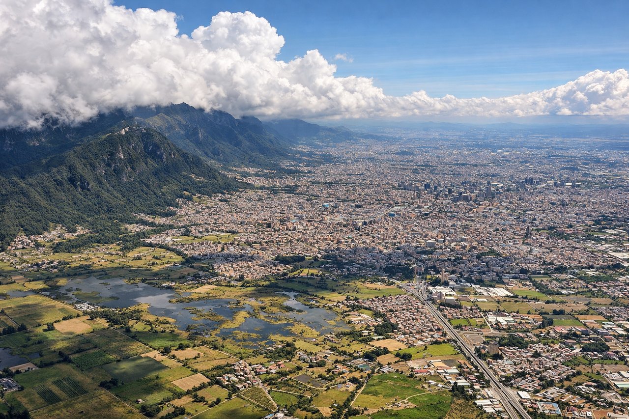
Landing at BOG
LEFTBogota's primary runway is 26L/26R (east-west orientation). Approaching from the south, left-side seats face east and provide views of the Andes' Cordillera Oriental and the high plateau (altiplano) where Bogota sits. You'll see the city's sprawl across the elevated plain and the dramatic eastern escarpment.
Landmarks on this routeAll landmarks →
Will your flight be in sunlight?
Pick a date and time in the Sun Map to watch the sun move across your whole flight.
About This Route
Which side of the plane should I sit on flying from Velazco Astete (CUZ) to Eldorado International (BOG)?
Sit on the Right side of the plane for the best views on flights from Cuzco to Bogota. Right-side seats capture the most dramatic geography: the Sacred Valley and Andean peaks during departure, then the flight path northwestward provides views of the high Andes chain and major river valleys (Magdalena system) that define Colombia's interior geography.
What can I see during takeoff from Velazco Astete in Cuzco?
During takeoff from Velazco Astete (CUZ), sit on the Right side for the best views. Cusco typically departs runway 27 (westbound). Right-side seats face north during climb-out, offering direct views of the Sacred Valley and the high Andean peaks that dominate the immediate terrain around Cusco. Notable sights include: Andes Mountains (Eastern Cordillera), Sacred Valley floor, Urubamba River valley, Cusco city grid.
What can I see when landing at Eldorado International in Bogota?
When landing at Eldorado International (BOG), sit on the Left side for the best views. Bogota's primary runway is 26L/26R (east-west orientation). Approaching from the south, left-side seats face east and provide views of the Andes' Cordillera Oriental and the high plateau (altiplano) where Bogota sits. You'll see the city's sprawl across the elevated plain and the dramatic eastern escarpment. Notable sights include: Cordillera Oriental (Eastern Range), Bogota altiplano plateau, Monserrate peak, city grid of Bogota.
How long is the flight from Cuzco to Bogota?
The flight from Velazco Astete (CUZ) to Eldorado International (BOG) takes about 2 hours 30 minutes. The shortest flight path between them is 1,269 miles (2,043 km); winds and air traffic control usually add a few percent.
What does the Cuzco to Bogota flight path pass over?
The flight path crosses the Peruvian-Colombian border in the Amazon basin foothills, then climbs into the Colombian Andes. Notable features include the upper Ucayali River drainage (visible in early cruise), the transition from Amazon lowlands to Andean foothills around the Putumayo region, and the Cordillera Occidental (Western Range) as you approach Bogota's airspace. The Magdalena River valley becomes visible in the final approach phase, running north-south through Colombia's interior.