While takeoff offers good Sacred Valley views on the right, the landing approach into El Alto on the left provides more dramatic and extensive scenery: the Altiplano plateau, Lake Titicaca in the distance, and the Cordillera Real peaks make the descent more visually rewarding than the climb-out.
Flight Path
The flight path crosses the high Andean plateau between the two airports. You'll pass over the Puno region and the northern reaches of the Altiplano, with views of smaller lakes, scattered settlements, and the gradually increasing elevation as you approach the La Paz basin. The terrain transitions from the Sacred Valley's green agricultural areas to the sparse, high-altitude plateau landscape.
Great circle distance and headings ›


Phase by phase
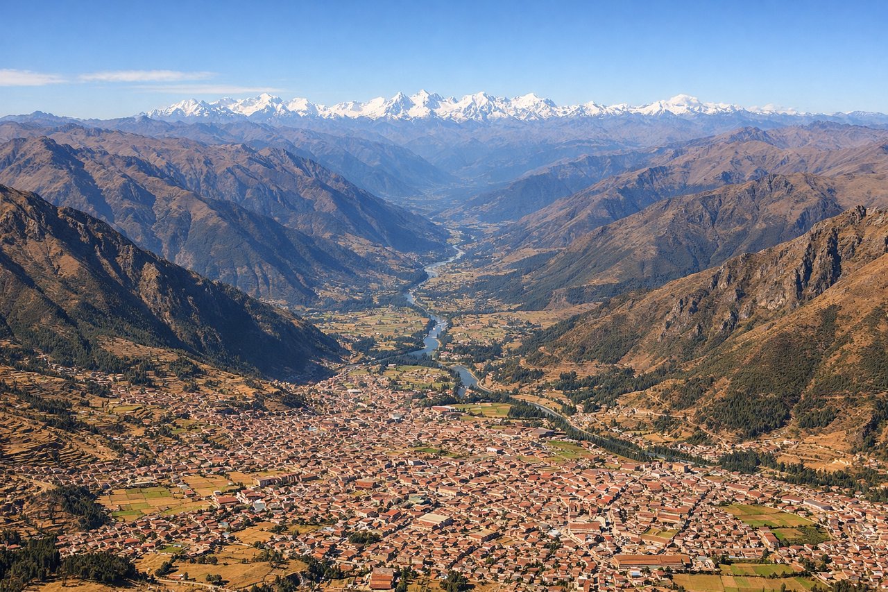
Takeoff from CUZ
RIGHTRight-side seats offer the best views during the initial climb-out from Cusco. You'll see the Sacred Valley floor and the surrounding Andean peaks that frame the airport, with the Urubamba River valley visible below as the aircraft gains altitude.
Landing at LPB
LEFTLeft-side seats provide superior views during the descent into El Alto. You'll see the dramatic approach across the Altiplano plateau and the final descent into the La Paz basin, with Lake Titicaca visible in the distance to the northwest and the snow-capped peaks of the Cordillera Real appearing as you descend.
Landmarks on this routeAll landmarks →
Will your flight be in sunlight?
See exactly which side of the plane gets sun and shade at your departure time.
About This Route
Which side of the plane should I sit on flying from Velazco Astete (CUZ) to El Alto International (LPB)?
Sit on the Left side of the plane for the best views on flights from Cuzco to La Paz. While takeoff offers good Sacred Valley views on the right, the landing approach into El Alto on the left provides more dramatic and extensive scenery: the Altiplano plateau, Lake Titicaca in the distance, and the Cordillera Real peaks make the descent more visually rewarding than the climb-out.
What can I see during takeoff from Velazco Astete in Cuzco?
During takeoff from Velazco Astete (CUZ), sit on the Right side for the best views. Right-side seats offer the best views during the initial climb-out from Cusco. You'll see the Sacred Valley floor and the surrounding Andean peaks that frame the airport, with the Urubamba River valley visible below as the aircraft gains altitude. Notable sights include: Urubamba River valley, Andean peaks of the Vilcabamba range, Cusco city sprawl to the south, terraced agricultural fields of the Sacred Valley.
What can I see when landing at El Alto International in La Paz?
When landing at El Alto International (LPB), sit on the Left side for the best views. Left-side seats provide superior views during the descent into El Alto. You'll see the dramatic approach across the Altiplano plateau and the final descent into the La Paz basin, with Lake Titicaca visible in the distance to the northwest and the snow-capped peaks of the Cordillera Real appearing as you descend. Notable sights include: Lake Titicaca (distant, northwest), Cordillera Real snow peaks, Altiplano plateau terrain, La Paz basin and city lights.
How long is the flight from Cuzco to La Paz?
The flight from Velazco Astete (CUZ) to El Alto International (LPB) takes 1h 15m.
What does the Cuzco to La Paz flight path pass over?
The flight path crosses the high Andean plateau between the two airports. You'll pass over the Puno region and the northern reaches of the Altiplano, with views of smaller lakes, scattered settlements, and the gradually increasing elevation as you approach the La Paz basin. The terrain transitions from the Sacred Valley's green agricultural areas to the sparse, high-altitude plateau landscape.