The left side keeps the Andes in view for nearly the entire flight — Bogotá's Eastern Hills on departure, the Bolivian Altiplano and Andean volcanoes at cruise, and the high peaks flanking Santiago on arrival — while the right side mostly overlooks flatter interior basins and the distant, less dramatic coastal desert.
Flight Path
Bogota to Santiago is 2,641 miles (4,251 km), a flight of about 5 hours 35 minutes.
Bolivian Altiplano, Andean volcanoes such as Sajama and Illimani near La Paz, the northern edge of the Atacama Desert, and the arid Chilean coastal ranges before the final descent into the Santiago valley
Great circle distance and headings ›


Phase by phase
Takeoff from BOG
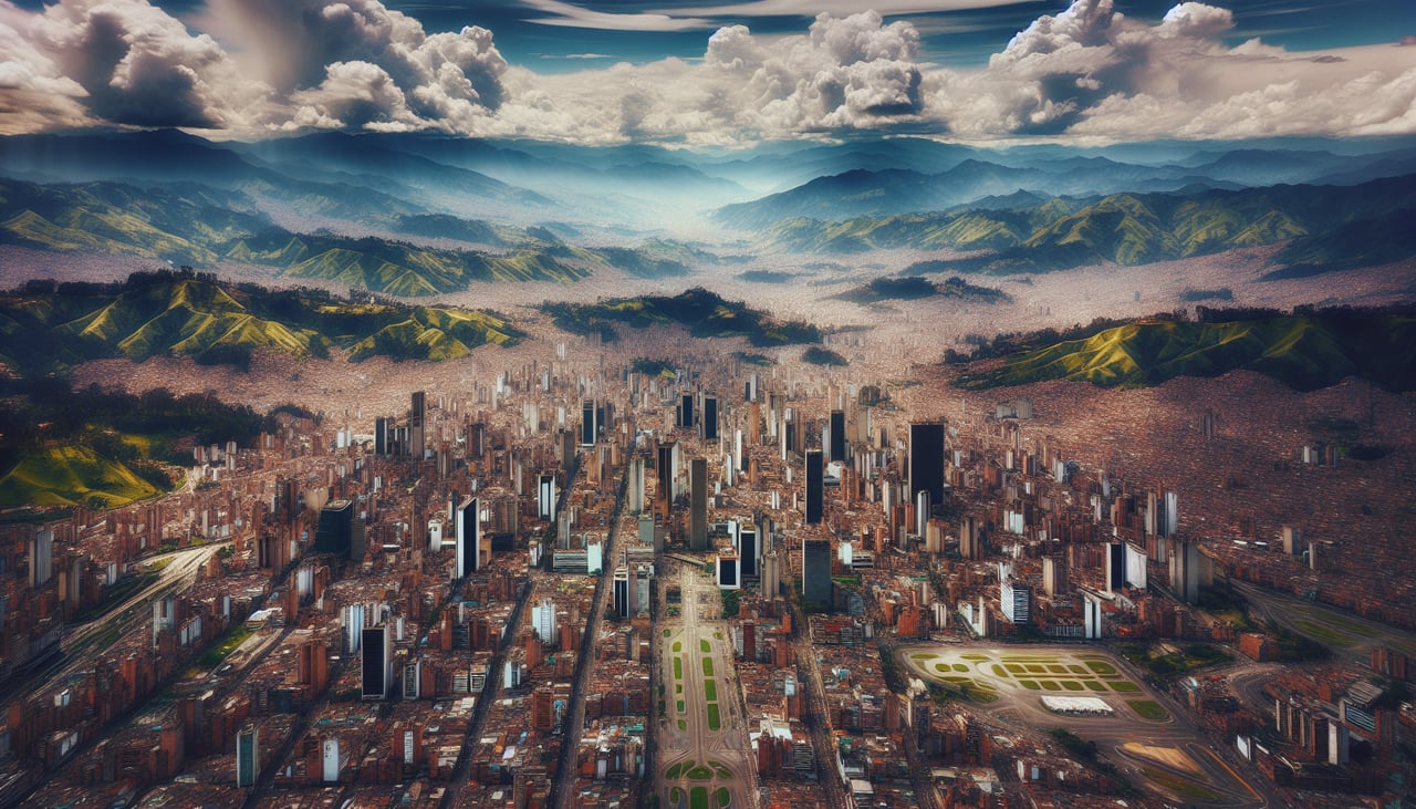
LEFTEl Dorado's departure track runs southeast before curving south toward Chile, and during that initial climb the left side faces Bogotá's Eastern Hills (Cerros Orientales) rising sharply above the city, with the high plateau of the Sabana de Bogotá spread out below. As the aircraft turns south, higher Andean ridgelines stay visible on the left for several more minutes.
Landing at SCL
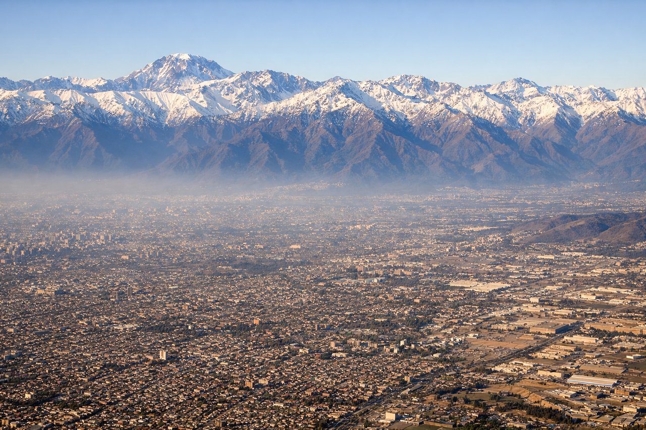
LEFTArrivals into Santiago descend from the north on a southbound heading, and the Andes front range sits immediately east of the city. On the left side passengers get a close, dramatic view of snow-streaked peaks rising right beside the descent path as the plane drops into the Santiago valley, something the right side (facing the flatter Coastal Range and city sprawl) can't match.
Landmarks on this routeAll landmarks →
Will your flight be in sunlight?
Pick a date and time in the Sun Map to watch the sun move across your whole flight.
About This Route
Which side of the plane should I sit on flying from Eldorado International (BOG) to Arturo Merino Benitez International (SCL)?
Sit on the Left side of the plane for the best views on flights from Bogota to Santiago. The left side keeps the Andes in view for nearly the entire flight — Bogotá's Eastern Hills on departure, the Bolivian Altiplano and Andean volcanoes at cruise, and the high peaks flanking Santiago on arrival — while the right side mostly overlooks flatter interior basins and the distant, less dramatic coastal desert.
What can I see during takeoff from Eldorado International in Bogota?
During takeoff from Eldorado International (BOG), sit on the Left side for the best views. El Dorado's departure track runs southeast before curving south toward Chile, and during that initial climb the left side faces Bogotá's Eastern Hills (Cerros Orientales) rising sharply above the city, with the high plateau of the Sabana de Bogotá spread out below. As the aircraft turns south, higher Andean ridgelines stay visible on the left for several more minutes. Notable sights include: Cerros Orientales and Monserrate hill, Sabana de Bogotá plateau, eastern Andean ridgelines, Bogotá's urban sprawl.
What can I see when landing at Arturo Merino Benitez International in Santiago?
When landing at Arturo Merino Benitez International (SCL), sit on the Left side for the best views. Arrivals into Santiago descend from the north on a southbound heading, and the Andes front range sits immediately east of the city. On the left side passengers get a close, dramatic view of snow-streaked peaks rising right beside the descent path as the plane drops into the Santiago valley, something the right side (facing the flatter Coastal Range and city sprawl) can't match. Notable sights include: Andes front range peaks east of Santiago, Maipo river valley, Santiago's eastern districts, snow-capped high Andes on the horizon.
How long is the flight from Bogota to Santiago?
The flight from Eldorado International (BOG) to Arturo Merino Benitez International (SCL) takes about 5 hours 35 minutes. The shortest flight path between them is 2,641 miles (4,251 km); winds and air traffic control usually add a few percent.
What does the Bogota to Santiago flight path pass over?
Bolivian Altiplano, Andean volcanoes such as Sajama and Illimani near La Paz, the northern edge of the Atacama Desert, and the arid Chilean coastal ranges before the final descent into the Santiago valley