The right side keeps the Andes in view for nearly the entire flight — dramatic peaks near Santiago at takeoff, the cordillera tracking the route north through Chile and Peru, and the mountain-ringed approach into Bogotá. The left side is dominated by the Pacific Ocean and flat coastal desert with fewer distinct features.
Flight Path
Santiago to Bogota is 2,641 miles (4,251 km), a flight of about 4 hours 50 minutes.
The flight path tracks north roughly parallel to the Andes through northern Chile's Atacama Desert and coastal Peru, with the western slopes of the Andes visible to the right and the Pacific coastline and occasional desert canyons visible to the left before crossing into Colombian airspace near the Andean highlands.
Great circle distance and headings ›


Phase by phase
Takeoff from SCL
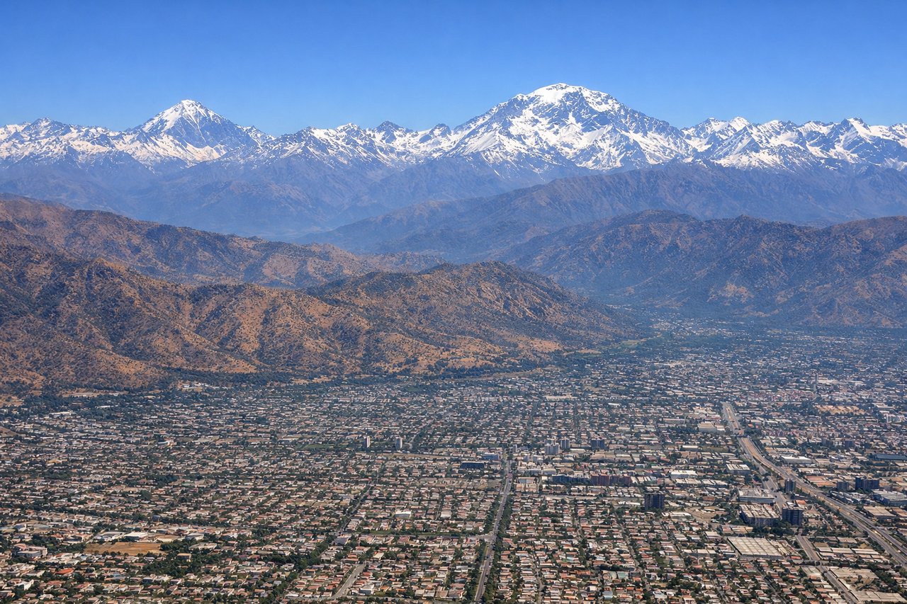
RIGHTSantiago sits in a valley hard against the Andes, and climbing out to the north the snow-capped peaks of the Cajón del Maipo and Aconcagua massif dominate the right-side view. The left side shows only the lower Chilean Coastal Range and hazy outskirts of the city.
Landing at BOG
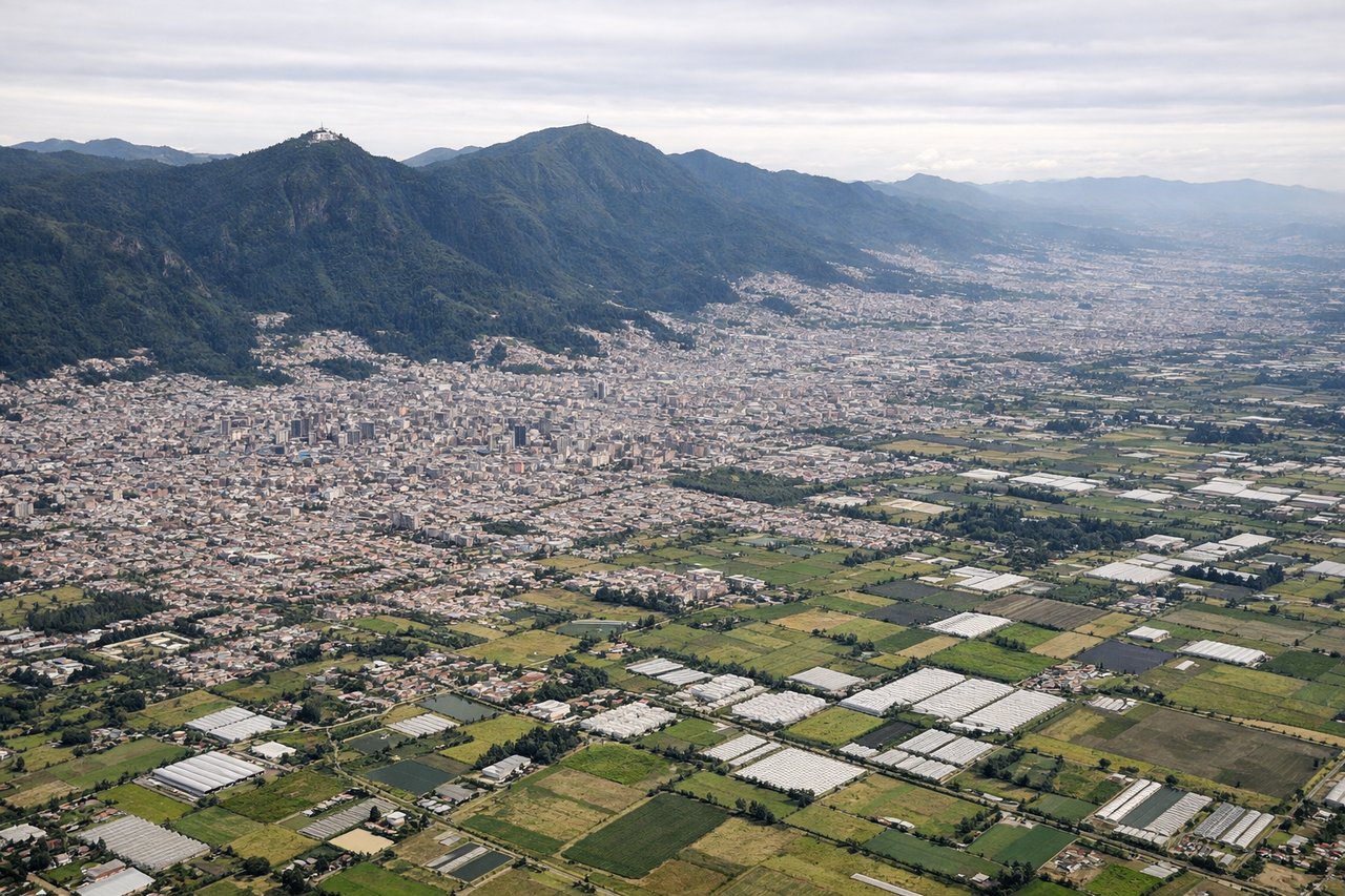
RIGHTOn approach into El Dorado, the plateau of Bogotá is ringed by mountains, and the descent path gives a strong view of the Cerros Orientales, the forested ridge with the Monserrate and Guadalupe sanctuaries overlooking downtown. The left side mostly shows the flatter western savanna with fewer distinct features.
Landmarks on this routeAll landmarks →
Will your flight be in sunlight?
Pick a date and time in the Sun Map to watch the sun move across your whole flight.
About This Route
Which side of the plane should I sit on flying from Arturo Merino Benitez International (SCL) to Eldorado International (BOG)?
Sit on the Right side of the plane for the best views on flights from Santiago to Bogota. The right side keeps the Andes in view for nearly the entire flight — dramatic peaks near Santiago at takeoff, the cordillera tracking the route north through Chile and Peru, and the mountain-ringed approach into Bogotá. The left side is dominated by the Pacific Ocean and flat coastal desert with fewer distinct features.
What can I see during takeoff from Arturo Merino Benitez International in Santiago?
During takeoff from Arturo Merino Benitez International (SCL), sit on the Right side for the best views. Santiago sits in a valley hard against the Andes, and climbing out to the north the snow-capped peaks of the Cajón del Maipo and Aconcagua massif dominate the right-side view. The left side shows only the lower Chilean Coastal Range and hazy outskirts of the city. Notable sights include: Andes high peaks near Cajón del Maipo, Aconcagua massif (distant), Mapocho River valley, Santiago cityscape below.
What can I see when landing at Eldorado International in Bogota?
When landing at Eldorado International (BOG), sit on the Right side for the best views. On approach into El Dorado, the plateau of Bogotá is ringed by mountains, and the descent path gives a strong view of the Cerros Orientales, the forested ridge with the Monserrate and Guadalupe sanctuaries overlooking downtown. The left side mostly shows the flatter western savanna with fewer distinct features. Notable sights include: Cerros Orientales ridge, Monserrate and Guadalupe hilltop shrines, Bogotá savanna, downtown Bogotá skyline.
How long is the flight from Santiago to Bogota?
The flight from Arturo Merino Benitez International (SCL) to Eldorado International (BOG) takes about 4 hours 50 minutes. The shortest flight path between them is 2,641 miles (4,251 km); winds and air traffic control usually add a few percent.
What does the Santiago to Bogota flight path pass over?
The flight path tracks north roughly parallel to the Andes through northern Chile's Atacama Desert and coastal Peru, with the western slopes of the Andes visible to the right and the Pacific coastline and occasional desert canyons visible to the left before crossing into Colombian airspace near the Andean highlands.