Right side wins at both ends of the flight. At departure you get the full Andes panorama, and at arrival you get the Santa Monica Mountains and LA coastline. During the cruise over the Pacific there is little to differentiate sides, but the bookend views make right the clear overall choice.
Flown SCL to LAX? Did we get it right?
Flight Path
Santiago to Los Angeles is 5,584 miles (8,987 km), a flight of about 11 hours 30 minutes.
The route tracks northwest over the Pacific Ocean, crossing the Atacama Desert coastline of northern Chile and southern Peru shortly after departure, then spending the majority of the flight over open ocean. The Intertropical Convergence Zone may produce visible convective cloud systems near the equator. Baja California's peninsula becomes visible on the right side during descent, and the Channel Islands off the Southern California coast may be visible on approach.
Great circle distance and headings ›


Phase by phase
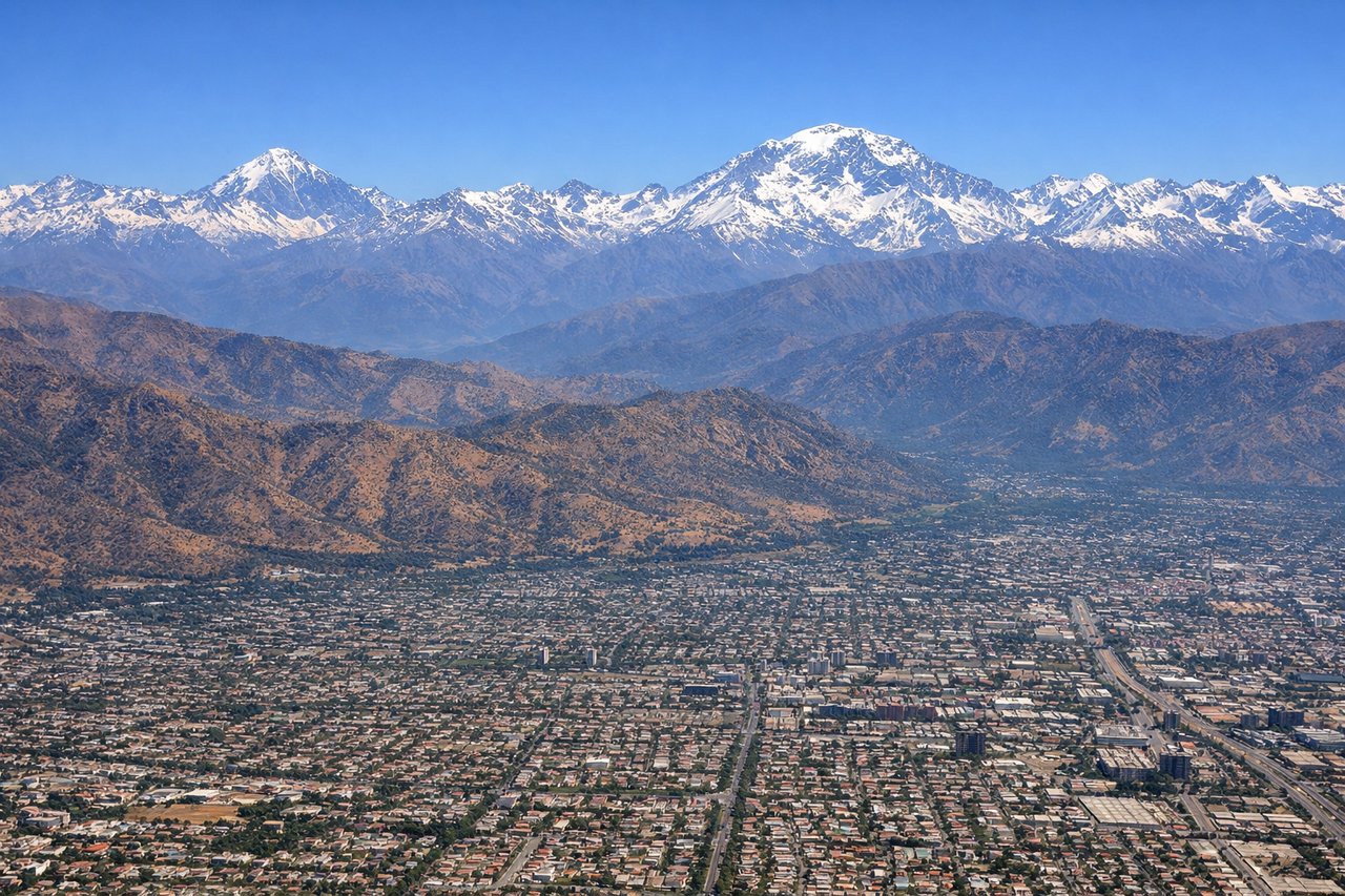
Takeoff from SCL
RIGHTSCL typically departs on runway 17/35, heading north. A right-side seat faces east toward the Andes, giving you a dramatic view of the Cordillera including peaks like Tupungato and Aconcagua as the aircraft climbs and turns northwest. The left side faces west toward the flat Pacific coastal plain with little of interest.
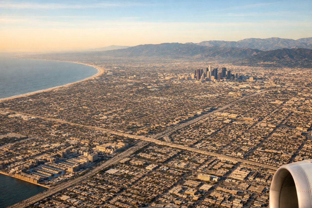
Landing at LAX
RIGHTLAX primarily uses runways 24L/24R for westward landings or 06L/06R for eastward approaches. On the common westward approach over land, a right-side seat faces north, giving views of the Santa Monica Mountains, the Los Angeles Basin, and the Pacific coastline. The left side faces south toward less distinctive suburban sprawl.
Will your flight be in sunlight?
Pick a date and time in the Sun Map to watch the sun move across your whole flight.
About This Route
Which side of the plane should I sit on flying from Arturo Merino Benitez International (SCL) to Los Angeles International (LAX)?
Sit on the Right side of the plane for the best views on flights from Santiago to Los Angeles. Right side wins at both ends of the flight. At departure you get the full Andes panorama, and at arrival you get the Santa Monica Mountains and LA coastline. During the cruise over the Pacific there is little to differentiate sides, but the bookend views make right the clear overall choice.
What can I see during takeoff from Arturo Merino Benitez International in Santiago?
During takeoff from Arturo Merino Benitez International (SCL), sit on the Right side for the best views. SCL typically departs on runway 17/35, heading north. A right-side seat faces east toward the Andes, giving you a dramatic view of the Cordillera including peaks like Tupungato and Aconcagua as the aircraft climbs and turns northwest. The left side faces west toward the flat Pacific coastal plain with little of interest. Notable sights include: Cerro Aconcagua (highest peak in the Americas at 6,961m), Volcán Tupungato, the Santiago urban grid in the valley below, and the snow-capped Cordillera ridge line stretching north-south.
What can I see when landing at Los Angeles International in Los Angeles?
When landing at Los Angeles International (LAX), sit on the Right side for the best views. LAX primarily uses runways 24L/24R for westward landings or 06L/06R for eastward approaches. On the common westward approach over land, a right-side seat faces north, giving views of the Santa Monica Mountains, the Los Angeles Basin, and the Pacific coastline. The left side faces south toward less distinctive suburban sprawl. Notable sights include: Santa Monica Mountains and Malibu coastline, the Los Angeles Basin urban grid, Santa Monica Bay, and the Hollywood Hills.
How long is the flight from Santiago to Los Angeles?
The flight from Arturo Merino Benitez International (SCL) to Los Angeles International (LAX) takes about 11 hours 30 minutes. The shortest flight path between them is 5,584 miles (8,987 km); winds and air traffic control usually add a few percent.
What does the Santiago to Los Angeles flight path pass over?
The route tracks northwest over the Pacific Ocean, crossing the Atacama Desert coastline of northern Chile and southern Peru shortly after departure, then spending the majority of the flight over open ocean. The Intertropical Convergence Zone may produce visible convective cloud systems near the equator. Baja California's peninsula becomes visible on the right side during descent, and the Channel Islands off the Southern California coast may be visible on approach.