The right side gets the Andes from the first minutes after takeoff, and it keeps the mountain-side views of Peru and Ecuador along the cruise. The left side's best moment is the Atlanta skyline on arrival, but the rest is mostly Pacific water, so it scores lower overall.
Flown SCL to ATL? Did we get it right?
Flight Path
Santiago to Atlanta is 4,715 miles (7,588 km), a flight of about 9 hours 50 minutes.
Pacific coast of northern Chile and the Atacama Desert margin, Peruvian coast with the Andes on the right, Ecuador and Colombia's Pacific side, Panama and the Caribbean Sea, western Cuba, Gulf of Mexico and the Florida Panhandle, then southern Georgia
Great circle distance and headings ›


Phase by phase
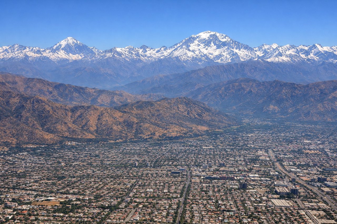
Takeoff from SCL
RIGHTDeparting Santiago on runway 35L or 35R, the plane climbs north with the Andes on the right side. The snow-capped wall rises directly behind the city, with Cerro El Plomo and the Santiago skyline in view. The left side mostly sees the low Coastal Range and haze toward the Pacific.

Landing at ATL
LEFTArrivals from the south swing around the east side of Atlanta and turn onto final for the west-flow runways. This puts downtown and Midtown on the left side, with the airfield sprawling below. The right side mostly sees tree-covered suburbs.
Will your flight be in sunlight?
Pick a date and time in the Sun Map to watch the sun move across your whole flight.
About This Route
Which side of the plane should I sit on flying from Arturo Merino Benitez International (SCL) to The William B Hartsfield Atlanta International (ATL)?
Sit on the Right side of the plane for the best views on flights from Santiago to Atlanta. The right side gets the Andes from the first minutes after takeoff, and it keeps the mountain-side views of Peru and Ecuador along the cruise. The left side's best moment is the Atlanta skyline on arrival, but the rest is mostly Pacific water, so it scores lower overall.
What can I see during takeoff from Arturo Merino Benitez International in Santiago?
During takeoff from Arturo Merino Benitez International (SCL), sit on the Right side for the best views. Departing Santiago on runway 35L or 35R, the plane climbs north with the Andes on the right side. The snow-capped wall rises directly behind the city, with Cerro El Plomo and the Santiago skyline in view. The left side mostly sees the low Coastal Range and haze toward the Pacific. Notable sights include: Andes wall east of Santiago, Cerro El Plomo, Santiago skyline and Cerro San Cristobal, Maipo Valley agricultural basin.
What can I see when landing at The William B Hartsfield Atlanta International in Atlanta?
When landing at The William B Hartsfield Atlanta International (ATL), sit on the Left side for the best views. Arrivals from the south swing around the east side of Atlanta and turn onto final for the west-flow runways. This puts downtown and Midtown on the left side, with the airfield sprawling below. The right side mostly sees tree-covered suburbs. Notable sights include: Downtown and Midtown Atlanta skyline, Hartsfield-Jackson airfield and concourses, Stone Mountain (on eastern arrival paths), Chattahoochee River corridor.
How long is the flight from Santiago to Atlanta?
The flight from Arturo Merino Benitez International (SCL) to The William B Hartsfield Atlanta International (ATL) takes about 9 hours 50 minutes. The shortest flight path between them is 4,715 miles (7,588 km); winds and air traffic control usually add a few percent.
What does the Santiago to Atlanta flight path pass over?
Pacific coast of northern Chile and the Atacama Desert margin, Peruvian coast with the Andes on the right, Ecuador and Colombia's Pacific side, Panama and the Caribbean Sea, western Cuba, Gulf of Mexico and the Florida Panhandle, then southern Georgia