The left side wins because of the Andes visible during the Santiago approach and glimpses of the Amazon basin and Andean foothills during the latter part of cruise, while the right side spends most of the flight over open Caribbean and Atlantic water with little variation.
Flown ATL to SCL? Did we get it right?
Flight Path
Atlanta to Santiago is 4,715 miles (7,588 km), a flight of about 9 hours 40 minutes.
Caribbean Sea and northern Colombia coastline, the Amazon rainforest basin of western Brazil and Peru, and the eastern slopes of the Andes as the route enters Bolivia and northern Chile
Great circle distance and headings ›


Phase by phase

Takeoff from ATL
RIGHTATL departures on this routing typically climb out to the south, and a brief bank puts downtown Atlanta's skyline and the Chattahoochee River on the right side before the aircraft levels over the flat Georgia piedmont. Neither side offers dramatic terrain, so this is a modest edge only.
Landing at SCL
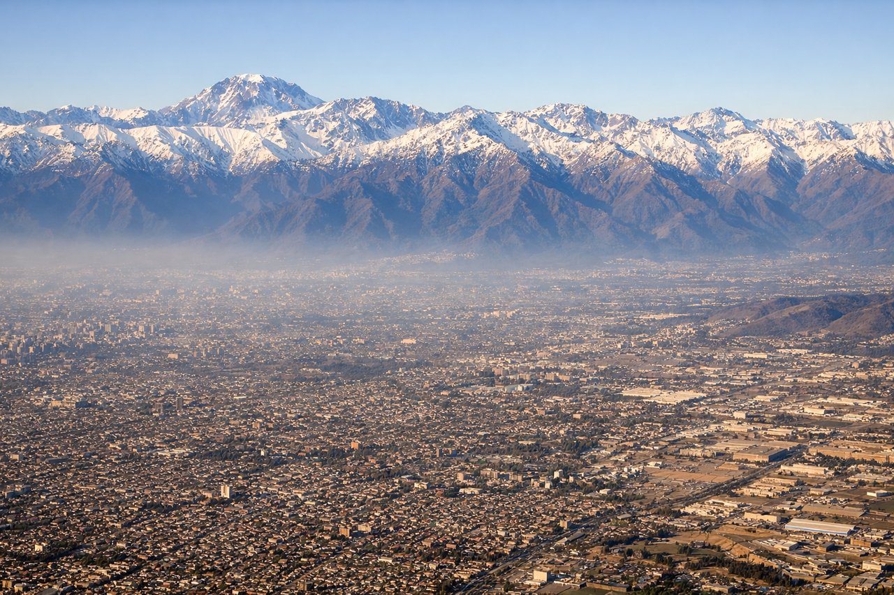
LEFTOn approach into Santiago from the north, the aircraft descends with the Andes rising dramatically on the left side of the cabin, their snow-capped peaks forming a stark eastern wall behind the city. This is one of the most striking mountain approaches in commercial aviation, with the Maipo Valley and Andean foothills visible right up to touchdown.
Will your flight be in sunlight?
Pick a date and time in the Sun Map to watch the sun move across your whole flight.
About This Route
Which side of the plane should I sit on flying from The William B Hartsfield Atlanta International (ATL) to Arturo Merino Benitez International (SCL)?
Sit on the Left side of the plane for the best views on flights from Atlanta to Santiago. The left side wins because of the Andes visible during the Santiago approach and glimpses of the Amazon basin and Andean foothills during the latter part of cruise, while the right side spends most of the flight over open Caribbean and Atlantic water with little variation.
What can I see during takeoff from The William B Hartsfield Atlanta International in Atlanta?
During takeoff from The William B Hartsfield Atlanta International (ATL), sit on the Right side for the best views. ATL departures on this routing typically climb out to the south, and a brief bank puts downtown Atlanta's skyline and the Chattahoochee River on the right side before the aircraft levels over the flat Georgia piedmont. Neither side offers dramatic terrain, so this is a modest edge only. Notable sights include: Downtown Atlanta skyline, Chattahoochee River, Hartsfield-Jackson terminal complex, Georgia pine forest belt.
What can I see when landing at Arturo Merino Benitez International in Santiago?
When landing at Arturo Merino Benitez International (SCL), sit on the Left side for the best views. On approach into Santiago from the north, the aircraft descends with the Andes rising dramatically on the left side of the cabin, their snow-capped peaks forming a stark eastern wall behind the city. This is one of the most striking mountain approaches in commercial aviation, with the Maipo Valley and Andean foothills visible right up to touchdown. Notable sights include: Andes Mountains, Aconcagua massif in the distance, Maipo River valley, Santiago's grid-pattern city sprawl.
How long is the flight from Atlanta to Santiago?
The flight from The William B Hartsfield Atlanta International (ATL) to Arturo Merino Benitez International (SCL) takes about 9 hours 40 minutes. The shortest flight path between them is 4,715 miles (7,588 km); winds and air traffic control usually add a few percent.
What does the Atlanta to Santiago flight path pass over?
Caribbean Sea and northern Colombia coastline, the Amazon rainforest basin of western Brazil and Peru, and the eastern slopes of the Andes as the route enters Bolivia and northern Chile