Right-side seats capture the more dramatic geography: Western Ghats during departure and the Aravalli Hills during approach. The northbound flight path itself follows the western edge of the Deccan Plateau, making right-side views of the plateau's escarpment more consistent throughout the flight.
Flown BOM to DEL? Did we get it right?
Flight Path
Bombay to Delhi is 706 miles (1,137 km), a flight of about 2 hours 30 minutes.
The flight path crosses the Malwa Plateau (central India, 1,500-2,000 feet elevation), visible as relatively flat terrain with scattered towns and agricultural fields. The Narmada River valley lies to the west (left side), appearing as a darker green corridor. The Vindhya Range forms a low ridge to the south (right side during cruise). Around Indore/Ujjain region, the landscape transitions from Deccan Plateau to the flatter Indo-Gangetic plains. The Chambal River valley may be visible as a darker linear feature. No major snow-capped peaks are visible on this route at cruising altitude.
Great circle distance and headings ›Phase by phase
Takeoff from BOM
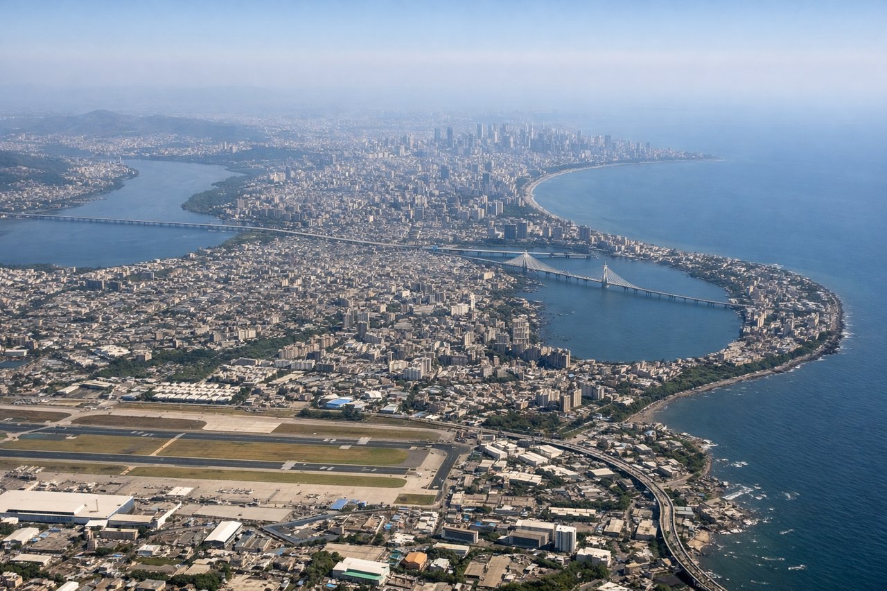
RIGHTBOM typically departs runway 09L or 09R (westerly). Right-side seats face north-northeast during climb, offering views of Mumbai's urban sprawl, the Arabian Sea coastline, and the Western Ghats escarpment rising inland. Left seats see the sea and receding coastline but miss the dramatic inland topography.
Landing at DEL
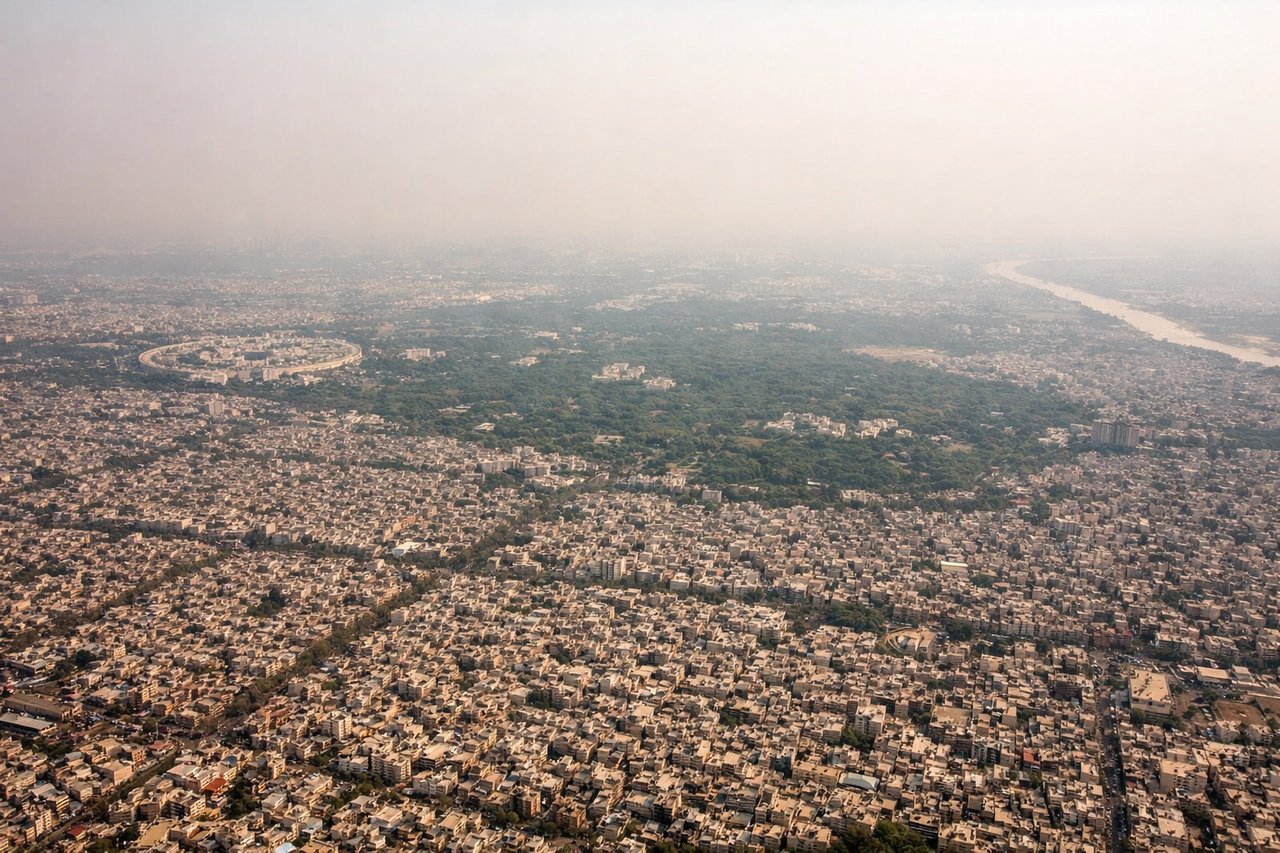
LEFTDEL typically lands runway 28L or 28R (westerly approach). Left-side seats during descent face south-southeast, providing views of the Yamuna River floodplain, Delhi's southern districts, and the Aravalli Hills ridge. Right seats see the approach path but miss the river and hill geography.
Will your flight be in sunlight?
Pick a date and time in the Sun Map to watch the sun move across your whole flight.
About This Route
Which side of the plane should I sit on flying from Chhatrapati Shivaji International (BOM) to Indira Gandhi International (DEL)?
Sit on the Right side of the plane for the best views on flights from Bombay to Delhi. Right-side seats capture the more dramatic geography: Western Ghats during departure and the Aravalli Hills during approach. The northbound flight path itself follows the western edge of the Deccan Plateau, making right-side views of the plateau's escarpment more consistent throughout the flight.
What can I see during takeoff from Chhatrapati Shivaji International in Bombay?
During takeoff from Chhatrapati Shivaji International (BOM), sit on the Right side for the best views. BOM typically departs runway 09L or 09R (westerly). Right-side seats face north-northeast during climb, offering views of Mumbai's urban sprawl, the Arabian Sea coastline, and the Western Ghats escarpment rising inland. Left seats see the sea and receding coastline but miss the dramatic inland topography. Notable sights include: Arabian Sea (immediate west), Western Ghats mountain range (northeast, 40-50 miles inland appearing as a distant ridge), Mumbai metropolitan area sprawl (north and east), Thane creek system (northeast, visible as water channels through urban grid).
What can I see when landing at Indira Gandhi International in Delhi?
When landing at Indira Gandhi International (DEL), sit on the Left side for the best views. DEL typically lands runway 28L or 28R (westerly approach). Left-side seats during descent face south-southeast, providing views of the Yamuna River floodplain, Delhi's southern districts, and the Aravalli Hills ridge. Right seats see the approach path but miss the river and hill geography. Notable sights include: Yamuna River (meandering through floodplain, visible as brown ribbon), Aravalli Hills (south and southeast, appearing as low rocky ridge on horizon), Delhi's southern urban sprawl (Dwarka, Chhatarpur areas), Indira Gandhi International Airport grounds (visible in final approach).
How long is the flight from Bombay to Delhi?
The flight from Chhatrapati Shivaji International (BOM) to Indira Gandhi International (DEL) takes about 2 hours 30 minutes. The shortest flight path between them is 706 miles (1,137 km); winds and air traffic control usually add a few percent.
What does the Bombay to Delhi flight path pass over?
The flight path crosses the Malwa Plateau (central India, 1,500-2,000 feet elevation), visible as relatively flat terrain with scattered towns and agricultural fields. The Narmada River valley lies to the west (left side), appearing as a darker green corridor. The Vindhya Range forms a low ridge to the south (right side during cruise). Around Indore/Ujjain region, the landscape transitions from Deccan Plateau to the flatter Indo-Gangetic plains. The Chambal River valley may be visible as a darker linear feature. No major snow-capped peaks are visible on this route at cruising altitude.