While the right side wins at takeoff for Mumbai city views, the left side dominates the majority of the flight. Over the Bay of Bengal the left side faces south toward the Andaman Islands chain. Crossing the Indochina peninsula the left side looks south toward the Gulf of Thailand. Over the East China Sea the left side has views toward the Korean Peninsula and eventually the Japanese archipelago on approach. The Mount Fuji arrival view on the left clinches it.
Flown BOM to NRT? Did we get it right?
Flight Path
Bombay to Tokyo is 4,217 miles (6,786 km), a flight of about 9 hours 30 minutes.
The route crosses the Bay of Bengal where the Andaman and Nicobar Islands are occasionally visible on clear days, then transits Myanmar and the Indochina peninsula over the Irrawaddy and Mekong river valleys which appear as broad brown ribbons through green lowlands. The South China Sea follows, then the route skirts southern China or crosses the East China Sea depending on routing, with the Ryukyu Islands chain including Okinawa visible as small green specks in the blue water before the Japanese home islands appear on the horizon.
Great circle distance and headings ›


Phase by phase
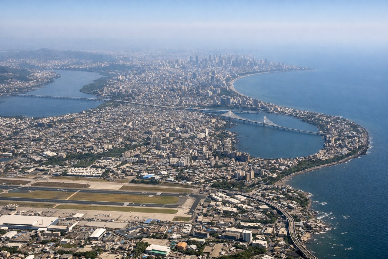
Takeoff from BOM
RIGHTMumbai's main departure runway 27 sends aircraft westward over the Arabian Sea, but for the northeast-bound route to Tokyo, aircraft typically use runway 14/32 or depart on 09 heading east. On a northeast departure, the right side gives you the Mumbai city skyline, the dense urban grid of Dharavi, and the Bandra-Worli Sea Link bridge over Mahim Bay before the aircraft climbs over the Western Ghats.
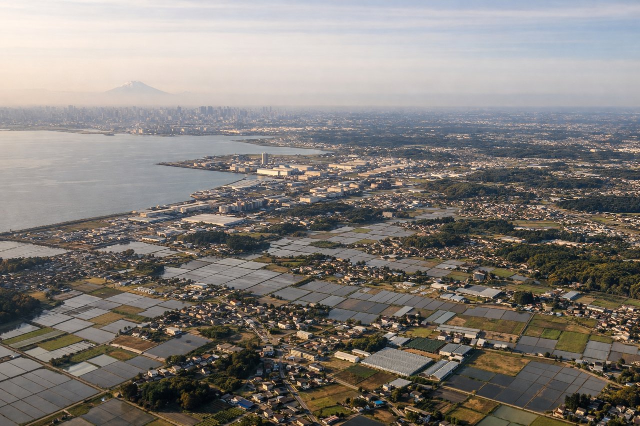
Landing at NRT
LEFTNarita typically uses runway 34L/34R for northerly arrivals, meaning the approach comes from the south-southwest. The left side on final approach gives a clear view of Tokyo Bay, the dense urban sprawl of greater Tokyo including the Chiba lowlands, and on clear days the distinctive cone of Mount Fuji sitting on the western horizon roughly 60 miles away.
Will your flight be in sunlight?
Pick a date and time in the Sun Map to watch the sun move across your whole flight.
About This Route
Which side of the plane should I sit on flying from Chhatrapati Shivaji International (BOM) to New Tokyo International (NRT)?
Sit on the Left side of the plane for the best views on flights from Bombay to Tokyo. While the right side wins at takeoff for Mumbai city views, the left side dominates the majority of the flight. Over the Bay of Bengal the left side faces south toward the Andaman Islands chain. Crossing the Indochina peninsula the left side looks south toward the Gulf of Thailand. Over the East China Sea the left side has views toward the Korean Peninsula and eventually the Japanese archipelago on approach. The Mount Fuji arrival view on the left clinches it.
What can I see during takeoff from Chhatrapati Shivaji International in Bombay?
During takeoff from Chhatrapati Shivaji International (BOM), sit on the Right side for the best views. Mumbai's main departure runway 27 sends aircraft westward over the Arabian Sea, but for the northeast-bound route to Tokyo, aircraft typically use runway 14/32 or depart on 09 heading east. On a northeast departure, the right side gives you the Mumbai city skyline, the dense urban grid of Dharavi, and the Bandra-Worli Sea Link bridge over Mahim Bay before the aircraft climbs over the Western Ghats. Notable sights include: Bandra-Worli Sea Link, Dharavi and central Mumbai urban grid, Mahim Bay, Western Ghats escarpment to the east.
What can I see when landing at New Tokyo International in Tokyo?
When landing at New Tokyo International (NRT), sit on the Left side for the best views. Narita typically uses runway 34L/34R for northerly arrivals, meaning the approach comes from the south-southwest. The left side on final approach gives a clear view of Tokyo Bay, the dense urban sprawl of greater Tokyo including the Chiba lowlands, and on clear days the distinctive cone of Mount Fuji sitting on the western horizon roughly 60 miles away. Notable sights include: Tokyo Bay, Mount Fuji on the western horizon, Chiba urban-industrial lowlands, Tokyo metropolitan grid.
How long is the flight from Bombay to Tokyo?
The flight from Chhatrapati Shivaji International (BOM) to New Tokyo International (NRT) takes about 9 hours 30 minutes. The shortest flight path between them is 4,217 miles (6,786 km); winds and air traffic control usually add a few percent.
What does the Bombay to Tokyo flight path pass over?
The route crosses the Bay of Bengal where the Andaman and Nicobar Islands are occasionally visible on clear days, then transits Myanmar and the Indochina peninsula over the Irrawaddy and Mekong river valleys which appear as broad brown ribbons through green lowlands. The South China Sea follows, then the route skirts southern China or crosses the East China Sea depending on routing, with the Ryukyu Islands chain including Okinawa visible as small green specks in the blue water before the Japanese home islands appear on the horizon.