The left side wins on the strength of both bookends: a genuine city view during the harbor departure from Boston and a rare combination of the Seattle skyline plus Mount Rainier on arrival. The right side has a slight edge during cruise over the northern Rockies and Great Lakes, but it isn't enough to offset the weaker harbor-only takeoff view and the Sound-only landing view.
Flown BOS to SEA? Did we get it right?
Flight Path
Boston to Seattle is 2,489 miles (4,006 km), a flight of about 6 hours 15 minutes.
Great Lakes region (Lake Michigan/Lake Huron), Upper Midwest plains of Minnesota and North Dakota, northern Rocky Mountains near Glacier National Park in Montana, and the Cascade Range as the flight descends toward Puget Sound
Great circle distance and headings ›


Phase by phase
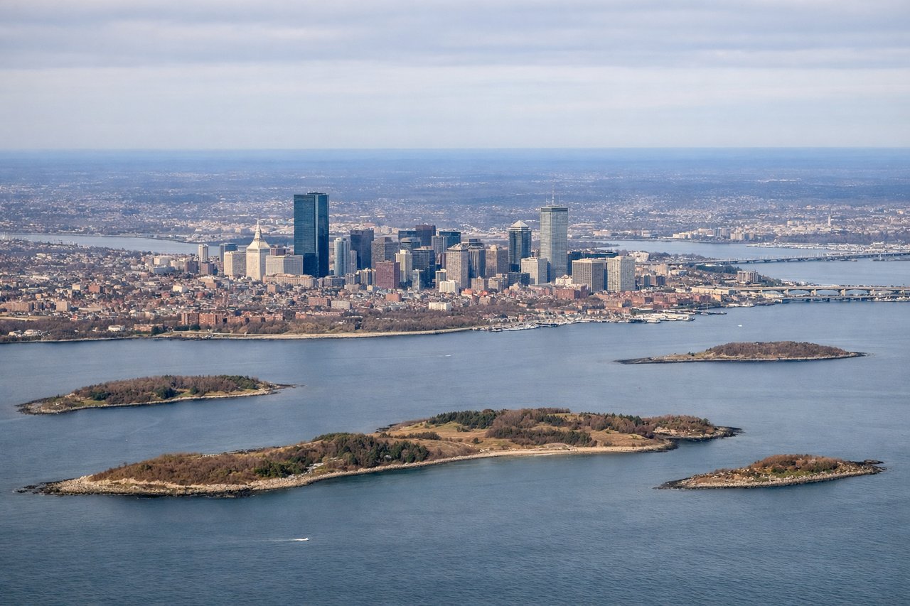
Takeoff from BOS
LEFTBOS noise-abatement departures climb north over the harbor before turning onto the westbound course, and during that turn the left-side windows face the city rather than open water. Passengers get a clean look at the downtown skyline and Charles River basin just as the ocean-facing right side is showing mostly open harbor water.
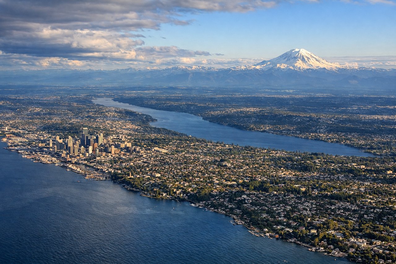
Landing at SEA
LEFTSEA's south-flow approach pattern typically brings arriving flights down from the north along Puget Sound before turning onto final for the south-facing runways, putting downtown Seattle and Mount Rainier on the left side of the aircraft. The right side mainly faces open Sound water and the more distant Olympic range.
Will your flight be in sunlight?
Pick a date and time in the Sun Map to watch the sun move across your whole flight.
About This Route
Which side of the plane should I sit on flying from General Edward Lawrence Logan International (BOS) to Seattle Tacoma International (SEA)?
Sit on the Left side of the plane for the best views on flights from Boston to Seattle. The left side wins on the strength of both bookends: a genuine city view during the harbor departure from Boston and a rare combination of the Seattle skyline plus Mount Rainier on arrival. The right side has a slight edge during cruise over the northern Rockies and Great Lakes, but it isn't enough to offset the weaker harbor-only takeoff view and the Sound-only landing view.
What can I see during takeoff from General Edward Lawrence Logan International in Boston?
During takeoff from General Edward Lawrence Logan International (BOS), sit on the Left side for the best views. BOS noise-abatement departures climb north over the harbor before turning onto the westbound course, and during that turn the left-side windows face the city rather than open water. Passengers get a clean look at the downtown skyline and Charles River basin just as the ocean-facing right side is showing mostly open harbor water. Notable sights include: Boston downtown skyline (Financial District, Prudential/Hancock towers), Charles River, Back Bay, Cambridge/MIT.
What can I see when landing at Seattle Tacoma International in Seattle?
When landing at Seattle Tacoma International (SEA), sit on the Left side for the best views. SEA's south-flow approach pattern typically brings arriving flights down from the north along Puget Sound before turning onto final for the south-facing runways, putting downtown Seattle and Mount Rainier on the left side of the aircraft. The right side mainly faces open Sound water and the more distant Olympic range. Notable sights include: Downtown Seattle skyline and Space Needle, Elliott Bay/Puget Sound, Mount Rainier, Lake Washington.
How long is the flight from Boston to Seattle?
The flight from General Edward Lawrence Logan International (BOS) to Seattle Tacoma International (SEA) takes about 6 hours 15 minutes. The shortest flight path between them is 2,489 miles (4,006 km); winds and air traffic control usually add a few percent.
What does the Boston to Seattle flight path pass over?
Great Lakes region (Lake Michigan/Lake Huron), Upper Midwest plains of Minnesota and North Dakota, northern Rocky Mountains near Glacier National Park in Montana, and the Cascade Range as the flight descends toward Puget Sound