Christchurch to Melbourne is 1,478 miles (2,379 km), a flight of about 3 hours 30 minutes.
While takeoff favors the right for Southern Alps views, the landing approach—which occupies more time and provides closer, more dramatic scenery—strongly favors the left. Port Phillip Bay and the approach corridor offer superior visual interest for most of the descent phase.
Flight Path
The flight crosses the Tasman Sea for roughly 1,200 nautical miles. At cruise altitude (around 25,000-30,000 feet), the Tasman Sea itself dominates—a vast expanse of open ocean with occasional cloud formations. No significant land features are visible in the midpoint; the route passes over open water. As the aircraft approaches Victoria, the Australian coastline becomes visible, with the Otway Ranges appearing as a dark, forested ridge along the southwestern Victorian coast roughly 50 miles before descent begins. Port Phillip Bay becomes visible approximately 40 miles out on approach.
Great circle distance and headings ›

.JPG?width=600)
Phase by phase
Takeoff from CHC
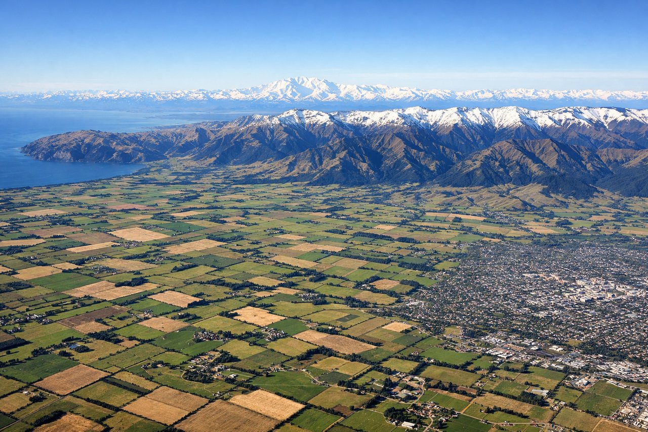
RIGHTChristchurch typically departs eastbound (Runway 02 or 20 depending on wind). Right-side seats face toward the Southern Alps and Canterbury Plains immediately after departure, with the dramatic mountain backdrop dominating the initial climb.
Landing at MBW
LEFTMelbourne Moorabbin (Runway 17/35) typically receives aircraft from the southeast. Left-side seats during descent provide views of Port Phillip Bay, the Dandenong Ranges, and Melbourne's urban sprawl. The approach path crosses the bay, offering water and suburban views.
Landmarks on this routeAll landmarks →
Will your flight be in sunlight?
Pick a date and time in the Sun Map to watch the sun move across your whole flight.
About This Route
Which side of the plane should I sit on flying from Christchurch International (CHC) to Melbourne Moorabbin (MBW)?
Sit on the Left side of the plane for the best views on flights from Christchurch to Melbourne. While takeoff favors the right for Southern Alps views, the landing approach—which occupies more time and provides closer, more dramatic scenery—strongly favors the left. Port Phillip Bay and the approach corridor offer superior visual interest for most of the descent phase.
What can I see during takeoff from Christchurch International in Christchurch?
During takeoff from Christchurch International (CHC), sit on the Right side for the best views. Christchurch typically departs eastbound (Runway 02 or 20 depending on wind). Right-side seats face toward the Southern Alps and Canterbury Plains immediately after departure, with the dramatic mountain backdrop dominating the initial climb. Notable sights include: Southern Alps (Mount Cook visible on clear days ~80 miles southwest), Canterbury Plains (flat agricultural expanse to the west), Banks Peninsula (distinctive peninsula shape to the southeast), Lyttelton Harbour (visible as water body near Banks Peninsula).
What can I see when landing at Melbourne Moorabbin in Melbourne?
When landing at Melbourne Moorabbin (MBW), sit on the Left side for the best views. Melbourne Moorabbin (Runway 17/35) typically receives aircraft from the southeast. Left-side seats during descent provide views of Port Phillip Bay, the Dandenong Ranges, and Melbourne's urban sprawl. The approach path crosses the bay, offering water and suburban views. Notable sights include: Port Phillip Bay (large enclosed bay dominating the approach), Dandenong Ranges (forested hills to the northeast), Melbourne CBD (visible as urban cluster in the distance), Mornington Peninsula (visible across the bay to the south).
How long is the flight from Christchurch to Melbourne?
The flight from Christchurch International (CHC) to Melbourne Moorabbin (MBW) takes about 3 hours 30 minutes. The shortest flight path between them is 1,478 miles (2,379 km); winds and air traffic control usually add a few percent.
What does the Christchurch to Melbourne flight path pass over?
The flight crosses the Tasman Sea for roughly 1,200 nautical miles. At cruise altitude (around 25,000-30,000 feet), the Tasman Sea itself dominates—a vast expanse of open ocean with occasional cloud formations. No significant land features are visible in the midpoint; the route passes over open water. As the aircraft approaches Victoria, the Australian coastline becomes visible, with the Otway Ranges appearing as a dark, forested ridge along the southwestern Victorian coast roughly 50 miles before descent begins. Port Phillip Bay becomes visible approximately 40 miles out on approach.