Cleveland to Seattle is 2,016 miles (3,244 km), a flight of about 4 hours 55 minutes.
The right side keeps the more dramatic terrain in view throughout the flight — Lake Erie at departure, a possible glimpse of the northern Rockies near Montana's Rocky Mountain Front during cruise, and the North Cascades on descent — while the left side stays over comparatively flat Midwestern and Plains terrain for most of the route.
Flight Path
Great Plains of the Dakotas, Missouri River valley, and the Rocky Mountain Front near Montana's Glacier National Park region as the route curves toward the Pacific Northwest
Great circle distance and headings ›

.jpg?width=600)

Phase by phase
Takeoff from CLE
RIGHTDeparting CLE on the southwest-facing runways, the aircraft banks north as it turns onto its westbound course, putting Lake Erie's shoreline and downtown Cleveland's skyline directly under the right-side windows during the climb. The left side only shows the flat suburban sprawl south of the airport.
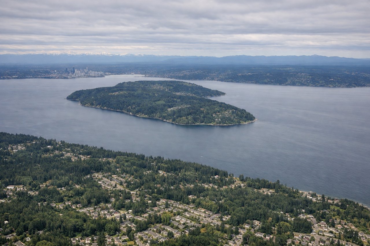
Landing at SEA
RIGHTArriving from the east, flights typically cross the Cascades and descend toward Puget Sound before turning onto final for SEA's north-south runways, giving right-side passengers a good look at the jagged North Cascades and the forested foothills near Snoqualmie Pass. The left side mostly faces open sky and the flatter Kent Valley during the turn.
Landmarks on this routeAll landmarks →
Will your flight be in sunlight?
Pick a date and time in the Sun Map to watch the sun move across your whole flight.
About This Route
Which side of the plane should I sit on flying from Cleveland Hopkins International (CLE) to Seattle Tacoma International (SEA)?
Sit on the Right side of the plane for the best views on flights from Cleveland to Seattle. The right side keeps the more dramatic terrain in view throughout the flight — Lake Erie at departure, a possible glimpse of the northern Rockies near Montana's Rocky Mountain Front during cruise, and the North Cascades on descent — while the left side stays over comparatively flat Midwestern and Plains terrain for most of the route.
What can I see during takeoff from Cleveland Hopkins International in Cleveland?
During takeoff from Cleveland Hopkins International (CLE), sit on the Right side for the best views. Departing CLE on the southwest-facing runways, the aircraft banks north as it turns onto its westbound course, putting Lake Erie's shoreline and downtown Cleveland's skyline directly under the right-side windows during the climb. The left side only shows the flat suburban sprawl south of the airport. Notable sights include: Lake Erie shoreline, downtown Cleveland skyline, Cleveland Metroparks green belt.
What can I see when landing at Seattle Tacoma International in Seattle?
When landing at Seattle Tacoma International (SEA), sit on the Right side for the best views. Arriving from the east, flights typically cross the Cascades and descend toward Puget Sound before turning onto final for SEA's north-south runways, giving right-side passengers a good look at the jagged North Cascades and the forested foothills near Snoqualmie Pass. The left side mostly faces open sky and the flatter Kent Valley during the turn. Notable sights include: North Cascades ridgeline, Snoqualmie Pass foothills, Puget Sound waterways, Lake Washington.
How long is the flight from Cleveland to Seattle?
The flight from Cleveland Hopkins International (CLE) to Seattle Tacoma International (SEA) takes about 4 hours 55 minutes. The shortest flight path between them is 2,016 miles (3,244 km); winds and air traffic control usually add a few percent.
What does the Cleveland to Seattle flight path pass over?
Great Plains of the Dakotas, Missouri River valley, and the Rocky Mountain Front near Montana's Glacier National Park region as the route curves toward the Pacific Northwest